×

|
Rate it:
Tags:
Level:
Length: 32 mi (51.5 km)
Surface: Fire Road
Configuration: Loop
Elevation: -
Total: 1 riders
Mountain Biking Upper Tellico
#161 of 202 mountain bike trails in Tennessee
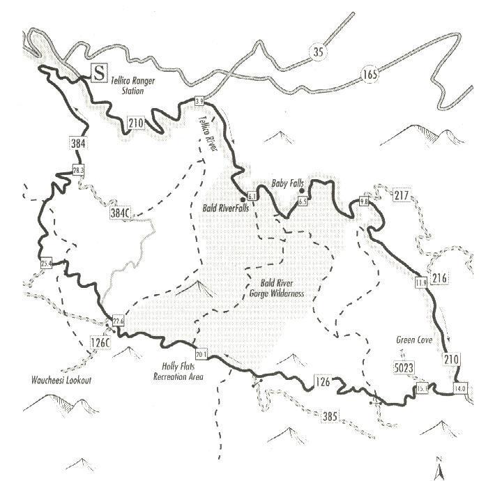
Give yourself lots of time for this ride. There are no technical difficulties, But it's sheer lenght along with it's climbs wil take it's toll.you'll ride for miles along the tellico river with it's many falls, before circling the entire bald river wilderness on a series of forrest roads. There is a small store in Green Cove or pack a lunch.
Pack a camera too you just might see a Bear.
First added by Rockinr on Oct 17, 2007. Last updated Apr 28, 2020. → add an update
Before you go
- Drinking water: unknown
- Lift service: unknown
- Night riding: unknown
- Pump track: unknown
- Restrooms: unknown
- Fat bike grooming: unknown
- E-bikes allowed: unknown
- Fee required: unknown
This trail information is user-generated. Help improve this information by suggesting a correction.
East from Tellico Plains on 165 five miles. Turn right on 210 at Bald river falls sign.
Park at the ranger station
