×

|
Rate it:
Tags:
Level: Intermediate
Length: 2 mi (3.2 km)
Surface: Singletrack
Configuration: Network
Elevation: -
Total: 9 riders
Mountain Biking Blackbutt forest
#35 of 169 mountain bike trails in New South Wales
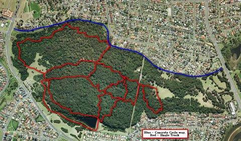
The trails at Blackbutt are fun all mountain and xc tracks. If you chose the right trails you will be rewarded with some fun technical sections, rock gardens, jumps and a long ride.
First added by cp195 on Jul 1, 2016. Last updated May 7, 2020. → add an update
Before you go
- Drinking water: yes
- Lift service: unknown
- Night riding: unknown
- Pump track: unknown
- Restrooms: yes
- Fat bike grooming: unknown
- E-bikes allowed: unknown
- Fee required: unknown
This trail information is user-generated. Help improve this information by suggesting a correction.
Exit the main highway Shellharbour road at a gate that leads to the Blackbutt forest park, walk up a hill to another park where there is a toilet block and then just ride any trail you chose.


Some good trails great for beginners and intermediate riders, had some rock gardens, dirt, logs and occasionaly some jumps
| ThankFun ride
| Thank