×

|
Rate it:
Tags:
Level: Beginner
Length: 15 mi (24.1 km)
Surface: Singletrack
Configuration: Loop
Elevation: +547/ -526 ft
Total: 22 riders
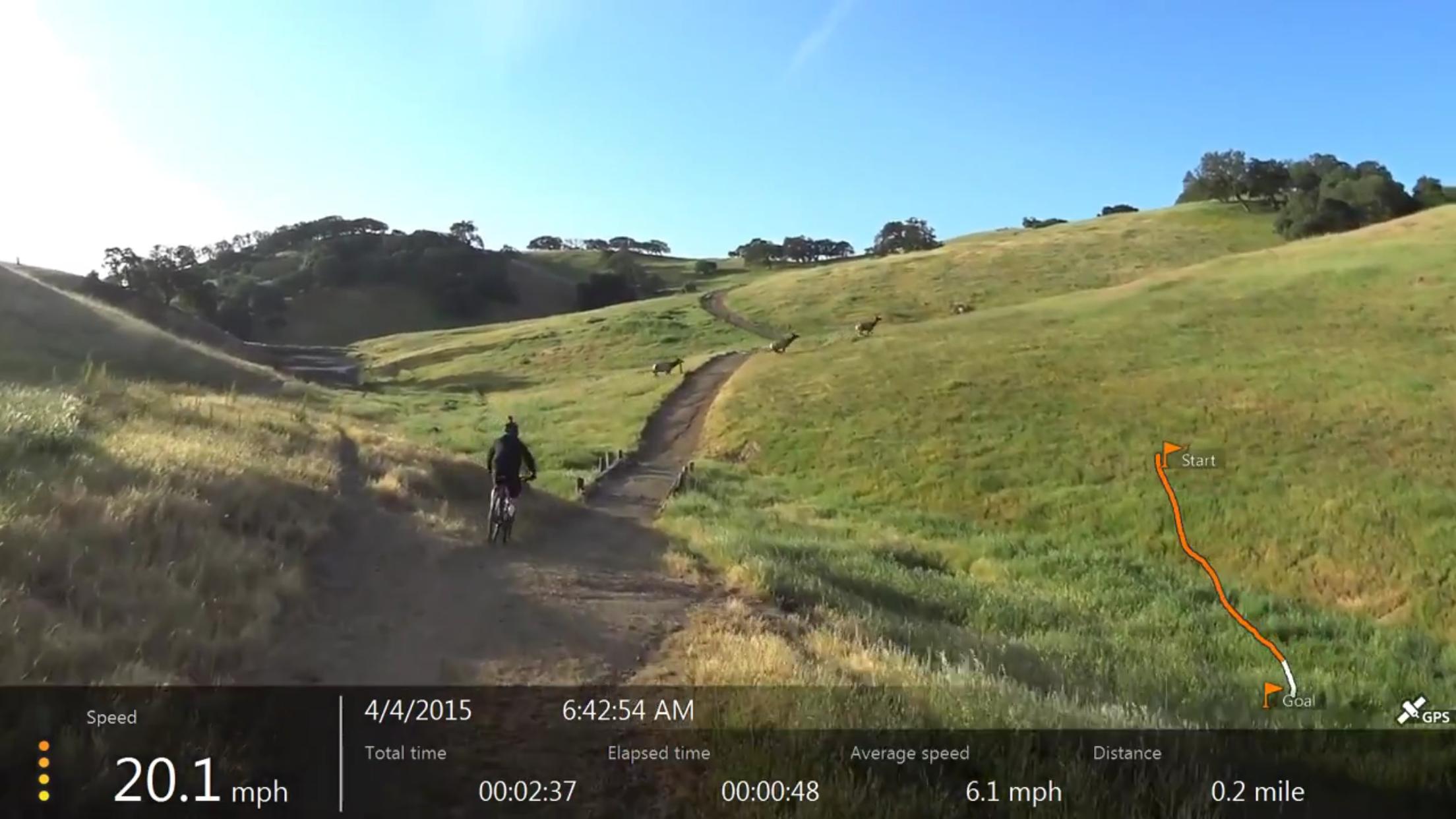
Mountain Biking South Boundry Loop
#205 of 1,005 mountain bike trails in California
start at the pigs pond trail and go east to west for a tougher climb, also never be shy about going off the trail and following the cattle trails, go west to east for a major climb off the get go but alot of long rolling downhill. the views are awesome and chances are you will not see another person. unless im there.
First added by tbone on Feb 21, 2004. Last updated Apr 30, 2020. → add an update
Before you go
- Drinking water: unknown
- Lift service: unknown
- Night riding: unknown
- Pump track: unknown
- Restrooms: unknown
- Fat bike grooming: unknown
- E-bikes allowed: unknown
- Fee required: unknown
This trail information is user-generated. Help improve this information by suggesting a correction.
from I-5 take 152 west to dinosaur point go left follow sign to pacheco state park.
from I-101 take 152 east to same as above.


Good trails and good experience for a rookie
| ThankJust a bunch of horse trails which means that anywhere it gets steep, you can expect it to be torn up from the hooves and post holed. Rode here once and can't imagine being desperate enough to return.
| ThankIs anyone riding it this weekend?
| ThankIt's nice and Green. Perfect place to ride your bike.
| ThankPacheco State Park is one of the best Trail rides I've written so far. it's advanced then it's easy then it's intermediate. Very clean environment, fast real fast downhill's. I recommend this to anyone who is beginner intermediate any level there's a there's a trail for you.
| ThankThis is a great trail for beginners (like me) who live in the central valley or by gilroy. It is all fireroad but like everyone else has noted has plenty of cow trail of you want to get adventurous. It features plenty of climbing and cardio (had to walk my bike a lot but im a beginner) but the downhill is a great reward. Bring lots of water and watch out for rattlesnakes and tarantulas.
| ThankGreat place to go if you live in the Modesto/Turlock area and don't want to drive far.
* Review edited 7/1/2010
| Thankfun ride if you are in to fast downhills. steep climbs, had to walk the bike several times but worth it completely very isolated been twice and seen one other biker.. the trails can be hard to follow but use the map and common sense and you will be fine not a good place to ride alone. mainly fire road with single track and tons of cow trail, bring all the water you will need because there is no drinkable water in the park, and i wouldnt even drink the lake and stream water after filtering it
| ThankMountain view and South Boundry are hard to follow in some places. This area should be left for advanced riders or a group. Both were fun single track which made up for all the cow CR@P this time of the year. There are more than a few big steep walls. Hey if ya don't walk some your not trying
| Thank