×

|
Rate it:
Tags:
Level: Intermediate
Length: 12 mi (19.3 km)
Surface: Singletrack
Configuration: Network
Elevation: +207/ -176 ft
Total: 87 riders
Mountain Biking Comlara Park
#14 of 128 mountain bike trails in Illinois
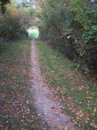
These trails are a fun place to ride close to Bloomington-Normal. The network consists of a wide doubletrack backbone maintained by the McLean County Parks and a number of singletrack loops that shoot off of the county trail. Some people like to make a loop, riding the county trails out and the singletrack back or vice-versa. I sometimes ride out & back both on the singletrack. The singletrack is for the most part pretty flat but tight & twisty. The two new sections north of the dam add a little elevation, particularly the newest (and as of 10/25/03 unfinished) section northeast of the dam. Highlights of the park include a series of ravines in Section 5; a number of logpiles in sections 6, 4, 3, "Bovine Run", and the new-new trail; a fast downhill/slow climb (depending on which way you go) on the new-new trail, and a floating bridge on the county trail. Comlara Off-Road Biking Association (CORBA) builds and maintains the trails; see our website (linked on this page) for more information about the club, more detailed descriptions of each section, and a few pictures of us building and riding the trails.
First added by searsandrewj on Oct 26, 2003. Last updated May 3, 2020. → add an update
Before you go
- Drinking water: unknown
- Lift service: unknown
- Night riding: unknown
- Pump track: unknown
- Restrooms: unknown
- Fat bike grooming: unknown
- E-bikes allowed: unknown
- Fee required: unknown
This trail information is user-generated. Help improve this information by suggesting a correction.
Find Exit 8 on Interstate 39 (8 miles north of Normal).
Go west on the road that crosses the I-39 (Lake Bloomington Road / County Highway 8). In 2 or 3 miles you will cross the dam that holds back Evergreen Lake (about halfway to the dam you will see a wooden sign for the campground & visitor center; do not turn here, but continue on straight). A mile or so past the dam, there is a gravel parking lot on the left where the woods end and cornfield begins. This is probably the best place to begin -- there is a bulletin board with a large map, general info, and a few 8 1/2 x 11 copies of the trail map in a mailbox on the back of the display. If you prefer, you can park at either end of the dam or at the big log between the dam and the main parking lot; all of these have or will soon have a smaller display showing the trail map.


Well Maintained, active local riding group. They host xc races from time to time. Good place to go ride if in the area.
| ThankLoved the experience I had here. The obstacles were easy and fun and it's in a very convenient location. I like that Corba is doing so much work to it and potential for more trails.
| ThankFun trail
| ThankThis place is fun to ride with a developing park area and several obstacles on the trails. The one thing that I didn't like was the layout. I got turned around several times because the trails cross each other. I just kept making right turns in hopes it would keep me along the lake and it worked out. Overall it wasn't extremely challenging and needs a few more high speed areas but it is still worth the ride for sure. The guys that maintain this trail system do a very good job especially with the way things have been this year.
| ThankFun trails, a little bit of everything. Quick singletrack on one side and intense trial obstacles.
| ThankGreat place to ride not to hard but flows well. Plus there are a lot of skinnys log rolls and even a few jumps. pretty flat except for by the spill way from the road go left on bovine trail there's 3 descent jumps then a log roll that I used like a jump drop type thing and then across creek after that you go uphill then there's a skinny area called prelude loop it go straight then there's a down hill and a couple jumps. Also trail 6 is basically all skinnys and log rolls hit it up pretty fun
| ThankWider trails make this great for beginners. I've taken my wife here to get here introduced to mountain biking. It also has a large selection or raised planks and bridges, but offers the choice to go around them for the less experienced riders.
| ThankI love this place and became a member of CORBA because of it. I ride it quite frequently even though I live about 40 miles away. Great single track with areas of double track in it. Very well maintained and constantly being improved with obstacles like wooden bridges and log "hills". Check out comlaramtb.com for trail conditions or to learn more about the trail. Camping is great and cheap at the campground on the north side of the lake and each side of the lake's spillway offers some decent downhill single track. This is a great trail for anyone that is not a seasoned pro with spots for timid beginners as well. Hikers, equestrians and cross-country skiers welcome and friendly here.
| ThankI live in Lincoln -- no man's land for bike trails -- so every ride represents a drive. I'll think twice about going back to Comlara. Why? Everything seems to represent a "taste" rather than a "full experience." The legs are just too darned short. I am a senior (ahem, 65) rider and rode sections 2,3,4,5 and 6 in just over an hour with only a few portions described as memorable. The most technical was No. 6 and the trickiest part there was an 18-foot 2x6 nailed to a log. (Give me the log instead.) The log piles were permanently strapped together, so there's consistency, no rattles and no surprises. I did like the smattering of very tight sections.
That said, there's a lot of plusses for the trail. The trail is excellently maintained; this is a hard-working club. It's very safe: No low limbs to duck; no broken limbs to spear you and wide areas have been cleared around the log piles and the rail. Even the bridges at the bottom of a ravine are wide and sturdy. All of which makes this a great course for the novice rider. And here's a real plus: Maps are available in a mail box at the trail head and the trails are well marked. While I checked my map a few times to orient myself and see where I wanted to go next, I never felt lost.
| ThankGood singletrack not to technical, moves very well, one downhill run close to the dam not to bad you can really pick up some good speed through there. really good trail for anyone who lives close. the guys at colmara mtb club do some great trail work check out there website for trail maps, pics, and other cool stuff
| Thankwww.comlaramtb.com
ATJ