Over the past few weeks we’ve been working hard to improve the trail mapping tools here on singletracks and I wanted to talk about some of the progress we’ve made so far. If you submitted GPS trail data recently you know we’ve been super slow approving stuff but hopefully by the end of the week we’ll be all caught up.
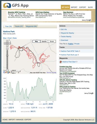
One of the things we found this summer is that a lot of people are getting into riding with a GPS but they aren’t really sure how to format and share the resulting data. Admittedly we haven’t done a great job organizing our GPS tutorials here on singletracks but it’s definitely on the to-do list. In the meantime, I’ll sum up our philosophy on mapping trail systems: 1 trail system, 1 map. If it takes multiple trips to map an entire trail system, use software like TopoFusion or GPSApp.net (more on that site later) to combine all the tracks into a single GPX file for the entire park.
Last week we made sweeping changes to the back end of our map serving system and while you may not notice any visible changes right away, this allows us to do some cool stuff in the future (like color coded trails, individually named trails within trail systems, and custom waypoint icons). We’re even looking at ways to allow subscribers to “mash up” trail maps to create their own routes by combining multiple trail systems – something our old system wouldn’t allow.

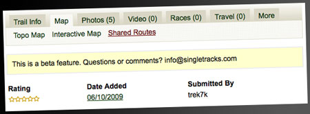
This week we also added the ability for subscribers to rate and comment on shared routes in the GPS Activity Tracker and linked those shared routes on the “official trail map” tab. So in addition to the “1 map, 1 trail system,” you can also see and download specific routes others take within a trail system.

Finally, I want to briefly mention a beta project we’re working on called GPSApp.net. The site allows you to upload data directly from your Garmin GPS device or GPX data file and provides tools for formatting, grouping, and cleaning up your GPS trail data. The site is free to use and we’ve even set up a forum thread here on singletracks to collect feedback. Many of the features found on GPSApp.net may eventually migrate to singletracks so if you want a preview of what’s to come, check out GPSApp.net!


0 Comments