

The Singletrack Silverton Society (SSS) is breaking new ground by building some of the first machine-built flow trails at high elevation in the Colorado Rockies. Colorado is renowned as one of the best mountain bike destinations on Earth, largely due to the massive network of historic singletrack lacing its rugged, majestic mountains. Many of these historic trails are sublime mountain bike rides, with classic routes like Trail 401, the Monarch Crest, and the Colorado Trail widely regarded as some of the best trails in the world.
While I’ll be the first to admit that I prefer rugged, raw, natural singletrack, the state of Colorado has lagged behind places like Washington, British Columbia, and even Utah when it comes to building bike-specific singletrack in big mountain environments. Where MTB advocates in Colorado have built bike-specific trails, they’ve most often been in the lower elevations, closer to towns and population centers. Sure, trails have been built by mountain bike advocacy groups at higher elevations (Baxter Gulch, built by CBMBA in Crested Butte, comes to mind), but they’ve generally been designed as rugged multi-use trails — not bike-specific flow trails.
To date, most of the machine-built, bike-specific flow trails high in the mountains have been constructed in ski resort bike parks, but the new trails in Baker’s Park in Silverton can only be accessed by a steep pedal up the flanks of the near-vertical San Juan mountains.
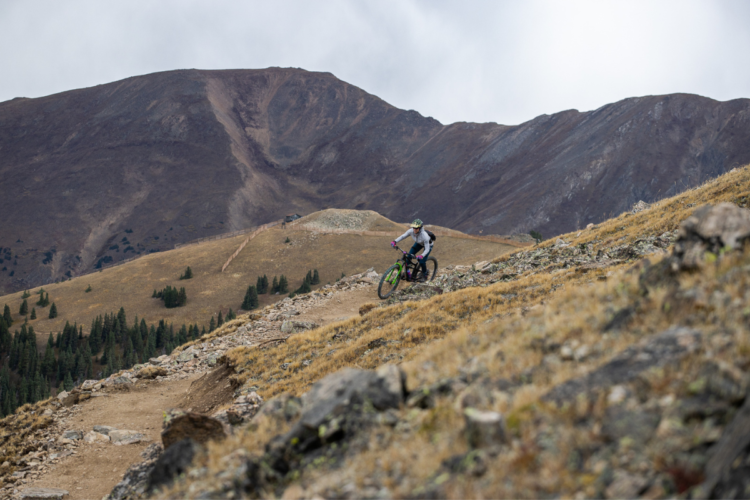
The air is thin in Silverton: the Baker’s Park trailhead rests at 9,550 feet above sea level, with the singletrack climbing steeply straight out of the parking lot. The first 6-mile singletrack loop will open this weekend (weather permitting), and it ascends a whopping 1,000 feet to top out at about 10,500ft. And this is just the lower half of the first phase; once complete, the upper half of this loop will climb roughly 600 more vertical feet.
The SSS plans to build 30 miles of singletrack in Baker’s Park. Zone 4, when completed, will climb well above treeline and top out at a sky-scraping ~12,750ft on Storm Peak Ridge, for a whopping 3,200 feet of human-powered climbing and descending.


One of the largest plots of public land in the region — and it’s owned by the BLM.
The Silverton Singletrack Society contracted IMBA Trail Solutions to design and construct the trails at Baker’s Park. Currently, the switchbacked climbing trail ascending the mountainside features a stack of steep, tight turns that take pedaling finesse and body English to clean. Board members from the SSS have assured me that these turns will be widened next year, as Trail Solutions will need to move their machines both up and down the climbing trail to build the Phase 1 upper loop.
The climb begins by passing through an easement granted by a local mining claim. While the SSS could have routed the trail up higher, the owner of this claim approached the SSS voluntarily, offering an easement as they knew it would improve the grade of the trail. After a short pedal, riders pass an “Entering Public Lands” sign, and the rest of the trail system is located on BLM land.
Cliff Pinto, owner of Pedal the Peaks bike shop in Silverton and SSS board member, told me that the main reason they chose this plot of land was because it was one of the only large plots of contiguous public land located within riding distance from downtown Silverton. “If we had built this 10 minutes outside of town, […] it’s not that backyard ride for the locals. It’s not [going to] bring people into town,” said Pinto.
The expansive mountain valleys surrounding Silverton consist of “public land with smatterings of hundreds of stacked mining claims that are private,” said Pinto. While very few of the mining claims produce any material, they are still privately held. Today, most mining claims have instead become the sites of private alpine cabins.

Perhaps one reason the SSS has been successful in getting approval for flow trails in the high alpine, and other advocacy groups have not, is because the Bureau of Land Management (BLM) manages this parcel of land, and not the United States Forest Service (USFS). In general, the BLM in Colorado is much more open to mountain bike trail development than the USFS, with the first double black diamond downhill-only mountain bike-only trail built on BLM land having been constructed in nearby Grand Junction.
Generally, the BLM manages land located at much lower elevations than the parcels in Silverton. However, the region’s lengthy mining history meant that the BLM was tapped to manage this land, as the agency more often manages areas with heavy resource extraction than the USFS. In broad strokes, the USFS is concerned with managing watersheds, while the BLM is concerned with managing resource extraction. In Colorado, this has resulted in the USFS managing most of the high-elevation land, with the BLM managing most of the land at lower elevations.
This unique combination of factors has coalesced, allowing the SSS to be one of the first mountain bike advocacy groups to build such high elevation flow trails in Colorado.

The SSS began by building an intermediate trail, but they plan to construct trails ranging from beginner to expert.
After grinding uphill for about a thousand feet, riders will reach an incredible overlook of the town of Silverton, flanked by the rugged San Juan mountains. Sultan Mountain rises as a massive monolith on the right side of the skyline, with Kendall Mountain forming the left flank. From the overlook, you can also peek up into an alpine valley far to the left, following the upper reaches of the Animas River, with endless mountains trotting away in the distance.
If the views from the “lower loop” are this good, I can’t wait to see what the upper reaches of Baker’s Park have in store! It’s thrilling to realize that this “lower loop” is just the first half of the first phase. Trail Solutions has developed a comprehensive plan incorporating trails ranging from beginner to expert. However, the SSS purposely began by constructing the intermediate trail first.
“We kind of wanted to start in the middle,” said Klem Branner, Board President and founding member of the SSS. “Really, what we’re missing here is, like, you can go ride your bike on the road, or you can go ride the super gnarly stuff we’ve got, like Boulder Gulch, Bear Creek, all that, but there’s really nothing that’s for your average intermediate mountain biker. So that’s why we want to start there.”


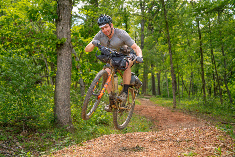
It’s time to rip on one of Colorado’s first high-elevation flow trails!
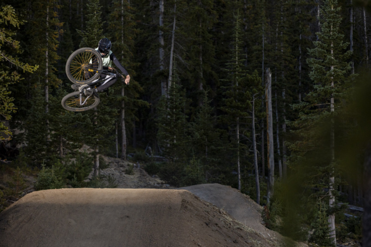
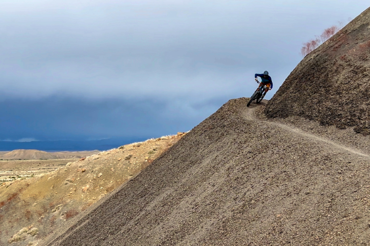
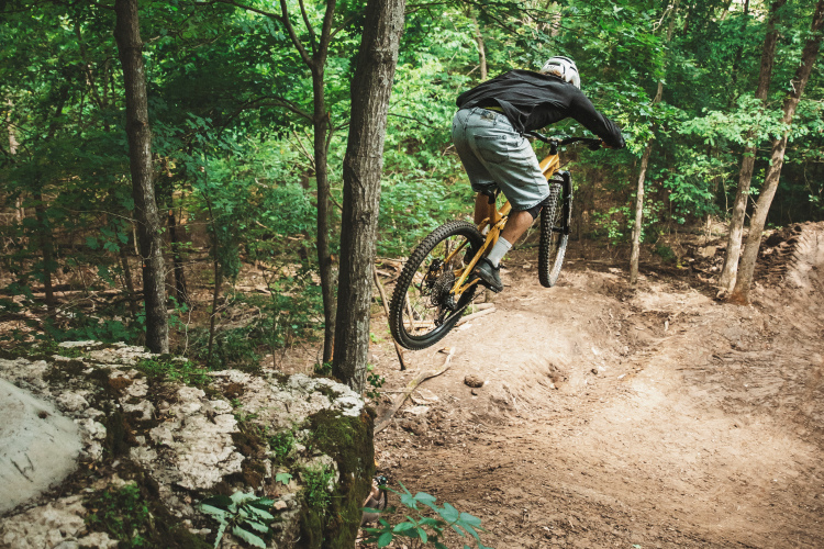
After savoring the view at the overlook, a brief uphill pedal will bring riders to a junction with the planned upper loop, and then, it’s time to drop the saddle and drop in! While the climbing trail needs to be tuned up, the descent has been fully finished. The berms and rollers flow seamlessly together, providing a delightful kinesthetic swoop and flow as you drop precipitously down those 1,000 vertical feet back to the trailhead.
At present, the trail tread is quite wide, but a narrow track will inevitably develop as the trail wears in. It’s also likely that some small stones will begin to work their way out, but right now, even though this is marketed as an “intermediate” trail, it’s flowier and smoother than most of the “beginner” trails in the San Juans. Still, there’s no getting around the aerobic grunt to reach it, unless you choose to ride an e-bike — Baker’s Park is open to Class 1 e-bikes.
Beautiful banked corners allow riders to carry their speed around hairpin turns, flow into rollers, and pop off of small rock lips. While you can find the occasional side hit on this trail, and really pedal and pull to air off of some rocks placed at the tops of rollers, this is genuinely a “flow trail” but not a “jump trail.” There are no tabletop jumps, no sculpted lips. Even so, it’s impossible not to have a smile on your face when you finally roll back into the parking lot.
This descent is built around an intermediate trail speed, and due to the steep mountainside, it is possible for advanced riders to overcook the occasional corner or roller. It’s good to remember that on flow trails of this nature, the wise course is to dial into trail speed and then stick to that speed all the way down the mountain. That said, the optional side hits and rocks to pop off provide fun diversions for advanced riders.

Is this really a two-way multi-use trail?
If you study the concept plan, you’ll notice that some of the trails in Zone 3 are designated as bike-only downhill trails. The trails built to date are not designated as bike-specific — instead, they are technically two-way, multi-use trails open to bikers, hikers, and horses.
I say “technically,” because the lower loop descent is certifiably a downhill flow trail. It was designed and built by mountain bikers to be a downhill mountain biking trail — there’s no two bones about it. The reality is that in many places, the reason we haven’t seen such trails built is because when trails are designated as two-way multi-use trails open to all forms of traffic (including horses), they need to be built to accommodate that traffic.
The current trails in Baker’s Park were not designed for two-way traffic. There’s a distinct climb and a distinct descent.


While we were pedaling up the mountain, I asked Pinto about the interactions of different user groups in the area. According to Pinto, while equestrians do occasionally use trails near Molas Pass and Coal Bank Pass, they’re rarely seen near Silverton. He emphasized that you’d have to be crazy to choose to pedal up the down trail and ride the loop in reverse, but still, I found myself wondering: will the “crazy” people out there come to Baker’s Park and do crazy things?
I’ve witnessed equestrians riding in-town bike-optimized trails in Salida, CO, just because they could. I’ve witnessed hikers causing a scene on bike-optimized flow trails because they were technically open to hikers, too. So even though the trails in Baker’s Park have been designed and built with one particular use case in mind — mountain biking — the potential for future user conflict definitely exists.

Phase 2 construction is funding-dependent.
While all of the trails have been approved via the NEPA process, the timing for the full build-out of Baker’s Park is ultimately funding-dependent. Fundraising is “ongoing,” according to Branner. “We’ve got a number of irons in the fire. And it’s just like, as things work out, we’re just going to continue to build it, and hopefully, at some point, we’ll hit some bigger ones that’ll enable us to take some bigger leaps.”
In 2024, the SSS “did receive a grant from the state of Colorado that is for planning purposes.” They’ll use that grant to flag the last 20 miles of the project, as only the first 10 have been pin-flagged thus far.
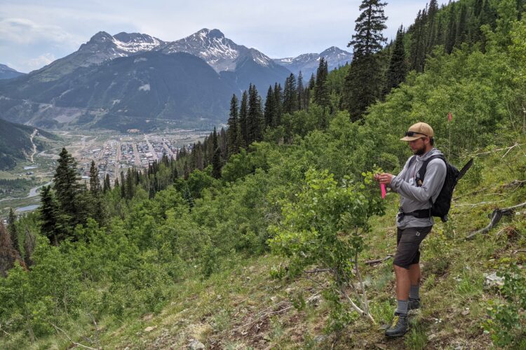
Branner noted that they continue to apply for crews from the Southwest Conservation Corps (SCC), and that 2024 was the third summer the SCC had worked on Bakers Park. As we rode, we passed both workers from Trail Solutions and the SCC fine-tuning sections of trail for the grand opening on October 12th. Despite the repeated work, the SSS has been encouraged to continue applying for SCC workers, so hopefully, the SCC will be back in 2025.
While the SSS continues to apply for public grants, both Branner and Pinto expressed hope that perhaps a wealthy private donor would get involved and help fund the rest of the project. The total cost of the first phase is $800,000, and much of that has already been funded. The total 30-mile build-out is expected to cost an additional $1.7 million, for a total of $2.5 million.
It’s becoming more and more common for wealthy private donors to fund trail building projects that cost many multiples of this amount. Just down the road in Durango, the Katz family purchased over 1,800 acres to create the Durango Mesa Park, the future home of the largest municipal bike park in the country. The Waltons have famously pumped tens of millions into the trails in Bentonville, and the Chestnut Family Foundation is investing heavily in mountain bike trails in Atlanta — most recently, $8 million for an urban bike park with a mere 2.25 miles of singletrack.
In comparison, $1.7 million for an additional 20 miles of top-tier high-alpine flow trails to finish off Baker’s Park sounds like a bargain! If you’re interested in supporting the SSS, no matter how big or small your donation might be, be sure to visit their website for more information and consider donating to their GoFundMe.

2 Comments
Oct 17, 2024
Oct 17, 2024