Jeff co-founded Singletracks with his wife Leah in 1998 and has been dedicated to sharing the mountain bike information that inspires others to take epic adventures ever since. He started mountain biking in high school and served in the US Air Force before devoting himself full time to Singletracks in 2007.
Though formally educated as an engineer, Jeff began writing stories at an early stage, inspired by his mother who is a longtime accomplished author. He enjoys covering the world of mountain biking from every possible angle, whether it's trails or gear or skills. His goal for every story: that readers learn at least one new thing.
Author snapshot
MTB Background and expertise
- Riding experience: Trail, XC, and bikepacking.
- Mountain biking since: 1992
- Number of products reviewed: ?. I think my first product review for the site was this one for a plastic wallet.
- Current stable: Canyon Neuron, Orange P7 hardtail, and Scott Fun XC
Education and writing experience
- Bachelors of Science in Engineering, Duke University
- Masters of Business Administration, Duke University
- Other publications: Panther Press (Lakeside High School - Augusta, GA), CitySearch.com
There's been a lot in the news lately about trail building and advocacy and fortunately most of it has been good news thanks to groups like IMBA and local bike clubs. On…
Durango Mountain Park is poised to be renamed after one of mountain biking's biggest names: Ned Overend. The Durango, CO resident was the first MTB world champion in 1990 and won the…
photos: CBP Man tries to smuggle marijuana across border in bike tires Yep, that headline just about sums it up but here are some more details (the Examiner said it was a…
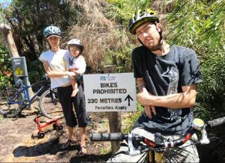
photo: ANNIKA ENDERBORG, Manly Daily. Here's an example of what not to do if you want increased mountain bike trail access: get quoted in the local paper saying you'll continue to ride…
photo by Nicole Goodhue Boyd, WickedLocal.com. I feel like this is something we've written about before but a recent article about ice biking got us thinking about this extreme form of MTB…
photo from Jill Valerius / Susitna 100. Is that a mountain bike or a motorcycle? If you're still making excuses about mountain biking this winter, this should make you feel really bad:…
photo courtesy Wikipedia. It's snowing here in Atlanta today but that's nothing compared to what a team of adventurers will encounter when they attempt to bike around Lake Baikal in Russia later…
image courtesy The Daily Mail. This week we came across an article showcasing some interesting bike concepts and as always it got us thinking about the future of mountain bikes. Of course…
An Idaho legislator is seeking approval for a special vehicle license plate to benefit mountain bike trails. While many states (including our home state, GA) offer cycling-themed plates, as far as we…
There's a new documentary film out about mountain biking women and judging by the previews it looks to be as adrenaline packed as any MTB film we've seen. Of course, this movie…
In mountain biking there are very few "classic" designs that haven't been torn to shreds over the years as tech advances to produce bigger and better MTB components. Sometimes, though, designers and…
If you're bummed about being shut out from Interbike every year, the folks at Western Spirit in Moab have just the thing for you: Outerbike. From September 30 through October 3 this…
A guide to choosing a GPS for mountain biking.
photo via RidingtheSpine.com Incredible news: After three and a half years and 21,000 miles in the saddle, the Riding the Spine crew has made it to the southernmost city in South America.…
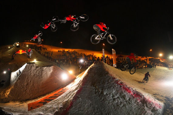
photo courtesy konaworld.com. Kona is sponsoring a really cool and unique event starting Friday called "White Style" at the Kona Leogang Bike Park in Austria. White Style basically creates a DH/FR course…
When I was a kid I had this idea for a clear bubble that enclosed my bike so I could ride in the rain and not get wet. Of course the idea…
Even though the weather may not be ideal for riding at the moment, we're busy preparing singletracks for the 2010 season and we're super stoked! In case you missed it, here's what's…
Titus Cycles is running 3 contests to give away some seriously sweet bikes to some seriously dedicated fans. They're handing out a total of 4 bikes and here's what you can do…
In the past 30 days alone, nearly 3,000 visits to singletracks.com were on an iPhone or iPod Touch (plus hundreds more on other handheld devices). If you were one of those visitors,…
If you're tired of getting lost on the mountain bike trail or are just looking for a new toy to play with on your ride, 2010 is the year for you to…
Many of us take a small first aid kit on the trail whenever we go mountain biking but for epic, backcountry rides I like to be prepared for anything. Even on fairly…
Scott Morris over at TopoFusion posted up a cool video visualizing thousands of mountain bike rides he's taken starting from his Tucson, AZ home. For those who don't know, Scott is a…
photo courtesy ColoradoDaily.com // MARK LEFFINGWELL Boulder Indoor Cycling is offering classes for surprisingly young mountain bikers over holiday breaks from school and teaching skills that many adult riders have yet to…
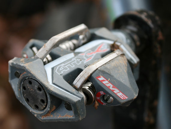
A review of the Time ATAC XS clipless mountain bike pedals.
photo courtesy BlueRidgeAdventures.net. Over on the Facebook fan page we asked for 2010 mountain bike goals and many of the responses had to do with long format racing (anything over 6 hours)…
Here's a quick guide to installing (or not installing) the Fox 32 Float 150 FIT RLC fork and how to dial it in for max performance on the trail. If you're looking…
Checkpoint map from a recent trail nav competition. Courtesy trailbreak.co.uk. We wrote about mountain bike orienteering a couple years ago and noted that it was a mostly UK phenomenon involving navigating a…
Selecting the perfect mountain bike saddle usually involves balancing the trade-off between comfort and weight. Super lightweight saddles often feel worse than metal folding chairs while really comfy seats are generally wide,…
Mountain bike paramedic in London. Photo via Firegeezer. By now you've probably seen police officers on mountain bikes but here's something I hadn't heard of: mountain bike paramedics. Apparently this has been…
Tri-Flow and Ray's Indoor MTB Park are holding the second annual XC Indoor Invitational Jan 15-17 at Ray's in Cleveland. The race is open to pro riders only and after qualifying rounds…
photo credit: CRAIG SIMCOX/The Dominion Post Back in 2007 Jeremy Simpson and Karl Holmes were mountain biking in the Wainuiomata hills of New Zealand when they encountered Graeme Burton on the trail.…
If you live in the northern hemisphere, today and tomorrow are officially the shortest days of the year. At first that fact might seem depressing but the good news is the days…
If you live anywhere near Laguna Beach, CA, you have to check out the annual Crankbrothers Christmas sidewalk sale this Saturday, December 19. The event runs from 10am-2pm and you can get…
Pro downhill mountain biker Brian Bartlett has come up with an innovative replacement knee built around the Rock Shox Monarch 4.2 Air Shock. According to the tech manual, "the Bartlett Tendon System…
This post is a bit of a holiday mountain bike potpourri - enjoy! Egg Nog Recovery Drink Just in time for the holidays, INFINIT Nutrition has released an Egg Nog flavored sports…
If you were on singletracks back in 2001 you might remember a site feature called "Sweet Bike." To our surprise it actually became one of the most popular features on the site…
Here's something interesting you may not have heard of before: a bike wheel that won't let you fall. The Gyrowheel can be mounted on the front of a bike and uses "gyroscopic…
A mountain bike helmet is the type of thing that you expect to do its job but really don't want to think about too much. In the case of a helmet, its…
You know the deal this time of year: it's usually way more fun to give than it is to receive. So while it might be exciting to find some of this stuff…
photo courtesy hadleighcountrypark.co.uk Back in September UK officials finally settled on a location for the Olympic mountain bike competition after the UCI determined that the Weald Country Park course wasn't challenging enough.…
I've been riding my 29er for almost a year now and one of the things that was frustrating initially was the lack of component variety available. It was kinda like being a…
I once asked a friend why he thought horses were so spooked by mountain bikes and he said it was because mountain bikers look like predatory jungle cats running through the woods.…
So this is actually an old study (2006) but I just read some commentary about this over on seriousrunning.com this week. Apparently cyclists who took Viagra as part of a study increased…
Ok, so this is interesting and not just because my hero from 90210, Jason Priestley, is involved. Rolling Stone ran an article titled "Death of a Freerider" a couple months ago about…
Last week I wrote about some of the technology behind the Gore-Tex membrane and how Gore works closely with brands like the North Face and Pearl Izumi to produce super high quality…
This past weekend I rode at the SORBA CSRA Bike Fest at Clarks Hill Lake in east-central Georgia and the weather was absolutely perfect. This was my first time riding the Bartram…
In case you hadn't heard yet, there's an encore presentation of Race Across the Sky, the movie about Lance Armstrong's epic battle with Dave Wiens in the Leadville 100 MTB race this…
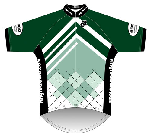
Element22 did a kick-ass job designing the singletracks jersey and we're finally ready to start taking pre-orders. We need to order a minimum of 10 of each style so to make sure…


 11
11

