Jeff co-founded Singletracks with his wife Leah in 1998 and has been dedicated to sharing the mountain bike information that inspires others to take epic adventures ever since. He started mountain biking in high school and served in the US Air Force before devoting himself full time to Singletracks in 2007.
Though formally educated as an engineer, Jeff began writing stories at an early stage, inspired by his mother who is a longtime accomplished author. He enjoys covering the world of mountain biking from every possible angle, whether it's trails or gear or skills. His goal for every story: that readers learn at least one new thing.
Author snapshot
MTB Background and expertise
- Riding experience: Trail, XC, and bikepacking.
- Mountain biking since: 1992
- Number of products reviewed: ?. I think my first product review for the site was this one for a plastic wallet.
- Current stable: Canyon Neuron, Orange P7 hardtail, and Scott Fun XC
Education and writing experience
- Bachelors of Science in Engineering, Duke University
- Masters of Business Administration, Duke University
- Other publications: Panther Press (Lakeside High School - Augusta, GA), CitySearch.com
IMBA and local advocates are working with the National Park Service to build new shared-use singletrack at Big Bend National Park in Texas.
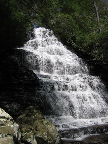
Chilhowee delivers challenging climbs and technical terrain near Lake Ocoee, but lacks the flowy singletrack magic found at nearby Tanasi trails.
Here's a one-sentence excerpt in the Singletracks.com style:
We're celebrating Labor Day weekend early with epic rides at Chilhowee and Tanasi trail systems near Chattanooga, Tennessee.
Pro mountain biker Jay McCue, paralyzed two years ago, proves determination conquers adversity while raising funds for a rehab bike to aid his recovery.
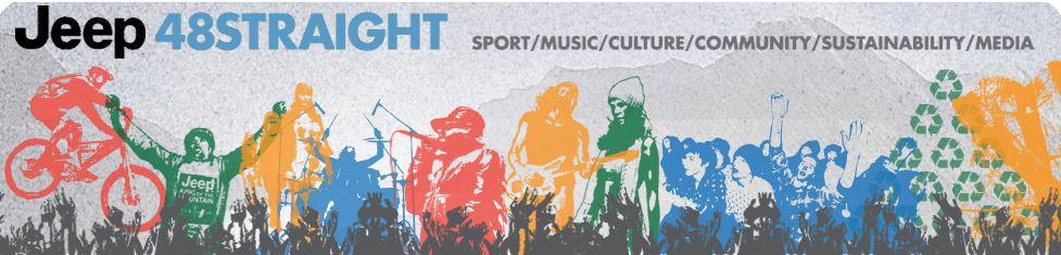
Cody Warren and Kathy Pruitt take top honors at Jeep 48Straight stop at Diablo Freerider Park in New Jersey this weekend.
IMBA's fifth annual Take a Kid Mountain Biking Day happens October 4th, with free event packs for groups registering before September 15th.
France's Julien Absalon claimed his second consecutive Olympic XC gold on a brutally reworked Laoshan course featuring 6,400 feet of climbing.
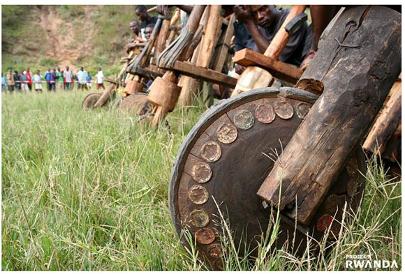
Tom Ritchey's Project Rwanda uses cycling to build awareness and economic opportunity, including the annual Wooden Bike Classic race for locals and tourists.
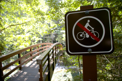
Mountain bikers face increasing trail closures across the US, with removal requests spiking despite recent advocacy gains by groups like IMBA.
CBS Sports will air three Jeep 48 Straight mountain bike events this fall, bringing more gravity racing action to television after Olympic coverage concludes.
Giant Bicycles opens its first company-owned store in California this October, carrying 90% Giant products in a new direct retail experiment.
California's Evomo creates sick mountain bike lifestyle apparel like the iconic Braincase tee featuring a skull constructed entirely from bike parts.
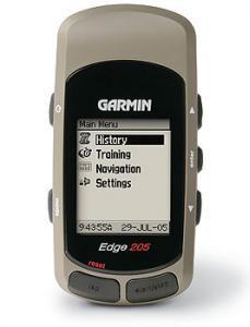
Post a review of trails, gear, tours, or shops in August for a chance to win a Garmin Edge 205 GPS and influence 2008's best gear rankings.
Cannondale's Olympic riders will compete on a super-secret 8.8kg Scalpel featuring raw carbon finish, prototype tubulars, and ceramic bearings this month.
# Suggested Excerpt
Dutch company YAKKAY markets stylish helmet covers for urban cyclists, transforming basic BMX-style lids into fashion statements for $180 total.
Mountain bikers should support safe routes to trails and advocate for more urban trail systems to make "riding to the ride" a practical reality.
Here's a one-sentence excerpt in the Singletracks.com style:
Complete Olympic cycling TV schedule including men's and women's mountain biking coverage times, plus road, track, and BMX events.
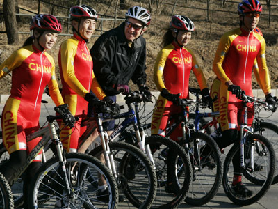
President Bush previewed the challenging Laoshan Olympic Mountain Bike Course with Chinese riders, calling it "really, really difficult" ahead of the competition.
Lance Armstrong finished second at the Leadville 100 MTB race, less than two minutes behind six-time winner Dave Wiens, and vowed to return.
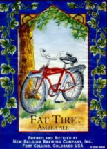
Looking to carbo-load before your epic weekend ride? Here are the best mountain bike-themed beers to fuel your singletrack adventures (responsibly, of course).
Trek tests a trailside vending machine in Madison, stocking tubes, CO2, and snacks, plus integrated work stand and repair videos.
Austrian mountain bike school teaches gnarly singletrack skills in the Kitzbühel Alps, complete with dumpling soup pit stops at mountain huts.
Eight riders fall ill after a UK mountain bike race, possibly from contaminated course conditions, prompting a health investigation into the stomach bug outbreak.
Look aims to reclaim mountain bike market share with new clipless pedals, but $199 price and learning curve may limit appeal.
Submit a helpful review of trails, gear, tours, or shops this month and you'll be entered to win a Garmin Edge 205 cycling GPS.
Meet the three U.S. mountain bikers heading to the 2008 Beijing Olympics, including rally racer Adam Craig and former circus reject Georgia Gould.
Get these catchy summer albums stuck in your head on your next ride: Weezer's Red Album, Nine Inch Nails' The Slip, and Silversun Pickups' Carnavas.
El Diablo's enormous bike and a bizarre backyard full of stolen bikes are just two of the must-see cycling pics from 100km.us.
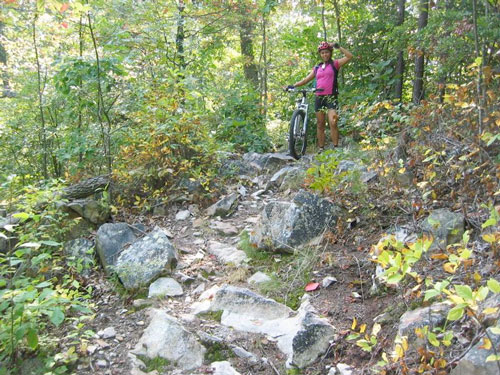
We tackled the IMBA EPIC Tanasi trail system near the Ocoee Whitewater Center, finding swoopy singletrack, technical descents, and surprisingly few crowds.
Singletracks t-shirts are back in stock with all sizes available for $12, plus free mountain bike stickers through August 2nd.
Mountain bikers are discovering that two wheels provide the perfect way to reach remote fishing spots inaccessible by car and too far to hike.
Mountain biking in Shanghai requires serious effort to escape the city, but tour operators like Bodhi are making off-road adventures possible in China.
Whistler's Crankworx festival features an indoor Air Dome with foam pits and progressive jumps to help riders safely develop air awareness.
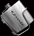
This custom flask holster from Ahearne Cycles mounts a Surly flask to your bike frame, selling 500 units annually at $30 each.
# Proposed legislation could clarify mountain biking access at National Forest ski areas, but industry motives for the bill remain unclear.
Mountain bikers will compete on a 1930s Chicago movie set and at Whistler Blackcomb Bike Park during the Red Bull Roundup this weekend.
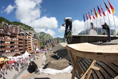
Mountain bikers bunny hop across rooftops at France's Avoriaz ski resort in this wild rooftop slopestyle competition before 10,000 spectators.
Italian suspension maker Marzocchi sells its mountain bike and motorcycle business to US auto parts giant Tenneco Inc. in a reverse-trend overseas deal.
The Jeep 48 Straight summer series hits three resorts with freeride mountain biking, music, and entertainment, though details remain scarce on the promotional website.
Two awesome mountain bike videos: a 10,000-foot descent down Peru's sandy Olleros trail and unicycling on San Diego's Iron Mountain Trail.
Comparing two options for tracking rides on a mountain bike.
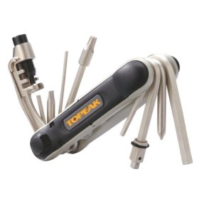
The LA Times reviews essential trail-side tools, but smart riders know to pack light and prepare only for the most common repairs.
Chelan County, Washington offers some of the fastest mountain bike trails in the region, just two hours from Seattle.
Australian mountain biker Chris Jongewaard wins appeal to rejoin Olympic team despite facing criminal charges from hit-and-run accident.
Rapid City hosted 300 riders for the National Unicycling Championships, with locals claiming mountain unicycling is safer and more controlled than traditional mountain biking.
Mountain bike festivals from South Dakota to New Zealand offer downhill racing, epic endurance challenges, and trail-building fundraisers for riders seeking summer adventure.
# Suggested Excerpt
Mountain biking motivates riders to lose weight, build confidence, mentor youth, and protect trails—proving the sport's power extends far beyond the ride itself.
---
**Word count:** 24 words
This excerpt captures the article's main theme about mountain biking's motivational impact while maintaining Singletracks' informative yet enthusiastic editorial voice.
Mountain bike documentaries resonate with riders because they tell authentic stories that capture the sport's real essence and help outsiders understand our world.


 1
1