* Pikes Peak Atlas

* Pikes Peak Atlas: Alt text: A detailed topographic map titled "Pikes Peak Atlas" by Robert Ormes and Robert Houdek, displaying various trails and trips around the Pikes Peak region. The map includes contour lines, marked trails, and locations such as Palmer Lake, the New Santa Fe Trail, and Falcon Trail, with a scale indicating a distance of 1 mile.
×
User
Today
 
  |   Rate it:

Tags:
Where to buy * Pikes Peak Atlas    SEE ALL
 
Loading...
Singletracks may receive compensation for purchases made through affiliate links shown above.

Product info

  Add a review
1 Singletracks members own this.
#1 out of 0
Brand: *
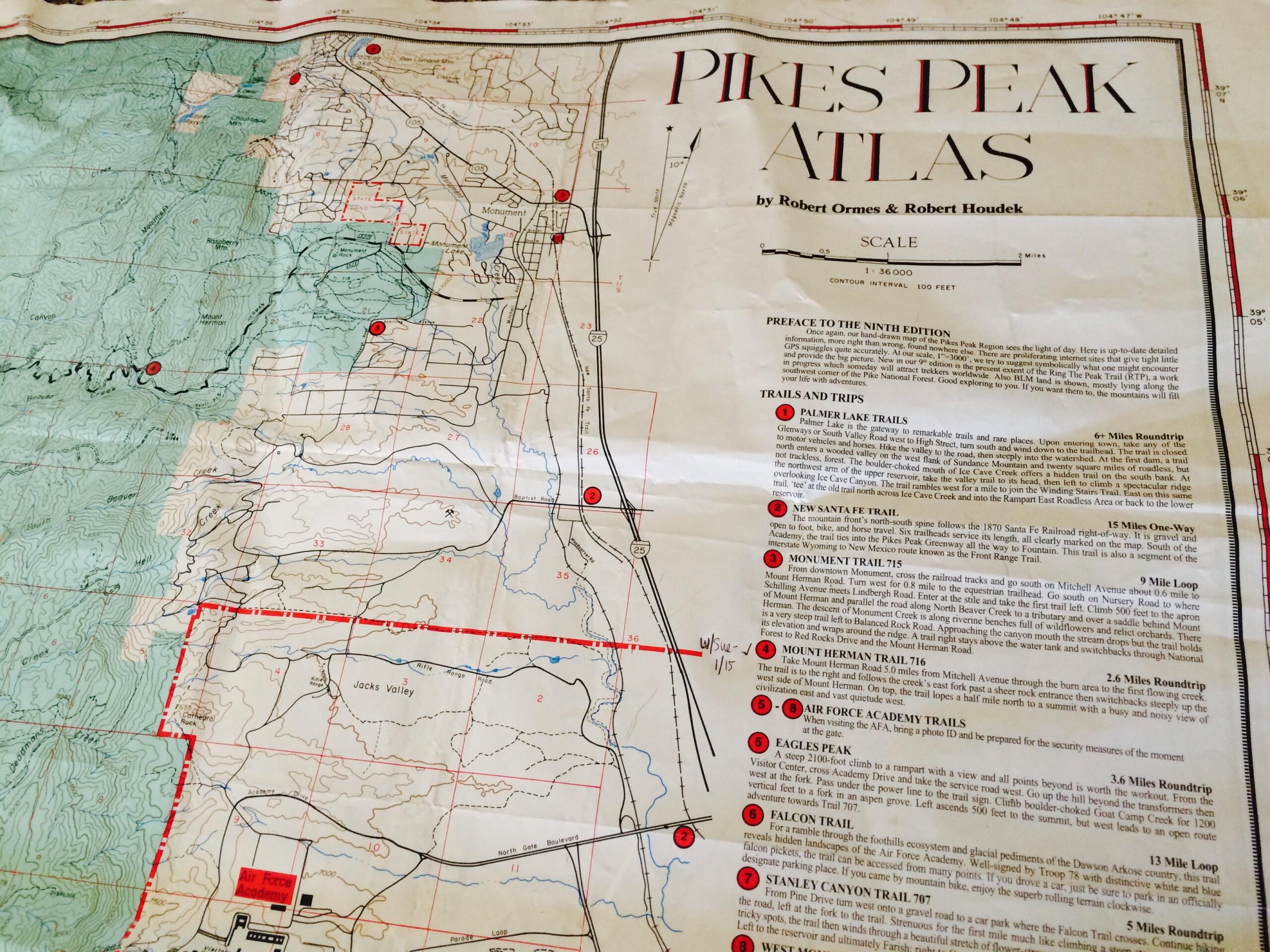
This map is a must have for the Pikes Peak region. The 2009 print is the most recent version, comprising years of work by Robert Houdek and Robert Ormes. The map is hand-drawn and uses a 1:36000 scale, is printed on water-resistant durable plastic. This is the MOST ACCURATE maps of the region, much to the dismay of the USFS who wish the many unofficial trails were not shown.


More reviews

* Pikes Peak Atlas Reviews

    Loading reviews...

Add a review

Rating
 
Review

Rider questions