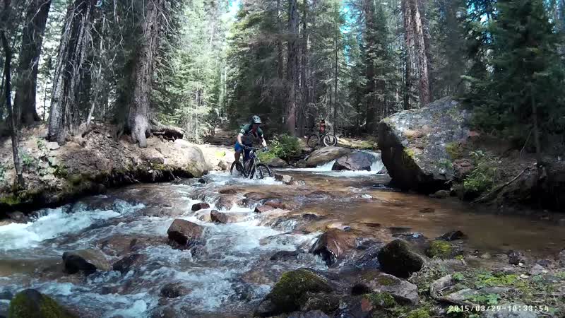
This is an alternate descent from the Crest that drops down the WEST / Pacific side of the Continental Divide. This is a long 10-mile descent that crosses Agate Creek seemingly dozens of times, so it's best ridden late in the season.
While not as gnarly as other descents off the crest such as Green's Creek, Agate swoops and flows with astounding corners, jumps, and berms, forcing you to whoop and holler like a mad man on the way down! Thanks to this trail's remote ending and the work that it takes to shuttle it, when you drop into the more moderately rolling creek bottom (complete with a few climbs) you'll feel totally isolated from the world and in the wilderness. However, coming across a few wrecked vehicles that flew off the highway years ago will remind you that there's a major mountain pass just a few hundred feet above you.


Hey Greg. I've been reviewing Agate Creek Trail for the first time. Looks really cool. Then a thought came to my mind looking at the map. It looks like there is another 2-2.5 miles and 800' of DH to be had near the bottom if the trail was extended to the bottom of the mountain from where the trail currently approaches the highway. That might be a nice trail project for the area.
| ThankThis is a pretty challenging descent with plenty of rocks and roots all the way down. Tons of stream crossings and a slightly nasty climb at the very end.
| ThankA super rad descent! Chunder up top, a little mellower once you're in the woods.
Lots of trail huck opportunities. Good sight lines mean you can ride this trail pretty much full speed, even blind. That's how I did it anyway.
You cross Agate Creek a ton of times on your way down, and as you do, it gets wider and deeper. As Greg said, "Just embrace the wetness." There's really no way around it.
The bottom of the trail flattens out and there's a really tough section with basketball sized rocks scattered everywhere. I dabbed a lot there and had to walk a couple spots after losing all momentum.
| ThankYet another great route off the Crest. It has a great mix of super steep and pedally, gnarly and not so gnarly. There is definitely some work involved, especially with the lower creek crossings and at least one hike-a-bike, but all well worth it. I echo Greg's comment "and the second best descent that I've ridden so far in the Salida area (after Green's Creek)." Even as a close second, it's still a solid 5 stars.
| ThankAwesome little bit of everything with breathtaking views!
| Thank