×

|
Rate it:
Tags:
Level: Intermediate
Length: 3 mi (4.8 km)
Surface: Singletrack
Configuration: Figure 8
Elevation: +404/ -218 ft
Total: 19 riders
Mountain Biking Alden Hill
#33 of 123 mountain bike trails in Maine
There is a 3.5 mile race loop with some sweet singletrack and some steep drop in hills. This is a easy race loop for most racers but I think overall this trail with the stream crossings and drop in hills will get the average rider.
First added by beantownmessenger on Sep 12, 2004. Last updated May 3, 2020. → add an update
Before you go
- Drinking water: unknown
- Lift service: unknown
- Night riding: unknown
- Pump track: unknown
- Restrooms: unknown
- Fat bike grooming: unknown
- E-bikes allowed: unknown
- Fee required: unknown
This trail information is user-generated. Help improve this information by suggesting a correction.
In Gorham, Maine at the corner of RT. 25 and RT 114 you will find University Of Southern Maine. If you can find the baseball parks at the school you will find the trails. You will need a parking pass to park at the school. There is on street parking in downtown Gorham only a half mile from the school.


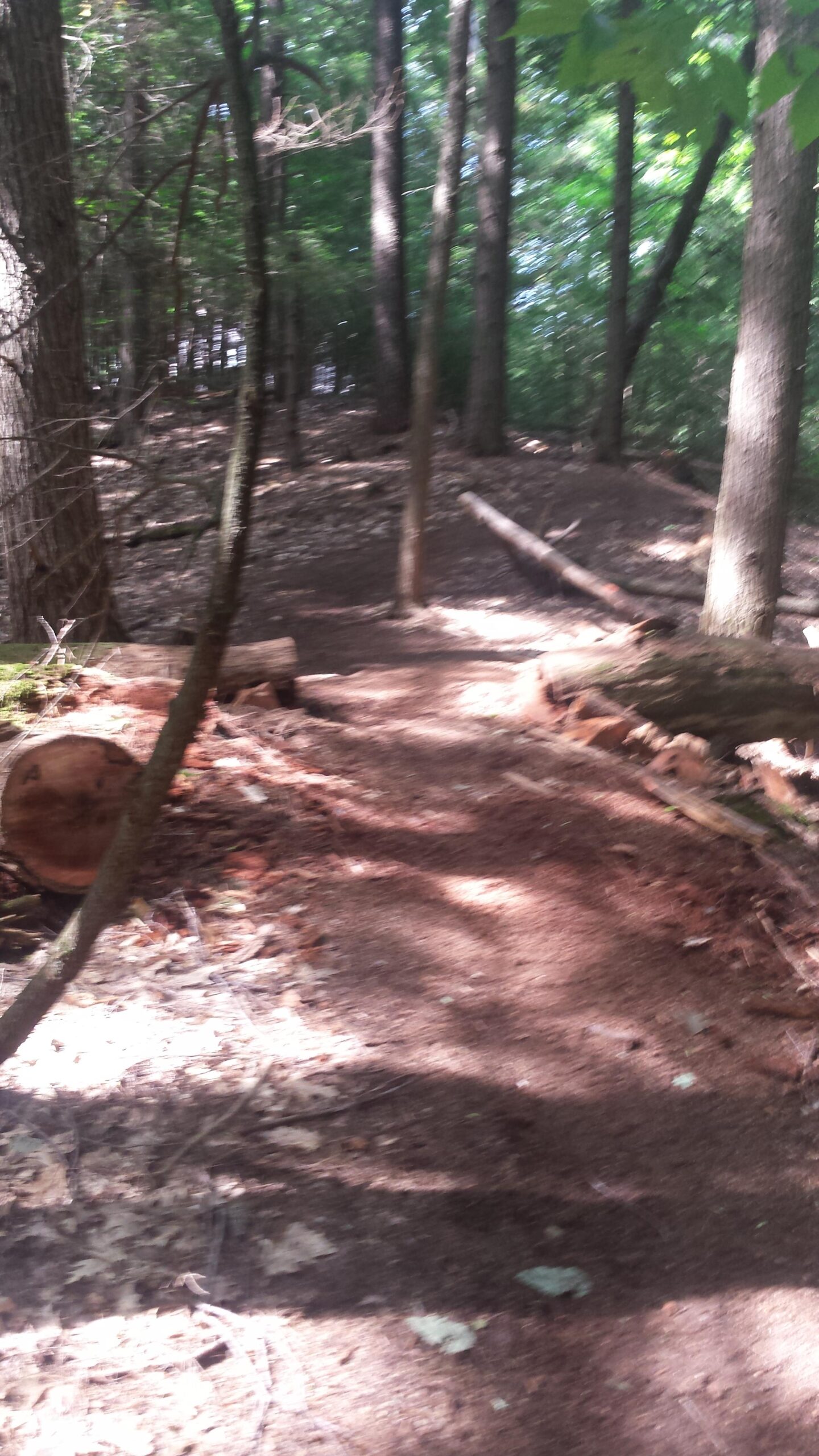

The trails were fun....once I found them. Lots of flat out stretches... some fun technical ST int the woods. Overall - what stuck out more than anything is that nothing is marked!
I was stunned that no one mentioned NONE of the trails are marked. There is no trail map anywhere in the woods - nothing to show where you are, what connects to what or how long anything is. After driving out from Portland I was committed to exploring - but was a little unnerved not knowing if I was 1/2 thru the ride - or just about done.
The trails are maintained - and every once and awhile you will see orange flags in the ground that suddenly change to pink....what is the significance of the color change? Am I on a new trail? or did they just run out of orange? I had no idea.
Obviously the trail is maintained and is in good to great shape - why hasn't anyone bothered to map it out???? Arrgh!
** Best way to find this trail and save yourself headaches is to park in the lot by the USM police station. If you head to the police station entrance, you will see a break in the wooden guardrail on your L- that is an access point to the trails. It's steep and gravel, then merges with a WIDE dirt road that takes you past the pond on your L...then you merge on to some single track climbing and from there you will see 'wide dirt roads' and trails that shoot off to your L and R...where they each lead is anyone's guess.
Allow yourself time to explore, find your way back and pack plenty of water and snacks in case it takes you longer to get back to your car then you were planning.
| ThankI'm a beginner and I just rode this trail for the first time a few days ago. It's an awesome trail, pretty technical. Be ready to ride uphill for a while and then basically turn back around and go back down. There are options for trails though so don't take that as me saying it's boring! Just wanted to warn about the uphill. I started at the pump house but I noticed that there is access through a college parking lot. Its not obvious but it's against the tree line of the lot by the turf field, behind the guardrail. Just beware of the bridge at the bottom of the trail, I want careful and fell in the brook! Overall a good ride, although it was wet. Very thankful for these Gorham trails!
| ThankVERY FUN TRAIL. IT IS HIDDEN AT FIRST BUT ONCE YOU FIND IT THERE IS ENOUGH SINGLE TRACK TO LAST YOU A LONG TIME. TO FIND THE TRAIL PARK IN FRONT OF THE USM POLICE STATION. THERE IS A TRAIL RIGHT BEHIND IT COVERED IN WEEDS. FALLOW IT TO A POND AND KEEP TO THE WATER AND YOU WILL FIND A NETWORK OF SINGLE TRACK.( most of the trails are free from overgrowth)
| ThankTotally overgrown at this point.
| ThankSuper fun trail, a couple of steep grades kept this from rating "Easy" but that shouldn't stop beginners from taking a whack at this trail. It needs some TLC with a ton of debris, but overall a very fun trail. Also, I did not find the trail near the baseball fields. Park on 114 in town and coast past the two USM entrances then take your first left, the trail starts at the end of the road.
| ThankAwesome trail if some parts of it weren't so overgrown. Lots of fast open trail and singletrack. I would highly recommend a good bug repellant and a wrap for your head, as the horseflies are out in force. At the end of one of the main trails there is a road that leads to route 25....WATCH OUT FOR THE PACK OF NEIGHBORHOOD DOGS! They will chase you down from the end of the trail if you aren't fast enough.....it's good for the nerves though (nothing like a bunch of 80lb dogs sprinting after you!).
| Thank