BikeTicket2Ride trail photo
See all photos (28)
×
User
Today
 
  |   Rate it:

Tags:
Level:
Length: 50 mi (80.5 km)
Surface: Singletrack
Configuration: Loop
Elevation: +4,484/ -4,984 ft
Total: 3 riders
 

Mountain Biking BikeTicket2Ride

  Add a review
#14 of 33 mountain bike trails in Switzerland
#8,648 in the world

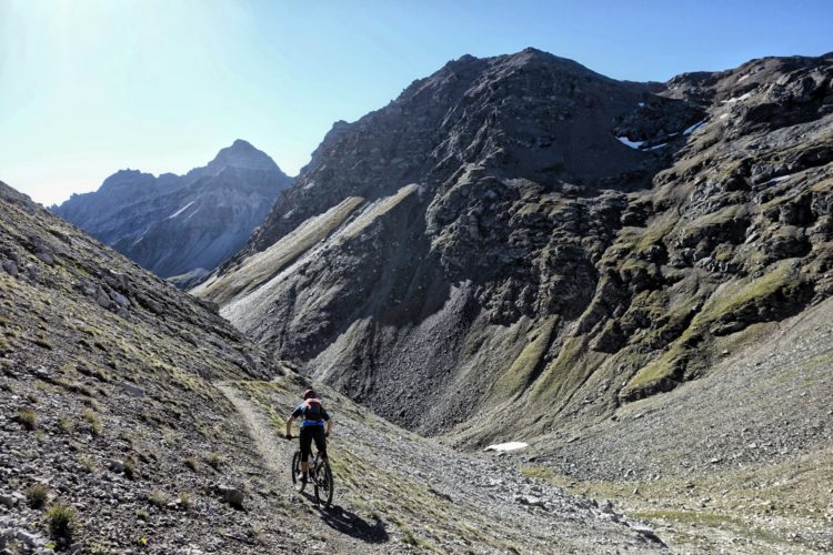
The BikeTicket2Ride Tour is a signed route with an accompanying GPS track that allows the rider to tour around the entire Chur/Churwalden/Lenzerheide/Arosa region with a series of lifts, descents, pedal climbs, and tons of Singletrack.
The tour can be conducted in a variety of lengths and difficulties, but I personally completed the Black route--the longest and most difficult. Despite being pretty long and technical, with all of the lift rides up the mountain, many riders in halfways decent shape should be capable of completing this tour.

First added by Greg Heil on Sep 15, 2016. Last updated Apr 22, 2020. → add an update
Before you go
  • Drinking water: yes
  • Lift service: yes
  • Night riding: unknown
  • Pump track: unknown
  • Restrooms: unknown
  • Fat bike grooming: unknown
  • E-bikes allowed: unknown
  • Fee required: unknown
This trail information is user-generated. Help improve this information by suggesting a correction.
Getting there
Chur
Featured in


BikeTicket2Ride Trail map

Add to or improve this map // Share this map on your website

Local Info

Club Sponsor

-

Local Bike Shop

-

Trail checkins

Greg Heil (Sep 7, 2016)
What's this?

Upcoming Events

None.
Add one

Trail conditions

Good (Sep 7, 2016)
login to update

Camping & Lodging

Coming soon!

BikeTicket2Ride videos

Add a video
We don't have any videos of this trail yet. Add one here.

Mountain Bike Trails Near Chur, Switzerland

*****
Advanced | 10 mi
*****
Advanced | 10 mi
*****
Advanced | 15 mi
| 15 mi

Add a review

Rating
 
Difficulty
 
Review

Reviews

    Loading reviews...

Rider questions