


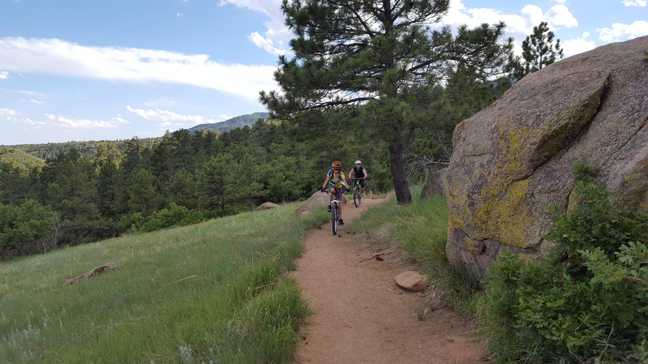
Most of these trails were not designed with the mountain biker in mind, but a few of them make for a pretty good ride. There are great training climbs (Talon, Blackmer, Cougar's Shadow). Around the bottom, the trails are wide and well manicured so that families with strollers can negotiatie them, but the higher you go, the narrower and more technical they get. The one exception is the Medicine Wheel Trail, which is near the bottom, is a half mile technical rock fest. For a good overall ride, hit the Talon/South Talon/North Talon trails and come back down. then head up Medicine Wheel to Blackmer to Cougar's Shadow, back on to Blackmer and Medicine Wheel, Boulder Run also has a few technical challenges. Although not the best ride in the area, this is a welcome addition to C-Springs' already impressive MTB resume. there is a $6 fee/vehicle to enter the park.
 | North Talon | 1.2 mi |


 2
2
Thumbs up. I was on a carbon gravel bike, and we went up Sundance -Talon - North Talon. Down South Talon - Talon - Sundance for an easy, moderate loop on non technical trails. I look forward to exploring the rest. Fun, flowy riding.
| ThankFinally rode CMSP a couple of times this week. IMO, most of the reviews sum up the trails quite well. There is a lot of variety here - "something for everyone" as they say. In terms of downhills, the longest, fastest DH is from the top of Talon North. It's about 4-4.5 miles down Talon North, down Talon South, down Talon and back to the parking lot (via Talon or Sundance to Zook). The most technical downhill is from the top of Cougar's Shadow. Head down Cougar either way and then down Blackmer. From Blackmer you have various options back to the car. Medicine Wheel is the gnarliest. There are still a few more trails I want to ride, but all in all, I had a lot of fun riding here. The park is a nice resource for the region. Also if you are bent on not paying the entry fee (currently $7 per car), you can ride your bike into the park (no car) for free.
| ThankWhy 5 stars? Because sometimes you just need to go to your happy place and ride without wondering if that rock garden is going to kill me today. The scrub oak is ablaze with color as are the grasses. Talk about leaf peeping, this is the place to do it but just not aspen leaves. It hasn't peaked yet so there is plenty of time to get out here and enjoy the beautiful fall weather. Rode clockwise around Sundance, up Zook around Little Bear and up Talon then commenced the lovely downhill.
| ThankBeing kind of new to Mountain Biking after a 7 year break, these trails were perfect. Good gradual climb along Talon and almost made it to the top before the clouds opened up making the sprint back to the truck a muddy mess. Even with the rain falling on the trail, traction remained good and there were now problem areas.
| ThankThe trails at Cheyenne Mountain State Park are super fun. They're, for the most part, smooth, fast/flowy, with good climb sections, and some fun descents. I raced an XC race there once and had a blast. Great option for riding if you live in Colorado Springs, and it's very close to Ft. Carson if you're stationed there.
| ThankThis park has a great mix of trails, from highly technical to moderate singletrack and even some beginner level stuff. Cougar's Shadow, Coyote Run, and Medicine Wheel are the most technical, but riding all the way up Talon, Talon N., and Talon S. is a fantastic workout with great views and fun run back down. The park has a mix of surfaces, too: gravel, dirt, hard rock, sliprock, and so on. Trails are very well maintained and clearly marked, with maps positioned throughout. A side note: it costs $7 to park for the day. No dogs allowed, bears sometimes noted.
| ThankTrails aren't too well maintained in the winter and spring but are pretty good the rest of the time.
| ThankBeautiful views, well kept trails that drain exceptionally well.
| ThankGreat trail system. Trails are mostly accessible year around. Some technical sections. Good place for training.
| ThankRode a few of the lower trails and they are wide and very unnatural feeling. Lots of tight corners and poorly placed boulders to kill any flow you may find. Some serious drainage issues that need to be addressed. Lots of water running down the middle of trails. A few sections of technical rocky descent but not enough to make up for the minutes of climbing. Lots of slow speed technical climbing. Very well signed. Not my cup of tea...
| ThankGreat place to ride, but don't go too quickly until you are familiar with the specific trail you are riding. There are a few places where you will be ripping along, and then all of a sudden there are a few ill-placed small boulders. Also a few unexpected gravel areas. Ride a loop once, then go back around for your kicks!
| ThankThis is my happy place and today was no different than any of the other miles I've ridden here. Stellar! There is plenty for everyone in terms of ability but one thing is certain, if you don't leave with sweat pouring down your face, lungs so full of fresh air they could burst, and a smile on your face, then perhaps you should ride somewhere else ; )
| ThankGreat place to ride! I love the wilderness feel of the area.
| ThankThee are a great mix of trails, with a mix of difficulty, technicality, and climbing. Plenty of climbing!
Really enjoy riding here.
I LOVE this place. Its easy to get to and we typically don't see anyone on trail past the parking area. There are more than 20 mies of trail here and its very Choose Your Own Adventure. Its good for beginners/ intermediates. If you don't have a Colorado Parks Pass its $7 for the day. I like to ride up Coyote to Kestrel, back to Blackmer for a fun downhill, then over to North Talon for another climb and downhill. You really can't go wrong - its a fun place!
| ThankThis trail system makes for a nice family ride. Most trails are machine cut and 6ft wide. There are some rocky technical sections thar were fun like the Medicine wheel. Hikers everywhere on weekends. $7 to get in.
| ThankGood trails, lots of fun, and beautiful area. Not a top tier spot, but definitely worth riding. Will ride again.
| ThankI have just started back in mountain biking after a 12 year hiatus and I have recently ridden Ute Valley as well as Red Rocks and I will say that for me this was one of the most fun rides I have been on in a ling time. Being 20 pounds overweight I have a hard time with some of the hills - while I did have to walk a few times, the walks were short and did not distract form the ride in any way. This will be my marker for performance this summer - I will ride this trail clean and quickly in no time!
I parked in the lower parking lot and rode; N. Zook > Medicine Wheel > S. Blackmer (up) > N. Blackmer (down) > S. Zook > back to Parking
http://connect.garmin.com/activity/275267212
I encountered lots of sweeping single-track, nice soft dirt, rock gardens, good climbs, sweet downhills, challenging technical sections and lots of trees. I did not see many hikers despite that it was 60° out. Being winter here in Colorado, I did run into a lot of packed snow on the North facing slopes - but very packed and easy to ride. Also, there was a lot of mud form the snow that was melting; I only had to bounce my bike once to get it off - most of the time it just came off on it's own.
Medicine Wheel - this is a very technical rocky section (basketballs to boulders in size) and I rode it up form North to South - an obvious mistake - this trail was designed to be ridden down form South to North. It parallels N. Zook - so if you are with less experienced riders, you can take this fun 1/2 mile detour while they follow Zook and meet you at the intersection.
I did get a rear flat about 3.75 miles in, don't know why yet, but since my son had my pump I had to walk the last mile out.
Details:
| Thank4.8 miles
1:13 minutes (including the walk)
892 total elevation gain
Max Elevation 6,636 ft
I only rode Sundace trail and then rode up Talon and then did Talon South. Sundance trail was pretty easy climb, then hitting Talon, its almost all climbing for about 1.5 miles. Talon is not to technical, just the climbing that makes it tough. If you want a good work out take Talon all the way up and then do the Talon South/North loops. The downhill coming back down Talon was pretty fun too. The facilities at the Park were very clean and well maintained. I would def go back and camp at this park.
| ThankCheyenne Mountain State Park offers trails for every level of rider. There are countless miles of well maintained trails and beautiful views. They have everything from steep bouldered trails to light groomed family paths. I have recorded over 300 miles on the trails over in the park and continue to find new challenges each time i go out.
| ThankParking/trail access (unless you ride from outside the park) costs $7/visit or you can buy a $70 pass that gets you into all CO State Parks for a year. (Prices current as of April 2012).
In the last two months I've ridden every trail in CMSP. My favorite ride that takes about 45 minutes (7.25 miles) starts at the visitor center. Take Coyote Run>Soaring Kestrel>Bobcat Way>Acorn Alley, then stay straight on the road heading south for about .1 mile and there's a wide trail on the right. Take that down to Boulder Run and make a right. Take Boulder Run to Blackmere Loop and do Blackmere counter clockwise. Once you're done with the Blackmere Loop, retrace your route down to the visitor center.
Blackmere Loop has some nice technical parts; 99% of the trail is "rideable." Going counter clockwise you get about 2.5 miles of flowing downhill, my favorite part of the loop.
Bobcat Way and Soaring Kestrel is a fun downhill as well, not technical except for some spots that are mostly toward the bottom.
Boulder Run and Coyote Run are fun trails with some challenging technical spots, mostly rocks, but very rideable for the average mountain biker.
The only trail I avoid completely is Medicine Wheel. For me, it's 70% not "rideable." I don't care for Cougar's Shadow as it has a lot of rocks and I have to hike about 1/3 of it, but it's a good place to challenge myself. It's a beautiful trail though and hiking it is great.
The southwestern end of Talon will test your lungs and thighs on the way up. North Talon is a good thigh burner and somewhat rocky, but rideable and fun. South Talon (counter clockwise) is a nice flowing downhill once you get past the first .25 mile or so. The main Talon trail is a great downhill.
Sundance and Zook Loop trails are great for beginners/kids. My 7 and 9 year old boys love these two trails. Zook Loop has some easy technical spots (rocks in the trail to navigate around) that are just enough to make it interesting and a challenge the beginner. Sundance is mostly 2-4' wide and not technical, but watch out for the loose gravel if you're going fast downhill, particularly on the south/east portion of Sundance.
Trail map here: http://www.parks.state.co.us/SiteCollectionImages/parks/Parks/CheyenneMountain/CMSPTrailMap.pdf
* Review edited 6/13/2012* Review edited 6/13/2012
| Thank