×

|
Rate it:
Tags:
Level: Beginner
Length: 1.3 mi (2.1 km)
Surface: Singletrack
Configuration: Out & Back
Elevation: +37/ -66 ft
Total: 108 riders
Mountain Biking Corn Mill Shoals Trail #19
#116 of 553 mountain bike trails in North Carolina
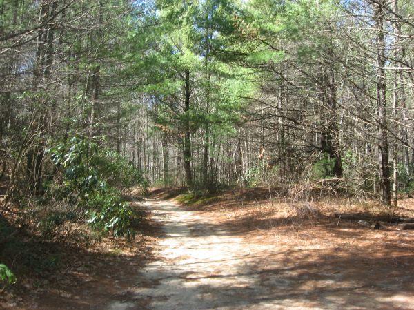
Head across the road from the trailhead to pick up the beginning of this trail.
While this section of trail mostly consists of doubletrack, it connects to a
fantastic number of amazing trails. As a result, it is a part of an excellent ride!
First added by Greg Heil on Mar 25, 2011. Last updated Apr 28, 2020. → add an update
Before you go
- Drinking water: unknown
- Lift service: unknown
- Night riding: unknown
- Pump track: unknown
- Restrooms: unknown
- Fat bike grooming: unknown
- E-bikes allowed: unknown
- Fee required: unknown
This trail information is user-generated. Help improve this information by suggesting a correction.
"From I-26 South, take exit 9 (Asheville Airpot). Go to the right towards the
airport and Brevard. Go approximately 15 miles until NC 280 becomes US 276.
Follow this into and through Brevard (staying on four lane hwy). Go
approximately 9 miles past Brevard into Cedar Mtn, NC. Go left onto Cascade
Lake Road. Go about 2 miles and you will see the parking area on the left.


Trail is basically a gravel road out of the Corn Mills Shoal parking area (near Cedar Rock and Burnt Mountain trails) but if ridden from Bridal Vail Falls it is a challenging climb over an abundance of roots and narrow slivers of slick rock that leads you to Laurel Ridge, Cart (tough) and Mime Mountain trails. Those trails form an entertaining loop with Reasonover Creek Trail when riding out of Fawn Lake Access Area. Plenty of photo-ops on that ride…..creek crossings, a lake and waterfall.
| ThankI love the river crossings and forest on this trail. The trail itself is OK with a few armored sections and some rooty bits spicing up an otherwise average trail.
| Thanklittle bit for everyone here. there are some very technical climbs because of the roots but can be walked easily. this seems to be the go to loop in Dupont. great views. great decents. loved it
| ThankNo bridges, but a fast water crossing and a steep rock face and a couple other technical features make this a wee bit more than a beginers trail.
| ThankThis trail is basically two different animals. The stretch from the parking area to the creek crossing is nice and easy - sandy doubletrack winding through the forest. After the creek crossing, the trail turns to true singletrack with some rocky advanced sections as it continues on to Bridal Veil Falls. This is a critical connector to some of the best loops in Dupont, so get to know it.
| ThankAs I mentioned above, this section of trail really isn't very noteworthy on its own, but is in an integral part of a fantastic loop! Basically, this is a gateway trail to other, much better trails. But if you're a beginner, this could be a good introduction to mountain biking.
| Thank