×

|
Rate it:
Tags:
Level:
Length: 18 mi (29 km)
Surface: Singletrack
Configuration: Loop
Elevation: -
Total: 6 riders
Mountain Biking Fiddle Creek
#477 of 1,005 mountain bike trails in California
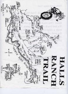
Halls Ranch Trail to Fiddle Creek is a STEEEEEP, loose two mile climb about 2000'. At the Y stay left on to Fiddle Creek. Map said 4 miles but it was over 7. Overlooks are great, very rustic there were no tire tracks. If you like scouting trail and are advanced have a blast. Gears are nice for this
First added by Juan_Gear on Jun 19, 2005. Last updated Apr 30, 2020. → add an update
Before you go
- Drinking water: unknown
- Lift service: unknown
- Night riding: unknown
- Pump track: unknown
- Restrooms: unknown
- Fat bike grooming: unknown
- E-bikes allowed: unknown
- Fee required: unknown
This trail information is user-generated. Help improve this information by suggesting a correction.
Hwy 49 before Downieville Park across from the Halls Ranch Trail sign.

The climb was definately long, and the trail really loose. The views were good, but I didn't really care for the trail.
| ThankWife and I had a great adventure. When we got to the top a bad storm was coming in two days early. Great views of canyon. We sat in the truck for a while after real quite. after it all soaked in we talked no sop home. Felt so alive
| Thank