×

|
Rate it:
Tags:
Level: Intermediate
Length: 19 mi (30.6 km)
Surface: Singletrack
Configuration: Other
Elevation: +639/ -912 ft
Total: 117 riders
Mountain Biking Hermosa Creek Trail
#133 of 1,394 mountain bike trails in Colorado
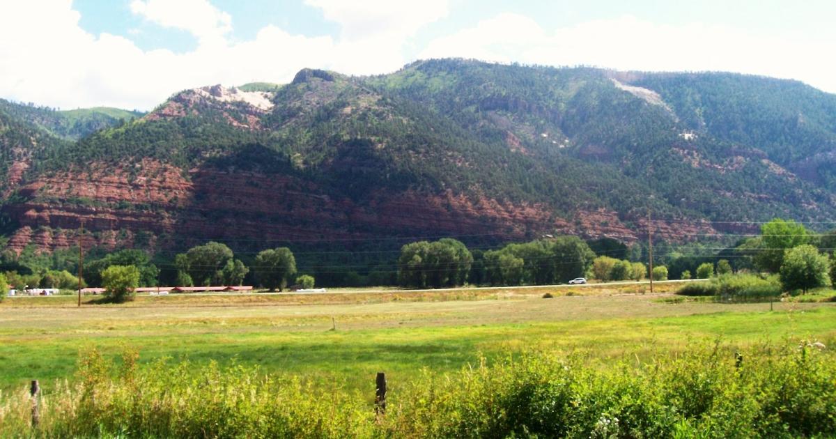
The trail starts at the West side of the parking area and follows great singletrack for the first several miles. As the trail curves South it enters a steep canyon and follows the river as it drops towards the town of Hermosa. There are several trails that cross this area, about 6 miles in you'll cross the Salt Creek trail, this has been well labeled in the past. There are some (3) river crossing, most have footbridges, and several small drainages. Hermosa Creek Trail drops about 1,500 feet total with 2 longer climbs occuring towards the end of the ride. This trail is a Point to Point with several options for leaving cars at the trails end. Usually the town of Hermosa is a good place, and you pass it on the way to the trailhead.
First added by Jasonrgilbert on Apr 10, 2009. Last updated May 11, 2020. → add an update
Before you go
- Drinking water: unknown
- Lift service: unknown
- Night riding: unknown
- Pump track: unknown
- Restrooms: unknown
- Fat bike grooming: unknown
- E-bikes allowed: unknown
- Fee required: unknown
This trail information is user-generated. Help improve this information by suggesting a correction.
From Durango Drive north on Hwy 550 towards Purgatory ski resort. Drive past the resort and make the first left, road FS 578 or San Juan CR 38. Follow that road up and make a right at the T on top. Take the next right and follow the dirt road down the valley. Follow the signs for Sig Creek Campground and Hermosa Creek Trailhead. The campground and parking lot are on the South side of the road and require a short river crossing, usually it's shallow, but it's a good idea to check.


Who was the shuttle through?
| ThankFirst off, go to Pedal the Peaks and buy the Singletrack Maps Durango Colorado Trails map. It's worth every penny. Also, Cliff is the shop owner and he is a wealth of information!
We rode this trail the last weekend of April 2013, and it had just opened.
My buddy and I chose to do an alternate start and ride down Corral Draw for the first section of this ride. However, he was concerned about his Subaru crossing Hermosa Creek on Local Road 550, so we had to Death March it the rest of the way up. That took a lot of the fun out of our day.
But, Corral Draw was awesome! 4-inch wide, off camber trail, all gradual downhill, for over an hour. I have never been that focused on a ride! If you did go off the trail, there's nice soft grass, but you'd take quite a tumble! Every now and then there's a little rocky section to keep you on your toes!
We cross the creek and joined up with Hermosa Creek trail. It was mostly fast and open, with little rock gardens here and there that we just blasted through. This was an amazing ride until the last 25%, which was mostly constant uphill for a long time. We were toasted from our Local Road 550 climb, and this uphill was NOT welcomed. I have not suffered like that in a long time, if ever. Eventually it became an effort even to push my bike. We got back to the bottom of the trail, right at dusk.
Overall, this was an amazing ride. But, if I did it again, I would insist on driving all the way to the top. That Local Road climb was not a good way to start the day.
Also, keep in mind, this is a long back-country ride with consequences if something goes wrong! Be prepared!
| ThankThis is a trail that has a couple personalities. The middle portion of the trail, from the Salt Creek Trail intersection south to the Clear Creek Trail intersection is the poster trail for sweet singletrack. Nice and narrow with fast, long sweeping turns. Plenty of ups and downs to keep you entertained and you never feel like you are burning off hard won elevation gains in your brakes. Probably some of the best cross-country singletrack around.
The portion of the trail from the north trailhead down to the Salt Creek trail is ATV doubletrack, is full of exposed rocks, and just really isn't that much fun. The southern portion, from the Clear Creek Trail intersection to the southern trailhead is good, but is a lot wider since it is popular with equestrian and motorcycle riders.
Personally, I like to ride it as an out-and-back from the southern trailhead. That way you can enjoy the best singletrack from both directions and you don't have to bother with a shuttle. Riding north to the Salt Creek Traill is good enough, but if you feel like earning a full merit badge you could ride all the way to the top and back.
| Thankfun
| ThankTough trail, lots of fun. Rode this when I was a super green rider and it was very hard, I'm sure if you have lots of time in the saddle you will be perfectly fine.
| ThankHermosa Creek Trail, listed as one of the Top Ten Single Track rides in America by Mt Bike Mag, is a must ride. If you are ready for an ALL day ride you can start from town and ride the 25 miles up Hwy 550 to Purgatory and up and over Hermosa Parkway, down to the trail head. 23 miles or so of sweet single track, back to Hermosa, and then road burn 8 miles to town. All told you would do about 55-60 miles and cover about 2500-3000 feet of elevation gain. An easier way is to either get dropped of at the top of Purgatory and ride back to down, or leave a car at Hermosa. Anyway you do it, this ride ROCKS! Be aware it is mostly downhill from Purg, but there is a 2 mile climb out of the canyon at the end.
| ThankAwesome Trail!! rode this 3 weeks ago with a few friends.
| ThankThere is a great alternate way to start the trail and it adds a few more single trail miles to it. Recommend to leave car in hermosa and shuttle up the the described T-junction (this is pretty much the crest climbing from Purgatory up to the Valley. (E.g. Durango Mtn Resort offers shuttle services) ride the dirt road down into the valley, then take a left towards the skilifts. you can find the trail on the Latitude 40 map "Seth's trail". it may be a bit hard to find in places (especially after the 2nd skilift), but if basically follows the trees on the south side of the valley. you will eventually get to the same parking lot descibed as starting point.
Starts on double track to the creek and then downstream for a few to singletrack. The trail useage is high, espically early. When singletrack you'll climb and descend the canyon walls several times as you head downstream.
| ThankOne of the best rides i have ever taken. I rode this trail with a buddy of mine right before i left Colorado to move back to Maryland. i was living and riding in Fort Collins at the time. I took a 10 day camping excursion to see the parts of the state I hadnt seen before and this was for the highlight of the trip. The trail is long, georgeous, challenging in spots, and a blast to ride. Watch out for cattle on the trail toward the trail head and make sure yoou take a swim in the river. its cold, but it feels great when your peddling hard. Awsome trail!
| Thankamazing trail. smooth, fast, banked curves. everything i read talked about shuttles but i thought it made a great 40 mile out and back
| ThankThis was a good ride, That's me in a couple of those pictures, My friends Mark and Donny, and their girls. The ride was a little short and I had to keep stopping and waiting for them all. But it was descent.
| ThankThis is close to my favorite ride, I love this ride, LOVE IT! Plan on a full day, you can ride it faster, but you miss out on a lot of other fun, like swimming in the river. Take plenty of water and a full set of tools, Because if you break down, it's a long, hard, walk out.
Have Fun.....* Review edited 4/19/2009
| ThankI can't beleive that this trail wasn't on this site. This is a great trail. Sorry, I didn't have any pictures or better directions. If you can add any of these, please do.
| Thank