


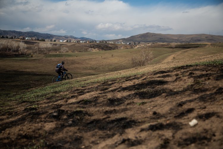
From the bridge that crosses the Poudre river, follow the trail north into the gulch. About 2.5 miles up, you will see a steep rocky section. Don't go up this steep section, but keep going straight north instead. The trail will start to wind west as you head up a meadow. At the top of the meadow, you need to make a decision... You can either turn around and follow the trail back down to the trailhead, or you can keep going. If you keep going, you will have to ride down the previously mentioned steep rocky section. This section requires expert riding (or walking) so use caution. Once down, follow the trail back to the road.


 1
1
It's been a few years since I've ridden this trail, but I remember fast, buff single track. Worth the drive out.
| ThankThis was my first ride on this trail. I consider myself above average rider, but had to stop several times on this climb. There are quite a few creek crossings so expect to get your feet wet. I took the left branch loop which led to a brisk downhill through the prairie. The right branch loop is extremely overgrown right now with several fallen trees. It was fun and I hope to do it again.
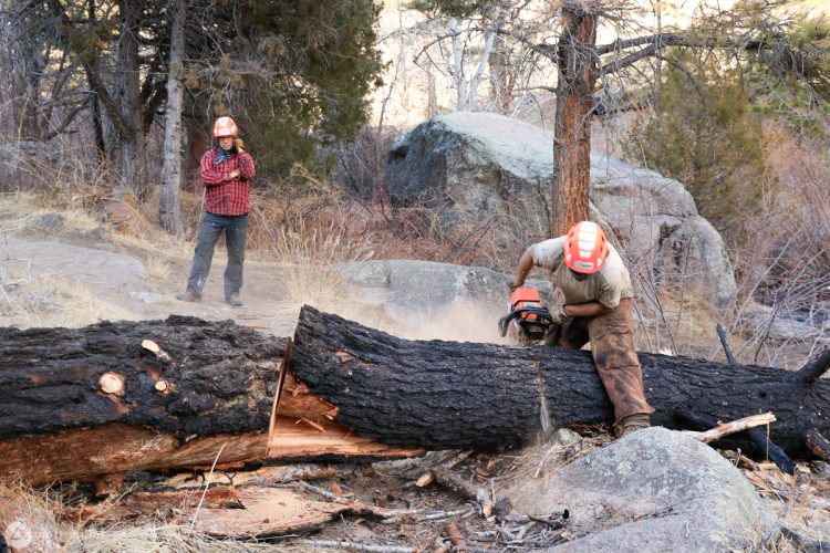
| ThankThe water was pretty high today (which is crazy for late August in CO), and the trail along the creek clearly hasn't seen much traffic. This trail needs some love -> there was a work crew out today.
| ThankThe main summary needs to be updated. There is now a parking lot if you drive across the bridge off HWY 14.
Also, a ranger stopped to me before I dropped in, to tell me that the creek is super full. He didn't know if it's snow melt or if the reservoir is releasing water. None the less most the the crossings are about 2 feet deep, so you gotta wade with your bike on your back. This is kinda fun if you're ready for it, but it kills your momentum which makes climbing up the bank a little more difficult. After doing this about 10 times, you get to either the switch backs or meadow, and you'll have a less energy than you thought you might.
In the meadow, rain has eroded the track so much that it's impossible for some people to pedal so there's another track starting, since this is soft dirt and grass mostly, it's hard pedaling through it.
In all it's a beautiful trail, and all the stream crossings mean when you get to the loop, there isn't really anyone else around, which is kinda nice. I went down the switch backs which was also fun, my front brake went out of adjustment from all the water (was riding an older bike with cantilever rim brakes) so I had to take it easy, but it was completely doable, and probably taught me something.
| ThankSpoke to a local ranger - the creek levels this spring are the highest they have ever seen.
As the trail crosses the creek approx 10 times - this means wet feet, and the occasional walk across. Not a huge deal, but it does break up the flow of the trail somewhat.
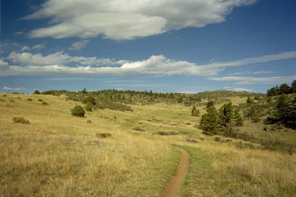
The flowers and butterflies are out, and the meadows are so green - so it is a pretty ride.
The "rock gully" thing seems a bit over-stated. I think both directions of lollipop have pros and cons. I went counte clockwise, with a walk up the gully, a ride up the meadow, and a ride down the switch-backs. No drama. The downhill along the creek was interrupted by the water flow, so wasn't as great as it could be.
| ThankThe first part of the climb is easy enough that you won't be pushing your bike. The loop at the top of the climb steps it up a notch, but the downhill is worth it. There are many small stream crossings on this ride, but you can just blast through most of them. It's kind of fun. The quick downhill, twisty single track, and splashing streams make this a cool ride that isn't in many guide books, but we found a lot of locals on this trail.
| ThankFor an Arizonan who's ridden around NM this trail's not that rocky. Makes a good dog trail with the stream
| ThankWe drove 1 1/2 hours to ride this trail and it was worth it. Smooth singletrack, just the right amount of technical sections and more than enough creek crossings. Even with the remnants of the recent fire, the scenery was still very nice. The climb to the loop wasn't a big deal but contributed to a nice ride back to the trailhead. You also get to enjoy a very nice drive up to the TH from Fort Collins.
| ThankClosed as of 6/4 due to hot spots from the Hewlett fire.
| ThankTry riding the lollypop clock-wise. Hike-a-bike up the steep rocky section, then cruise down the rest of the lollypop to avoid as much uphill. Will be interesting to ride after the forest fire.
| ThankGood summer trail. Not very difficult but offers some technical riding. Has several stream crossing so be prepared to get wet. Back side has long smooth single track that offers great speed. Good ride if your in the area but not worth a long trip for.
| ThankThis is my default ride if I dont have time to drive a long distance. Love this ride tho its got a good mix of single track and some technical sections. I've done the loop twice, and the downhill on the front side is extremely dangerous if you are not a great rider. Out and back is the safe choice, but if you are looking to leave flesh behind do the loop! Great ride either way
| ThankThis trail provides the yin to Youngs Gulch's yang. Where Young's is consistently rocky, this one is mostly smooth (except for the big descent if you take the loop). Where Young's is consistently wooded, this one is more open. Where Young's is consistently fun with brief moments of rest, this one is consistently uninteresting with brief moments of excitement. Take this one on a cool day, go to Young's when it's hot. Actually, they're both short enough that you can do them one after the other and have a great day.
| ThankLong single track, never ending climb, step descent of baby head boulders
| ThankNice slice of singletrack near Fort Collins. Many stream crossings, some rock gardens, some moderate climbing, and potentially a nasty, loose, large rock infested downhill. I rode it counterclockwise, which made it mostly climbing and was rewarded by a slow, nasty, rocky decent. I would prefer ride clockwise, push up the loose rock, and make the rest of the trail all downhill. Try'em both. There is an optional out-and-back on the NW portion of the end loop. Intersections are not marked, but the trailhead is and it has a bathroom.
| ThankAnother thing to note is that there are lots of stream crossings on this trail. About a dozen of them on the way out, plus another 8-9 in the loop. So prepared to get wet.
| Thank