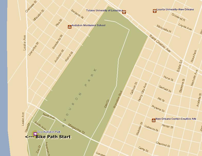
If I was start all over again on this track, I'd start at Audubon Park.
Begin by taking a warm-up ride around the 2-mile track a couple of times to soak up the glorious day your having & to have a look-see whos running today.
Then cross Tchoupitoulas St. (watch out, can be a little tricky. Ride with the traffic a ways to yield over to the other side instead of just trying to slice right through the traffic).
This will take you past the big Oak Trees to the huge parking lot of the Audobon Zoo.
A two-way lane leads you all the way up to the Mississippi River Levee.
At this point you can either turn left at the junction to see some more collegiate sun-bathing or make a right onto the beginning of a very long & winding track.
This track will then lead you & your pack of elitist through 3 surrounding cities outside New Orleans: Metairie, Kenner & Destrehan. Be carefull & BE CONSTANTLY ALERT for oncoming cyclist. These other Guys & Gals move at the speed of light. An accident will occur if you inadvertantly veer over the midpoint of the track. Also, parents, keep your kids leashed or close to your side. Many times I have come close to vehicular man slaughter by the carelessness of kids their parents.
Well, its been a good ride so far. Even though the wind may be a bit fierce at different orientations its considered good training for the legs on climbs & such.
Have a good ride and make some friends along the way.