×

|
Rate it:
Tags:
Level: Intermediate
Length: 8 mi (12.9 km)
Surface: Singletrack
Configuration: Loop
Elevation: -
Total: 21 riders
Mountain Biking Mitchell Creek Loop
#424 of 1,394 mountain bike trails in Colorado
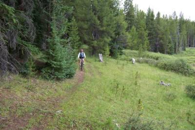
This is an excellent trail. The first 3 miles are on the Colorado trail which is well marked and maintained, only a few rocky sections and a lot of downhill. At the intersection of Wurtz Ditch Road trun right up the road and continue for about 1/2 a mile and return to the forest, the trail is marked by blue diamonds in the trees. This section has a few marshy areas and care shound be taken when navigating through them. The trail eventually reconnects with the Colorado Trail for a climb back to the parking area. This ride is at >10,000ft and should be ridden in the summer months. Note: There are trail maps at the trailhead mapping this route making it easy to navigate.
First added by ameyer on Aug 11, 2004. Last updated May 1, 2020. → add an update
Before you go
- Drinking water: unknown
- Lift service: unknown
- Night riding: unknown
- Pump track: unknown
- Restrooms: unknown
- Fat bike grooming: unknown
- E-bikes allowed: unknown
- Fee required: unknown
This trail information is user-generated. Help improve this information by suggesting a correction.
From Denver take I-70 west to exit 195 (Hwy 91). Continue west to Hwy 24 and turn right. Go north to the top of Tennesse Pass to the parking area on the left across from Ski Cooper ski area. There are 2 tarilheads as the Colorado Trail pa** through here, take the trail nearest the enterance to the parking area.

good ride, did it counter clockwise... a lot more uphill but still a fun ride. Not too technical just enough.
| Thank