×

|
Rate it:
Tags:
Level: Advanced
Length: 8 mi (12.9 km)
Surface: Singletrack
Configuration: Loop
Elevation: -
Total: 20 riders
Mountain Biking Mousetail State Park
#56 of 201 mountain bike trails in Tennessee
The trail is almost all singletrack (depending on where you start) and takes you along a steep edge overlooking the TN River. There are some decent climbs for the area and the trail is fairly rocky and is very well marked with signage and highlights. This is the home of an annual MTB race and his groomed by a small but dedicated group of riders out of Jackson and the surrounding area.
First added by tumbleweed14 on Nov 8, 2009. Last updated May 1, 2020. → add an update
Before you go
- Drinking water: unknown
- Lift service: unknown
- Night riding: yes
- Pump track: unknown
- Restrooms: unknown
- Fat bike grooming: unknown
- E-bikes allowed: unknown
- Fee required: unknown
This trail information is user-generated. Help improve this information by suggesting a correction.
A little less than halfway between Nashville and Memphis, head south of I40 about 30 minutes to 412 which runs E-W. Nestled on the east side of the TN river lies Mousetail State Park. Enter the park and go to the park HQ for a map. There are a couple of places from which to start the ride.


Stopped here to check out the Mtn bike trails. Had to ask a park lady where the trails were located. Still had to get out and walk around to find the trail. Trails needs TLC! Grown over in spots, buried under limbs and grass. I just walked a short distance and opted out of trying to ride. Looked like a sure fire way to loose a derailer.
| Thankhad a blast....leaves make finding trail hard, but had lots of speed and technical .........
| ThankWent there 12/19/15 and the trails were sweet!! The few guys from Jackson blew and raked nearly the whole trail off a few days before. Few added switch-backs to sections to break up the climbs. definitely a hilly course with some steep hills. Good work on keeping the trail maintained!
| ThankThe trail was single track, fairly well maintained, no sign of snakes (read once where rattlers were in the area), and lots of climbs but not too bad for a weekend rider. I agree with an earlier review that its many climbs and some sections where you can get some speed going down, but it has a lot of downhill turns where you can't open it up fully. This was my first visit to the park. I'd have more speed once I was familiar with the trail. Beautiful scenery, extremely peaceful and as quiet as any ride I've been on. Worth checking out.
My favorite place is still LBL although the Montgomery Bell ride is really fun too.
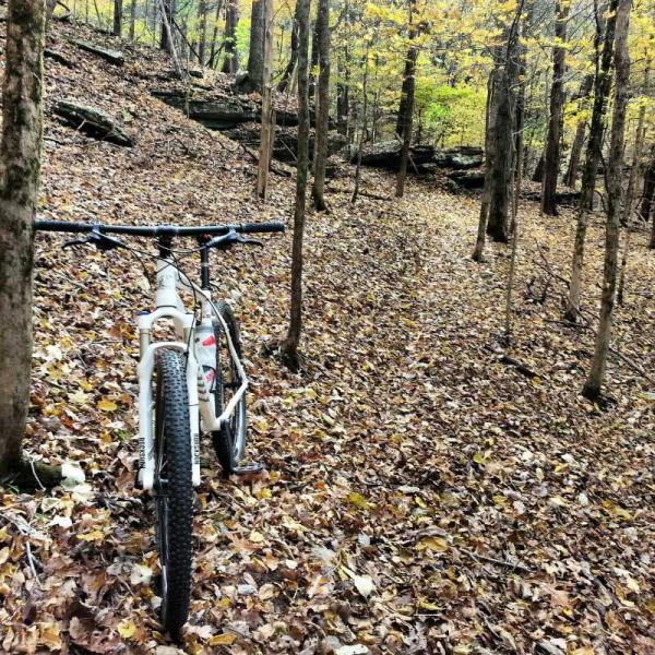
| ThankThis gem of a trail was all mine on a weekday in October. Riding the bluffs singletrack overlooking the river was so good I kept on stopping to enjoy it and made really bad time. There are some steep climbs and you rarely feel like you are backtracking over the same terrain. The obstacles weren't overly technical, just enough to keep it interesting. The trail was covered with leaves and hard to track in certain places but I was always able to find my way back with the markings on the trees. If you are in the area I highly recommend this to be on the "to do list".
| ThankAwesome trails. Pretty technical with some good climbs and descents. Not really for beginners or children but there are "emergency exits" well marked in case you bite off more than you can chew. I wouldn't recommend a basic (read: Wal-Mart)mountain bike or you will break it. Just ask my buddy ;) . A great workout for intermediate to advanced riders. If you don't like these trails, something is very wrong with you.
| ThankMy Cannondale Caffeine 29er Lefty sure loved it.
I am shocked that I was the one who had to add this trail given its relative proximity to both Nashville and Memphis. I went out there yesterday on a beautiful November morning and was very happy I drove the 1.75 hours from my house to get there.
The leaves have all fallen now and lay on the trail, which makes navigating a bit more difficult, and the going more cumbersome. It is very apparent that the trail is designed well with some good views and some flowy sweeping sections mixed in with some small jumps and tight turns to keep you awake. A bit reminiscent of sections of the LBL north south trail (not Canal Loop).
I met some guys down there who are out of Jackson and who maintain the trails and throw the Mousetail Race every year. They told me there are roughly 8 or so of them, sometimes fewer, who maintain the whole trail. If you see them out there, tell them thanks for the gem.
Although I only have ridden this trail once so far, and it was ridden under less than ideal conditions (debris), the trail definitely appears to be a worthwhile trek. I give it 4 stars for the West TN area.
| Thank