×

|
Rate it:
Tags:
Level: Beginner
Length: 12 mi (19.3 km)
Surface: Singletrack
Configuration: Loop
Elevation: +490/ -451 ft
Total: 10 riders
Mountain Biking Red Mountain Open Space
#682 of 1,400 mountain bike trails in Colorado
An easy ride with a fun, fast downhill. This would be good on a hard-tail or full rigid with some bigger, low pressure tires as there is plenty of time spent in dry stream beads (sandy). This trail has two connections to the Soapstone Prairie Natural Area. Riding this one clockwise will make the most of the downhill sections on Cheyenne Rim Trail, which generally have plenty of visibility to hit some good speeds. There are some good water bars on the Cheyenne Rim Trail going uphill. Turn around and get some good air, then back up again for the downhill. There is little cover on the entire trail, and plenty of biting flies.
The clockwise route will be from the trailhead: Sinking Sun Trail to Big Hole Wash Trail (left) to Ruby Wash Trail (right) to Cheyenne Rim Trail (right) past Canyon Trail (goes to Soapstone), right on Sinking Sun Trail (staying on Cheyenne Rim will go to Soapstone again) back to the trail head.
First added by Rob on Jul 13, 2009. Last updated Apr 28, 2020. → add an update
Before you go
- Drinking water: unknown
- Lift service: unknown
- Night riding: unknown
- Pump track: unknown
- Restrooms: unknown
- Fat bike grooming: unknown
- E-bikes allowed: unknown
- Fee required: unknown
This trail information is user-generated. Help improve this information by suggesting a correction.
Take State Hwy 1/Terry Lake Rd to CR15 (aka the Waverly turn off) - go north (left) on CR15, turn west (left) on CR78, turn north (right) on CR17, turn west (left) on CR80, turn north (right) on CR19 (pass gravel pit on left), turn left on CR21. Go over several cattle guards, traveling about 7 miles on CR21 which will end at the trailhead parking area.

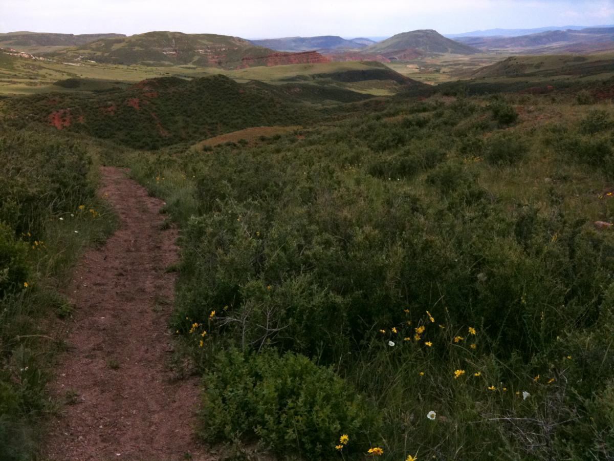

I did this trail counter clockwise. Up Big Hole Wash to Cheyenne Rim and backdown. CheyenneRim was long climbing through soft sand and gravel. Not the most fun, but a good struggle. Worth it for the views from the top. The peak sections of Cheyenne Rim were some of the best views I've seen in the area and not a singel sign of civilization as far as the eye could see.
| ThankThe open meadow at the top of Cheyenne Rim were fast, fun descents, but are followed by a bit more climbing. Once you navigate the switchback sections down, it's mostly fast and fun back to the trailhead. Avoid Ruby Wash on a bike. Deep gravel sucks.
IMO, I would not take a bike to Red Mountain, at least to the trails listed and directions above. Ruby Wash "trail", for the most part, is a dried river bed consisting of bottomless pea gravel and even when trying to ride downhill, it feels like you're on a 15% climb. Throw in constantly fighting to keep your balance, pedaling through what feels like wet concrete setting up around your tires and it just isn't any fun. The lower half of Big Hole Wash is the same. There is a trail, that is not shown on the normal maps that is at junction "F" if you're riding Ruby Wash downhill, ( the only way I'd recommend), that appeared to be new cut ST that avoids the wash and breaks east to rejoin Big Hole Wash where the pea-gravel wallowing ends and the moderately steep dbl track leads back to Cheyenne Rim near junction "G". Despite the fantastic scenery at the bottom of the tight slot canyons of Ruby Wash, the riding conditions are so bad, I doubt I'd ever ride there again. Some places are just better on foot and this is one of them.
| ThankFun downhill, good scenery. Not technical.
| Thank