Map of the Rich Fork Preserve bike and hiking trails, showing different trail routes (in green, orange, and yellow), park etiquette guidelines, trail difficulty levels, and contact information. The map includes symbols for parking, one-way paths, and bridge crossings, with details on park hours and trail lengths indicated. Rich fork Preserve mountain bike trail.
×
User
Today
 
  |   Rate it:

Tags:
Level:
Length: 2.5 mi (4 km)
Surface: Singletrack
Configuration: Loop
Elevation: -
Total: 2 riders
 

Mountain Biking Rich fork Preserve

  Add a review
#394 of 549 mountain bike trails in North Carolina
#22,113 in the world

Short track with good flow.

First added by Jaholl6413 on Sep 7, 2020. Last updated Sep 7, 2020. → add an update
Before you go
  • Drinking water: unknown
  • Lift service: unknown
  • Night riding: unknown
  • Pump track: unknown
  • Restrooms: unknown
  • Fat bike grooming: unknown
  • E-bikes allowed: unknown
  • Fee required: unknown
This trail information is user-generated. Help improve this information by suggesting a correction.
Getting there
407 W. Parris Avenue, High Point, NC 27262.
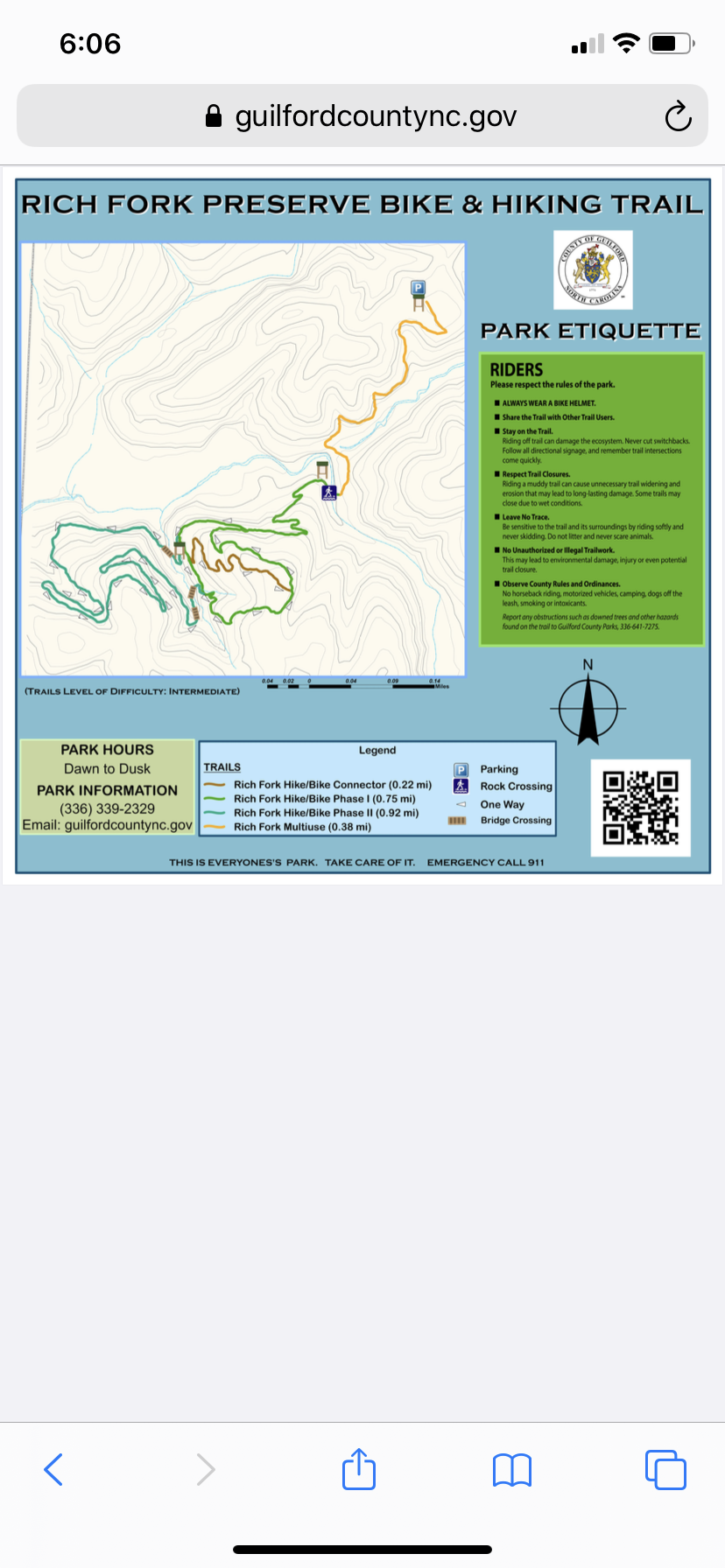

Rich fork Preserve Trail map

Add to or improve this map // Share this map on your website

Local Info

Club Sponsor

-

Trail checkins

eddyz9 (May 31, 2021)
What's this?

Upcoming Events

None.
Add one

Trail conditions

(Jan 23, 2025)
login to update

Camping & Lodging

Coming soon!

Rich fork Preserve videos

Add a video
We don't have any videos of this trail yet. Add one here.

Mountain Bike Trails Near High point, North Carolina

****
Intermediate | 6 mi
****
Intermediate | 8 mi
****
Easiest | 3 mi
****
Intermediate | 4 mi

Add a review

Rating
 
Difficulty
 
Review

Reviews

Rider questions