×

|
Rate it:
Tags:
Level:
Length: 17 mi (27.4 km)
Surface: Singletrack
Configuration: Out & Back
Elevation: -
Total: 1 riders
Mountain Biking West Fork Humptulips
#221 of 1,216 mountain bike trails in Washington
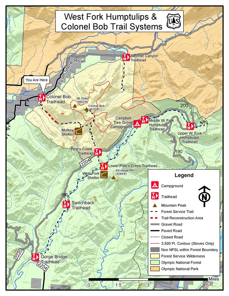
The Lower West Fork Trail is 17 miles in length. Trail grades are generally 0-10% with a few grades of up to 20%. This trail follows the river within a remote valley defined by jagged heights of Colonel Bob Wilderness to the west and Stovepipe and Moonlight Dome peaks to the east. The trail fords the river multiple times and winds along the western edge of Moonlight Dome Roadless Area, a large tract of un-logged national forest land in the rainforest valley. This trail also provides access to the Colonel Bob Wilderness via Lower Pete's Creek Trail #858.1 to Pete's Creek Trail #858. via fs.usda.gov
First added by Jeff Barber on Oct 10, 2014. Last updated Apr 28, 2020. → add an update
Before you go
- Drinking water: unknown
- Drinking water: unknown
- Lift service: unknown
- Lift service: unknown
- Night riding: unknown
- Night riding: unknown
- Pump track: unknown
- Pump track: unknown
- Restrooms: unknown
- Restrooms: unknown
- Fat bike grooming: unknown
- Fat bike grooming: unknown
- E-bikes allowed: unknown
- E-bikes allowed: unknown
- Fee required: unknown
- Fee required: unknown
This trail information is user-generated. Help improve this information by suggesting a correction.
From Aberdeen, WA take US Highway 101 north for 25miles to Forest Service Road 22/Donkey Creek Road. Travel 8 miles to junction of Forest Service Road 2204. Follow Forest Service Road 2204 for 14 miles to Campbell Tree Grove Campground. Continue on Forest Service Road 2204 for 500 feet and turn right into the trailhead parking area.
Alternate access route: Via Forest Service Road 2220 to Forest Service Road 2204.
