×

|
Rate it:
Tags:
Level: Beginner
Length: 5 mi (8 km)
Surface: Fire Road
Configuration: Out & Back
Elevation: -
Total: 4 riders
Mountain Biking Packsaddle Lake
#82 of 319 mountain bike trails in Idaho
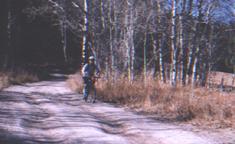
It starts on a slight incline and then gets gradually steeper. Trail is pretty smooth. After a tough climb, you get a downhill followed by a field. Then there's a fork in the road. If you actually want to get to the lake, take a left at the fork. Climb some more. View the beautiful Tetons on your left. You'll come to a clearing at the top. If you look down to the left, the lake is between the trees down the steep decline singletrack. Don't ride right into the lake. It's freezing, and does a quick dropoff.
First added by Sackattack on Mar 5, 2004. Last updated Apr 30, 2020. → add an update
Before you go
- Drinking water: unknown
- Lift service: unknown
- Night riding: unknown
- Pump track: unknown
- Restrooms: unknown
- Fat bike grooming: unknown
- E-bikes allowed: unknown
- Fee required: unknown
This trail information is user-generated. Help improve this information by suggesting a correction.
From Rexburg, take State Hwy 20 north to State Hwy 33. 20+ miles out you'll see a sign for Elk Ranch. Turn right there. Follow the road for 5 miles. You'll get to a gate in an old ranch fence. There will be a sign for Packsaddle Lake there.

Good trail. I parked my car about a mile away from the trail head and biked in because the spring conditions were wet. The climb isn't hard, but seems long. If you go in the spring the forest is thick and beautiful. The single track down to the lake is really steep so enjoy! To the lake and back is probably about 6 miles. I definitely recommend this trail
| ThankI can't believe how low I rated this last time. The climb is pretty steep despite being only a couple of miles long. The trail isn't all that smooth. It's rocky with divots where water runoff flows after it rains. The climb isn't tough enough to become bike n' hike, but it gets you panting. You stay under the trees for the most part, so you don't overheat. It is forest road, and that may be its biggest weakness. Still, a great workout complete with mountain-fresh air and a beautiful view of the Grand Tetons.
| Thank