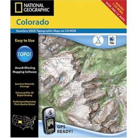
 I was all set to write a thoughtful review of National Geographic’s TOPO! software for mapping GPS data but after much frustration, I give up. Okay, I don’t completely give up, but suffice it to say this won’t be helpful if you’re seriously considering buying this piece of junk. (oops, I may have spoiled the suspense…)
It’s important that I mention I’m using the 2003 Mac version of the software so maybe the latest version has redeemed itself. However, after my experience with the 2003 version, I’m not about to fork over a single cent for the newer version, and I probably won’t even review it if you give me a copy. Well, maybe I would, I’m just saying I wouldn’t enjoy it.
With that out of the way, let me tell you why I hate this program. First off, the software crashes – a lot. When I opened up my copy to write this review the program crashed twice in the span of about 10 minutes and I really wasn’t doing anything interesting or fancy. The maps are pretty low quality scans of USGS maps and aren’t any different from what you can get everywhere else. The GPS data elevation plots are good, though it’s kinda tough to screw these up.
Importing GPX formatted data isn’t possible with this version of National Geographic TOPO! but I’m sure you can import GPX data with the new one (though the Amazon product description didn’t leave me with any warm fuzzies about this capability). Back when this was my primary topo program I used to upload data to my GPS just so I could import it from the GPS into the software. Gnarly, huh?
Oh yeah, then there’s the annoying fact that the maps for a single state (Colorado) come on 7 CDs! Yep, zooming in and out will prompt you to eject one disc, insert another and this gets old quick. Again, the new version probably comes on a single DVD but double check before you dive in.
Finally, there’s pricing. The MSRP on National Geographic TOPO! is around $100 – per state! Yep, that’s expensive if you travel around and highway robbery for a program that mostly just displays data that’s freely available in the public domain. By comparison you can get topos covering the entire US from DeLorme for well under $100.
The newest version of National Geographic TOPO! does include 3D mapping capabilities which my review version does not have but then again so does Google Earth (free). Nope, if you ask me this software really isn’t for anyone – don’t let the National Geographic seal of approval fool you!
If you absolutely must buy this software, do me a favor and buy it from Amazon through this link. At least that way I’ll get paid a small commission – but don’t say I didn’t warn you!¬†


1 Comments
Mar 24, 2007
Topofusion and ExpertGPS are MUCH better if you have access to the internet. I don't think Topofusion caches maps, but I know you can adjust the settings on ExpertGPS to cache a lot of maps for offline use.