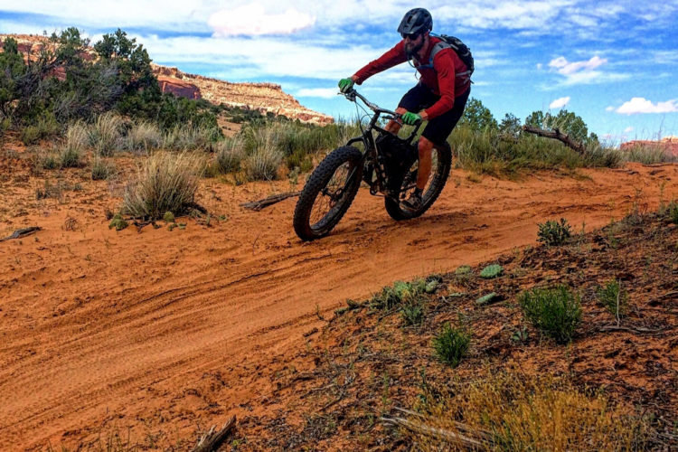
The Oregon Timber Trail (OTT) is a nearly 700-mile-long ribbon stretching between the Oregon/California border on its southern end, and the Columbia River Gorge to the north. With a net elevation loss when ridden north to south, the trail includes 66,000 feet of elevation gain over vastly different forest and desert landscapes. The Oregon Timber Trail Alliance (OTTA) has collected a healthy variety of resources to help riders complete the route in segments, loops, or all at once. With a bounty of backcountry riding, the trail remains a bikepacker’s dream.
The Oregon Timber Trail Alliance is led by fourteen dedicated members, alongside a few hundred volunteers, who work tirelessly to open forgotten tracks and build new ones that connect all the dots. The result of their efforts is a state-splitting, mostly singletrack route that’s connected by a variety of 4×4 doubletrack and gravel roads, along with a little bit of pavement. The route is split into four tiers, each with unique ecosystems and trail types that will keep riders’ jaws dropped to the bars.

The OTTA facilitates a variety of wayfinding, trailside cooking, bike maintenance, first aid, and other bikepacking-related courses to help prepare riders for the best experience possible. From tip to tail, the OTT crosses the Pacific Crest Trail (PCT) at four different points, providing opportunities for riders to stop for a hike further into the backcountry where they can use those well-honed survival skills.
We recently caught up with Gabriel Tiller and Dan Sharp from the OTTA to chat about how the trail became what it is today, and what the future holds.
Singletracks Over what beer, campfire, or coffee did the Oregon Timber Trail Alliance form?
Gabriel Tiller Oregon was already becoming a leader in popular long-distance
bikepacking routes such as the VeloDirt Oregon Outback and Limberlost‘s Three Sisters Three Rivers, so when I caught wind that Travel Oregon [the state’s tourism agency] was researching the feasibility of a cross-state mountain bike route, the time seemed right to dive into the project. What surprised us after staring at maps for a while was just how connective Oregon’s mountain bike trails already were.

Singletracks What is the ratio of singletrack-to-doubletrack riders can expect as they make their way from the Oregon/California border to the Columbia River George?
Gabriel Tiller Without building any new trails, a route that was 62% singletrack (415 miles) was created. This incorporates well-known MTB trails, infamous backcountry slogs, and unearthed a fair amount of forgotten trails with a huge trail stewardship push.

Singletracks Is the Oregon Timber Trail complete in its current state, or do you plan to add/reopen more singletrack?
Gabriel Tiller It is complete, yes, but like any long-distance trail, it will evolve over time. Even the PCT changes each year.
Over the next 5 years, we have roughly 30 miles of new trail in the works. These will eliminate road and paved sections, create better network connectivity, and add loop options for casual riders wanting to experience part of the OTT.

Singletracks What does the process of reopening or building trail look like from a legal standpoint?
Gabriel Tiller The process of building new trails on public federal land (Forest Service in this case) is a complicated one. A proposal must be submitted, and if a need is demonstrated, the route is flagged and an environmental review is performed. Planning, design, and construction funding must be obtained and executed. All said and done, a new trail project probably takes 4-6 years from start to finish.
We knew this would be a major hurdle for such a large concept so we chose to initially use 100% existing trails and roads. Some of these trails were unmaintained and impassible, but the legal barriers were not there so we have been able to rally a large volunteer trail stewardship effort in the areas of most need to bring these trails back to life. They tend to be the most remote which actually draws more curious volunteers out, and the land managers are typically more hungry for the extra assistance.

Singletracks Have you all found the communities surrounding the trail supportive of the project? How about land management organizations and private owners?
Gabriel Tiller [The route] covers a vast geographic area so it certainly varies, but by and large the communities have been exceptionally welcoming. Many seasoned riders have commented on the unexpected generosity they experienced in rural Oregon. The Oregon Timber Trail Alliance is working on strengthening the community relationships and bolstering local economies.
Land managers experience a variety of challenges across the OTT landscape—in some areas overuse is a concern, and in others underuse is the primary issue. For the most part, our dedication to trail stewardship has done more than anything to establish land management trust and subsequently open the door for new trail proposals.
The OCT zone is remote and rugged, sure. But in an era of machine-built flow trails, it’s a welcome refuge—towering firs painted with psychedelic lichens, ragged rocky peaks of dinner-plate shale that break beneath you, unrelenting climbs on soft dirt. Riding there is hard. Real hard. But it’s beautiful and sparsely populated and it’s all the reasons we love mountain biking.
I think it took four strong dudes six hours to ride the full Pyramids Loop. We were cracked. By the end we were strung out, with 30 minutes separating the faster two from the slower two. One member of our party, parched and desperate by hour five, tried to break into a vehicle because he saw some bottles of water scattered across the backseat. Later, he would drink straight from a stream even though at that point we were only twenty minutes from the car. It was a big, hard day. – James Williams, Bend OR

Singletracks The OTTA has hosted a broad range of events including trailside cooking classes, cultural awareness sessions, sawyer certification courses, and bikepacking navigation classes. How are these received, and do you plan to continue adding similar events in the future?
Dan Sharp The classes have been really well received and we plan to keep doing them next year as well. This has been a really rewarding part of the process — it pushes us to build our network and think about different ways to share unique elements of the trail and think about how we can broaden our own knowledge of the trail and how to both use it intelligently and how to better maintain the trail.
We really want to encourage curiosity about the trail and the communities it passes through. We really believe in both continued trail education and encouraging a new generation of trail stewards. Personally, I have gotten so much out of the whole process, from taking wilderness first aid courses to becoming a certified sawyer and learning more and more about trail work from some really experienced and smart folks.

Singletracks Have you had success getting volunteers to help out with trail building
and maintenance?
Dan Sharp Very much so. We have an amazing and dedicated crew of volunteers! For the past two years we’ve run four different work parties, one in each tier of the Timber Trail. Each work party is three or four days long, since many of the locations are remote, it makes the most sense to camp out and spend as much time as possible in each zone. We are also proud of the fact that we bring mountain bikers, hikers, equestrians, and trail runners together for these work parties. It’s great to have that common goal and to work together to get it done!

Singletracks Do you currently have a means of counting the rough number of folks
who use the OTT annually?
Gabriel Tiller No exact science exists to measure this, but it’s certainly a common question. We utilize trail logbooks in gateway communities, a yearly rider survey, monitor social media, and [we’re] looking into installing trail counters. In 2018 we estimate 50-75 people rode the entire trail, but our survey tells us that this comprises only about 12% of OTT use. 38% of users are doing day rides and about 50% are doing shorter multi-day backpacking trips along the OTT.
Singletracks How are wildfires and climate-change affecting the state of the trail and
its usability?
Gabriel Tiller In both of the previous two years wildfires have severely impacted the trail
during peak season, closing long sections and burning some areas. With the increasing summer temperatures, decades of fire suppression, and major beetle kill die-off we do not expect this problem to subside any time soon.

Singletracks Would you like to give a shoutout to any particularly helpful volunteers,
sponsors, or association members?
Dan Sharp First we’re grateful to anyone who has come out to work with us at any of our work parties or educational events. Our volunteers are so hard-working and we’re eternally grateful for their contribution.
Travel Oregon has really pushed the project and supported the OTT from the beginning.
We have to acknowledge Hannah Carlos for keeping us fed, and Nathan Frechen and Ben McCormack for organizing the work parties. Kim McCormack for teaching our First Aid course.
Kevin Rowell at the USFS Middle Fork Ranger district for leading our Technical Skills for Backcountry Trail Maintenance class and Bunchgrass Trail Parties, Alyssa and Gary from Horse Creek Lodge for hosting us for our Sawyer Certification Classes, Sally at Tired Dog Ranch for hosting us for our Backcountry Trail maintenance class.
Trans Cascadia for working so hard with us in Old Cascade Crest and the Oakridge area.
Nicky Meats has contributed some delicious meats. Nuun has contributed hydration. Riff has contributed Cold Brew. Base Camp and 10 Barrel Brewing have made sure we had beer at camp.
Singletracks What is your personal favorite tier or section of the OTT to ride, and in what season?
Dan Sharp Personally, I rode the Deschutes Tier and finished in Detroit and that section was wonderful! The Old Cascade Crest area is a massive highlight. The part of the Fremont tier that I rode during one of our work parties was fantastic too. I particularly love the sections that feel dramatically different to the trails we ride up North – more open, expansive vistas, hot springs, not to mention dropping in on the small communities to resupply is a massive highlight as well.

Work on the Oregon Timber Trail is ongoing, as more singletrack is uncovered and built, and annual maintenance continues. If you want to work on the trail you can keep up with volunteer events and training days here. If you can’t squeeze more time from life to throw dirt but you want to help out you can donate to the OTTA here.
Lastly, there are many first-hand accounts from folks enjoying the trail from border to border and beyond. You may want to read up before you roll out.

Key OTT Info
- Nearly 700 miles from border to border
- 66,000 ft of elevation gain
- 62% singletrack, 29% doubletrack/gravel, 9% asphalt
- Most of the trail is free of snow from late June to mid October
- The trail is open to mountain bikers, hikers, runners, horses, and in some locations, Off-Highway Vehicles.
- Most recent updates and events can be found on the OTT Facebook page.


0 Comments