A symphonic hum rose warmly above a wind-whipped Tyaughton Lake. The South Chilcotin Mountains of British Columbia sit far enough from a freeway to allow space for silence. The sort of quiet we forget about until lying prostrate. Freshly exhausted. Humbled. Hearing nothing but the “om” of insects as they sashay on surface tension. What’s to learn there? A version of “nothingness” so full of life it just might wet your eyes.
This chorus and stillness is one of many awe-inducing elements laced into the Chilcotin backcountry experience. Riding mountain bikes in this place is akin to surfing the open ocean. Respect is your only way forward when enveloped by nature’s unending power.
If traveling north, set your satellites for Tyaughton Lake once you hit Lillooett or Pemberton, and expect cell service to end along the way. It’s time to tune in and check out!

Trail tales and camp vibes
My good friend Erica and I recently spent a week pedaling through the South Chilcotin Mountains. Erica crafted a hybrid tour of BC bear country: camping at Tyaughton Lake for two days followed by a push to Spruce Camp to be plied with delicious food and cozy accommodations by the Tyax crew, capped off with two days of classic backcountry bikepacking on our own.
Could a trailcation get any better? Me say nope.
Tyaughton Lake Road to Taylor Creek Trail makes up the central highway from Tyaughton Lake if you’ve opted to pedal instead of floatplane. The road winds east for a bit before you hit the doubletrack and point back west, making one gargantuan switchback. Much of the ascent is shaded, and the grade was reasonable for pedaling through almost 90° F (32° C) summer swelter. Both of our first two rides began on this route, each ending at different lakes for the day’s final dip.

Climbing Camel Pass feels similar to riding on Mount Saint Helens, with large open expanses dotted by noble fir and stunted pine trees. Somehow, those roots hold fast to the hillsides despite loose scree and dust at their bases. Maybe the marmots help out? Fair warning: you’ll need to be prepared to push your bike up steep scree climbs a fair bit. The views and forthcoming descent will be worth every last drop of sweat.
The rip down Ridge-O-Rama was one of the most memorable trail segments on the trip. Many of the other trails wind and dine up and down all day, peeking in and out of the forests and alpine meadows to keep your heart rate and eyeballs entertained. This one instead rips wide open.
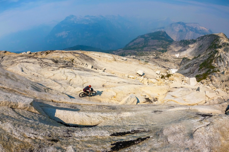
A view explodes from the top of Camel Pass, revealing snowcapped peaks that look like they might wrap around the whole globe. Exposure on either side of the ridge ribbon is significant, with sneaky cliffs appearing in random locations. If you are lucky to fall on the scree side, it should be a nice booty-slide to the bottom, but fortunately, neither of us had to test that possibility. Stay on your bike.

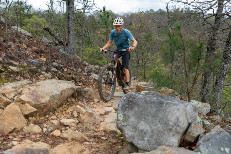
Many of the South Chilcotin trails sit in similarity: classic alpine XC that would mostly be rated with a blue or double-green diamond if not for the amount of effort it takes to get there. The exertion element is closer to a black or double black diamond. You’ll want to sharpen the fitness blade before these rides. We prepped with a vert month, climbing nearly 20,000ft each week prior to this trip, and still felt appropriately worked at the end of each day.
If pedaling north from the lake, you will have a good idea of the trail styles and how much you will be pedaling vs. pushing the bike. The deep beauty of this trail system lies in its vastness, its remote location, and in the environment you get the privilege of passing through. If, instead, you’re after purpose-built trails stacked with berms and booters, there’s a little bike park to the south with more than enough of that.

Two trails that stand out from the Chilcotin XC norm are Molly Dog and Pepper Dog. We hit these on our final day and were pleasantly surprised to find steeper and more challenging terrain. These trails feel more akin to the natural tracks we’re used to in Bellingham, where flow is something you earn through well-timed body adjustments. These tracks can also be shuttled from the main Tyaughton lodge, making for a fun intro or outro to the overall system.

If I had to choose my personal favorite singletrack from the trip, it would be Mid Gun Creek Trail. The track itself feels like mountain biking from my youth, with a horse-hoof-wide ribbon slithering between the trees. What made it so special for me was the portion flanking Hummingbird Lake. We paused to cool off in the water and I may never forget the profound silence of that place. No unnatural sounds made their way to our ears. The emerald snowmelt felt like a frigid gift. This is summer in all of its alpine glory.
Trail side trees in the Chilcotins differ significantly from the other zones we have explored in BC. Western Red Cedar and Hemlock are replaced by a variety of pine and Noble Fir above, and ferns are swapped for thistle and wildflowers below. This side of the range is arid and dryness is present in each species and soil type. While there are snowmelt streams littering the hillsides, the space between them feels like lizard habitat.

Early- to mid-July is an ideal time to visit the Chilcotins for a number of reasons. Snow is still melting, which makes for heaps of drinking water and refreshing skinny dips; the sun stays high for long rides with minimal clothing; and the wildflower-filled-fields are an exploding spectrum. It’s a truly beautiful time to get up high.
On the fauna front, wildlife viewing possibilities feel endless up there. We crossed paths with one fuzzy black bear, several marmots, a fluffle of rabbits, some grouse families, a herd of fearless mountain goats, all the avian species, and the scat or tracks of countless more furry friends. It’s always good to remember that we’re in their house, and they deserve our respect.

Our ride itinerary
When I asked around for route suggestions, one excited friend who had visited the Chilcotins several times said, “ride all of it. It’s all super good”. Fortunately, Erica tracked down some more concrete suggestions and was able to stitch together a fully-fuzzo-bear-tour that looked like this.
Day one:
- Camp at Frieberg on Tyaughton Lake.
- Ride: Climb Taylor Creek Trail (there will be some snow), over to Camel Pass, descend Ridge O Rama, and finish on North Cinnabar.
- Totals: 5,581ft ascent, 23 miles, 5.5 hours
Day two:
- Camp at Spruce Camp with the Tyax crew.
- Ride back up Taylor Creek Trail, keep going on High Trail to reach Spruce Camp. Possibly add Open Heart Trail for more vert if desired.
- Totals: 5,240ft ascent, 20 miles, 5 hours
Day three:
- Camp at Cowboy Camp or South Spruce Lake Campground.
- Ride up Tyaughton Creek Trail to Deer Pass Trail. Descend Mid Gun Creek Trail back to Spruce Camp.
- Totals: 5,190ft ascent, 26 miles, 6.5 hours
Day Four:
- Pedal out High Trail, then ride Molly Dog and Pepper Dog back to the car at Tyaughton Lake. Eat, drink, and be thankful for this time away from screens and “shoulds.” So grateful.
- Totals: 3,579ft ascent, 19 miles, 4.25 hours
Day Five:
- Ease back into the hustle as slowly as possible, starting with some river dips and reading. When we get to be our natural selves, returning to the swirl of it all is notably jarring.

What services are available in the Chilcotins?
MTV Unplugged in New York was the only album Nirvana won a Grammy for, albeit posthumously. Ironically, the band was also the first to use some amplified instruments in an Unplugged session. In the Chilcotins, ditching electricity and cellular service for a few days did us more good than we can recount, and the rewards were doled out in the form of a well-massaged brain, with fewer tangles for our thoughts to shimmy past. Ironically, we utilized our phones’ GPS connection to navigate routes throughout. Next time, paper maps and a compass will come along.
Visits to the Chilcotins can look any way your heart desires. On the top shelf, you’ll soak in the views from a floatplane en route to icy alpine lakes for a fully catered and guided tour, resting in luxury huts courtesy of Tyax Adventures. Their cuisine is fresh and delicious, and the hot showers and comfy beds that follow will morph your hardest type-two ride into a sparkling rainbow memory. The Tyax chefs eagerly cater to all dietary restrictions, so your belly will be filled.

Of course, you can also roll with a fully self-supported bikepacking epic or a mix of methods. Wherever you end up, Tyax likely has backcountry services and personnel available if needed.
Tyax was founded over twenty years ago when a group of BC-based mountain bike racers saw the fun of riding horse trails back toward Babylon. Their buddy with a float plane dropped them in a lake, and it was on them to return home.

Dale Douglas was the original float plane operator. He eventually hired some of those buddies to guide guests around the Chilcotin Mountains between the now five huts that were acquired from equestrian organizations. Dale’s daughter, Bobbi Douglas, now runs the company for its new owner, Blackcomb Helicopters. Bobbi coordinates staffing and logistics while also guiding a few clients herself.

Tyax holds the permits to operate tours in the region, and their trail crews deftly maintain all of the tracks throughout the brief riding season for horses, hikers, and bikes.
Whether employing Tyax services or rolling solo, it’s a good idea to check in with the main office at Tyax Lodge when you arrive. That way, someone will know to search for you if a mountain goat munches your map.

Packing possibilities
If you’re reading this, you likely know what to pack for a bikepacking adventure. We have a few suggestions in addition to the usual featherweight stove and slingshot.
While wind is nature’s insect repellent, you’ll want to pack an ample supply of your own. Tandem with the annual spray of wildflowers comes an equally abundant cloud of horseflies, mosquitos, and no-see-ums. We were able to fend off most of them with a eucalyptus-based repellent from Murphy’s Naturals, and occasionally went full-chem when the hard stuff was available. One of us did collect a tick along the way, so make sure to check yourself before hitting the bag at night.

Unlike pesky bugs, you may want to see a waddling bear or three, and there are plenty of those fuzzos to find. It’s recommended to pack a can of bear spray in case a grizzly mistakes you for a honey-slathered salmon steak. We crossed paths with one black bear despite consistently making noise and singing a song about a bear paw-smashing blueberries to make pies for all of their friends. The galumphing fur ball crossed the road and dove into the salmonberries before either of us could unsheath a camera.
When tent time rolls around, you will want a container and rope to hang your food and any smelly goods in the trees, away from those aforementioned fuzzos. Most backcountry camps in the Chilcotins have bear-safe food caches on site, but it won’t hurt to have a backup. A long rope may also come in handy for stream crossings, as several of them push through rapid currents that numb the toes.

Finally, grab the water purifier… or don’t. I can’t advise anyone to risk their health, but we were able to drink directly from most of the streams we forded. The BC rule seems to be: “if you’re above 1,500 meters, saunter upstream from the trail a bit to avoid horse contamination and drink all you like.” That sage wisdom worked well for us, and there were clear stream crossings roughly every other kilometer in mid-July. Chug at your own risk.

Best bike suggestions
We took the only mountain bikes we own: mine a 160mm Raaw Madonna and my friend Erica’s a 140mm Evil Offering. Erica was happy with a little extra travel on the chunkier tracks, while I would prefer a lighter-weight trail bike with 130mm or less travel next time. There are gnarly stone sections in the Chilcotins and some chunky scree fields to dance through, but most of the trails could be described as “classic alpine XC” that’s sufficiently handled on a shorter travel machine.
It was nice to keep most of our featherweight camp gear slung low in a backpack for maximum maneuverability, but strapping everything to a hardtail frame could also be a good option. We will return to this magical place soon, and I may try a lighter setup with no on-body bags for round two. The hike-a-bike will be trickier, as will the throttle-open descents, but it seems worth some experimentation.
Apart from bike selection, it’s worth mounting a front tire with some substantial shoulder lugs. Most of the trails run along ridgelines or fully-exposed bench cuts where a little extra grip goes a long way to instill confidence. The soil is what you might expect on the east side of the Pacific Range: dusty desert scree for days! I rode with a Schwalbe Magic Marry up front and Erica had a Maxxis Assegai. Both were appropriate for the loose-over-loose terrain.

In keeping with the “unplugged” backcountry vibe, e-bikes are not yet permitted in the Chilcotins. While we did see the trail crew riding them and didn’t see anyone enforcing the rule, it may be worth noting. Also, you’d need to pack a sizable solar panel or spare battery to keep things rolling if you decide to shirk the rule.

Denouement
“Ride all of it. It’s all super good.” Turns out that’s a dead-accurate statement. If you enjoy high-alpine fun, the Chilcotin backcountry is worth topping your list. Mix in as much floatplane and fine dining with Tyax Adventures as you wish. No matter how you swing it, this place will fill your soul up and leave you to schedule the next trip north.
We felt deeply privileged to have this experience. To afford the nourishment, time, and fitness it takes to explore. To have learned the importance of nature bathing and difficult physical challenges, with many years in those practices. To have access to this First Nations’ land where we get to soak in the profound connection we all have to the earth and its inhabitants.
Checking out left me grateful for innumerable elements of life, and better prepared for my path back home.


3 Comments
Aug 20, 2024
To those looking at the trail maps of the area. The lower Tyaughton trail is not fun especially if carrying your gear. One can easily do this area self-supported. I've always done this self-supported. You never know where you will be and having all you need with you is very reassuring.
Sadly the Lower Gun Creek trail is closed due to burnt-out bridges. The area is a little less fun to ride. I dislike going up to windy pass from Spruce.
A nice loop would be going up Taylor Creek to Windy pass. Camping at Spruce. Then riding to Lorna lake. Then riding out Relay creek back to Taylor Creek trail head.
Aug 22, 2024
Aug 19, 2024