We poked our trail-dusty faces into the dim, creaky bar. The building was nestled in a cluster of about seven wooden shacks that made up the long-abandoned Arizona mining town of Cleator. All three patrons turned their heads to look at us, but didn’t say anything. We shuffled into the Cleator Bar and Yacht Club, the only business for miles. Ironically named, of course, as we were miles away from anywhere you could float a boat. I began to worry this place was so far from the interstate they “didn’t take kindly to strangers.” But then the bartender leaned his huge smiling head around a worn wooden support beam and asked how the heck we found the place.
The three of us (my friends Sarah and Shay and I) were bikepacking the Black Canyon Trail, and this place was the only source of water for about 30 miles.
The bartender introduced himself as Muley as he popped the caps off our $3 bottles of Dos Equis. Muley’s gray beard was in a tiny ponytail, which waggled as he told us the history of the Cleator, the mountainside mining town we’d rolled into. His floppy little puppy, Thor, was staked up around the corner beside a tin wall covered in beer posters. Muley unhooked Thor and followed us out to a picnic table in the dusty back lot littered with lawn furniture, Ski-doos, and boats. He sat down, cracked open a beer for himself and began telling us about the day he met John Wayne.
His stories flowed for about an hour, until the sun started to dip behind the mesa and we knew we had a short amount of time to find a spot to camp. We were a quarter of the way through a 100-mile bikepacking trip. It was a rough start (the techy terrain already had me in doubt) but from this encounter I knew it was going to be a trip I would not regret.
BCT quick stats and details
- Official route distance: ~80 miles
- Official route elevation: ~4,000ft climbing, ~6,500ft descending
- Our route distance: 105 miles
- Our route elevation: 9,533ft
- GPS Data: Day 1 | Day 2 | Day 3
- Technicality: Moderate with some advanced sections
- Our bikes: Hardtails
- Must stop locations on the route: Cleator Bar and Yacht Club, pie at the Rock Springs Cafe


About the Black Canyon Trail
The 70-mile trail traverses the mountains north of Phoenix, beginning about a two-hour drive north of downtown and heading south (of course, it runs both ways but it’s very much trending downhill if you ride it this direction).
The whole stretch of trail is about 76 miles, with a trailhead at mile 12 that would work as a start option to shorten it a bit. We added in a couple detours as well: 10 miles round trip to go to Cleator, and 2 miles to stop at the Rock Springs Cafe. Once we hit the end of the trail back in town, we continued riding back to our AirBnB in Carefree, so we wound up with a total of 106 miles and 9,583 feet of climbing. The Bureau of Land Management says the elevation change on the BCT is 4,500ft of climbing with 7,500ft of descending.
The Black Canyon Trail was originally forged by the Hohokam nation, prehistoric Native Americans who used the route as a pathway linking local settlements together–it provided tribes a way to travel long distances while staying close to a water source, the Agua Fria. The Department of the Interior converted the BCT as a livestock route in 1919, which was when they gave it the anglicized name.
We began the ride at the tippy top of the trail (where it meets Orme road), about 7 miles off the exit from I-17. The BCT officially ends once the trail meets up with Carefree Highway in north Phoenix, but you can park your car at Emery Henderson Trailhead to cut off six flat miles at the end, or continue riding along doubletrack through an area called Biscuit Flat, where we encountered a gang of feral donkeys (amazing). Once you get to this part of town, there are a lot of paths, bike lanes, and trail options to get to wherever you started.

Gear, weather, camping and water
Best time of year: Fall or Spring are the best. The Black Canyon Trail is too exposed for the summer, and if you choose to do it in the winter just be prepared to bundle up at night.
Bike: This mostly-blue trail has black sections that are ten miles and longer. The trail is most comfortable on a full suspension bike, but for the sake of frame cargo space, we rode hardtails. I loaded up my Santa Cruz Chameleon mullet and she was thriving through the chunky rocks and tight switchbacks.
Tires: My tubeless Maxxis Minion and Aggressor tires were seriously the trip MVPs. The trail was ripe with cholla cactus needles and sharp rocks ready to slice a sidewall. Somehow we finished the ride with no flats (but I know others who haven’t been so lucky).

Bags: Because I ride such a small bike, it can be hard to fit any old bikepacking set on the frame, so I really appreciated having the highly adjustable Specialized x Fjallraven Seat Bag Harness to hold my huge drybag up off my back tire.
Tarp: If you’re using an inflatable sleeping pad, bring a durable ground layer to prevent cactus needles and goat heads from popping it.
Camping: This trail is located on BLM land, so you can camp pretty much anywhere you choose along the way.
Water and availability: Ideally, carry 5 liters per person. There is one refill spot each day, and this trail is in the DESERT so the more you can carry the better. I could only carry 4 liters, and between cooking and hydrating I ran out towards the end of the last day (luckily my friends could top me off). Since my low-standover frame offered limited carrying capacity, I ended up carrying a backpack with a three-liter reservoir for most of my water.
Because Arizona rivers only flow at certain times of the year, natural water access is limited. We called the local BLM office to check the status, and they told us that it was possible there was some water, but it was best not to count on it. There did turn out to be water trickling along in the Agua Fria, which we crossed several times by simply riding through it because it was low enough (spring might be a different story).
Caching water is another great option, especially if you’re considering stretching the trip to more than three days. Spots where the trail crosses easily-accessed roads include Big Bug Trailhead (mile 12) and Gloriana Trailhead (mile 32). You can also refill at the restaurant or gas station in Rock Springs (mile 47), and then that’s it for the rest of the ride.
Wildlife Warning: Depending on the time of year, you might be more likely to encounter some desert critters like snakes. The closer you are to summer, the higher your odds, since they really only come out when it’s nice and hot so they can toast their little bods in the sun.
Day One: Climb to Cleator
We got up to the start of the route in the evening in order to get an extra sleep under the stars. The drive was about two hours north, so getting there the night before lent itself to a sunrise jump start on the 38-mile day ahead of us. It started off almost immediately with some challenging climbing. It was vista after stunning vista though, and the views kept me mostly distracted from the punchy hills.
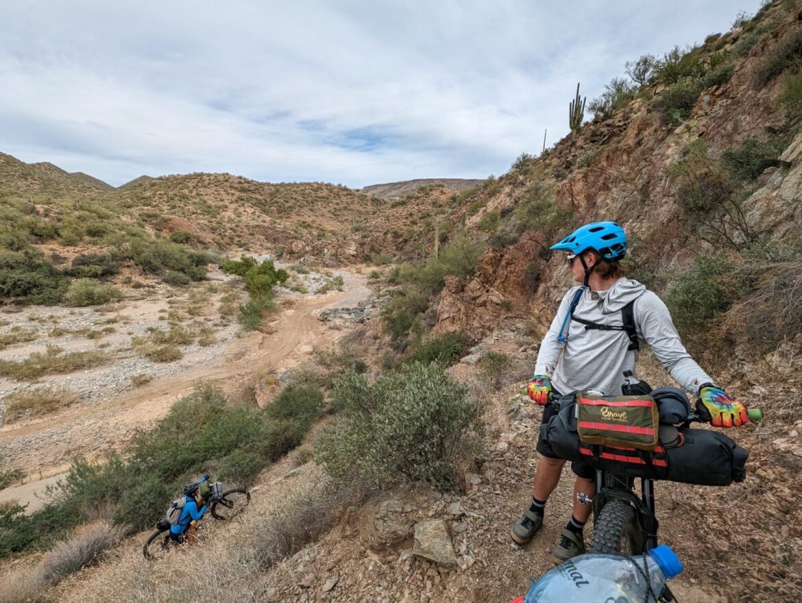
We rounded a bend into the first section that was cut into a canyon wall at mile 23. It was glorious: flowy, scenic, and a little freaky. We hit quite a few sections like this throughout the entire trip, and they were definitely some of the most thrilling.


If you start at Orme Road, you’ll reach Bumble Bee Road around mile 26, at which point a right turn will take you up a five mile climb to the town of Cleator. There is really only one patronizable establishment in Cleator, but trust me–it’s worth it. The Cleator Bar and Yacht Club is a land-locked saloon building repurposed into a dusty bar surrounded by permanently beached boats, jet skis, and sun-faded lawn furniture. This is where we met Muley the bartender. Later he told us he wasn’t even paid to work at the Yacht Club; he was a volunteer.
After our Alice-in-Wonderland experience in Cleator, we headed back down Bumblebee Road to the trail, and took it about a mile south from the road to camp for the night. I wouldn’t suggest going too much further than three miles beyond the road to look for a camp spot; flat ground gets rarer beyond that point.


Day 2: Pie in Black Canyon City
On Thanksgiving Day, we rolled up to Rock Springs Cafe in Black Canyon City, it was buzzing with so many pie-buyers that the restaurant had completely sold out. It was a bummer, but I feel like any other day of the year you should be fine. In consolation, we bought ourselves ice cream and pickles and Mexican Coke from the gas station across the parking lot.
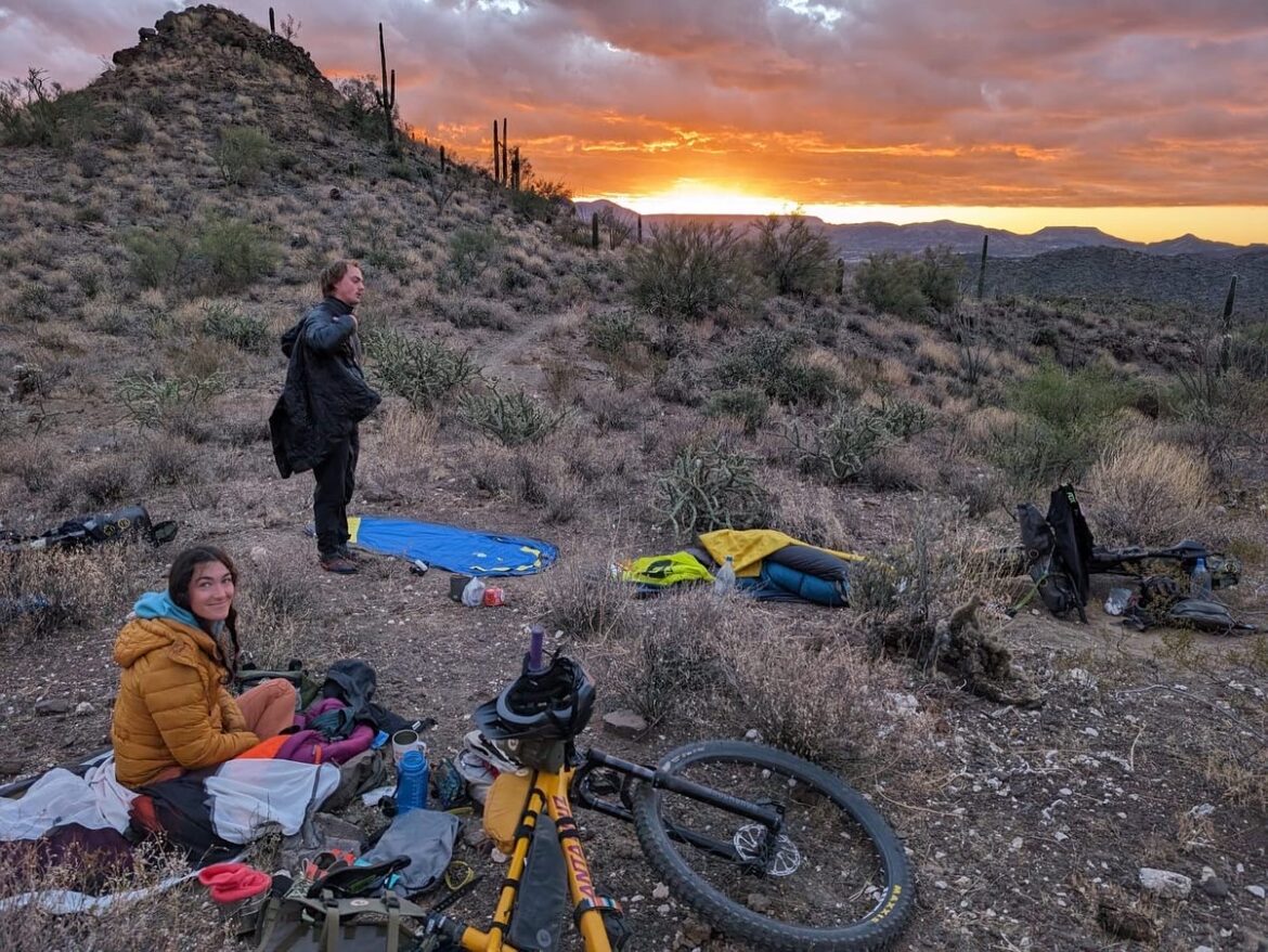
Getting down to the little roadside eatery was a mile detour by trail and then maybe an eight-minute ride along a service road from the trailhead. From when you leave this parking lot you’ve got about 12 miles of gradual, gorgeous climbing. We crested a high point right around golden hour, and set up camp near mile 55. We cooked a camp-stove Thanksgiving Dinner. On the menu were instant mashed potatoes, instant stuffing, cornbread, a whole can of cranberry sauce, and a 360 degree view of the sunset. We were feeling #blessed.
I should note that this day had some steep, technical climbs and loose rocky trail sections that were hard to get traction on. I only cried once. Just be mentally prepared for some tricky hike-a-bike.
Day 3: Mountain Views Behind Us
The mountains in the desert southwest have a harsher, more jagged look than mountains in areas with thick vegetation and forest, which gives the whole ride a stunning, Wild-West feeling. And since you’re starting up higher in elevation and passing through canyons getting lower and lower, the views go on for miles and miles, so you can’t help but sing “wiiiiiiiide open spaces” in your head.
The route on this day drops drastically in elevation, so you can look behind you and see where you’ve come from, which was honestly appalling and made us feel super accomplished. Layers of mountains is one of my favorite views, and this was picture perfect.
One thing that struck us as weird about the end of the trail is that there really isn’t a sign or marker letting you know it’s over, you kind of just…cruise off into the parking lot of a shooting range (so don’t be alarmed when you start to hear the gunshots closer to town–they are contained). If you want to keep riding at this point, you’ll cross about six miles of mellow sandy doubletrack called Biscuit Flat, which is where we ran into some baby donkeys (cute).
BCT: Type II Fun At Times, But Worth Every Minute
Full disclosure: Arizona riding is HARD. I mean it when I say it felt like an epic. To cover the amount of black and blue level trail between water sources each day, we were on the move from sunrise to sunset. But the views, the riding, the glimmers of residual Wild-West culture, and the backcountry solitude were unmatched on the Black Canyon Trail. The rugged beauty of the Arizona wilderness draws you in like a locals-only bar: A little prickly at first, but you’ll leave it with the warm feeling that you’re old friends.


4 Comments
Jan 16, 2024
Jan 17, 2024
Jan 16, 2024
Jan 19, 2024
-The Unicycling Unicorn