
It was June of 2020, the height of COVID and civil unrest in the nation, and thankfully, four days since I’d seen another human — the perfect time to be out in the middle of nowhere with nobody around. I buried myself in endless walls of sagebrush, mahogany, and pinyon pine with nothing more than a pair of loppers and a Makita reciprocating saw in hand. No cell reception. No outside distractions. No news of the social apocalypse. Just the endless expanse of Nevada’s Great Basin, resurrecting the longest trail in Nevada, the Toiyabe Crest Trail (TCT), one mile at a time.
Off in the distance, I saw a herd of sheep traversing across an open ridgeline at 9,000 feet above sea level. Leading them was a short, stocky man of South American descent, most likely Peruvian. He and his flock crossed a steep drainage and found themselves on a section of the TCT I just cleared. As he approached with his sheep dog on his heels, he smiled at me from under his gaucho hat, moving his hands forward and back along the narrow ribbon of dirt previously hidden by an impenetrable wall of sagebrush.
“Aaaah…Camino!” he exclaimed.
“Si!” I responded, proud of myself for knowing what he said, as my Español is not so bueno. It was the first word I uttered to another human in four days. I stepped off the side of the trail and waved him through a freshly cut path up to the top of the ridge at 10,000 feet elevation, where his giant white tent was pitched. “Gracias!” he said, vanishing back into the sage with his flock close behind.
I’m not sure what the sheepherder thought of this gringo, covered in sage dust and mowing down brush like it was my only mission in life. But considering how many hours I’ve invested into the TCT since first riding it eight years ago, it kind of has been my biggest mission in life.

The longest National Recreation Trail in Nevada
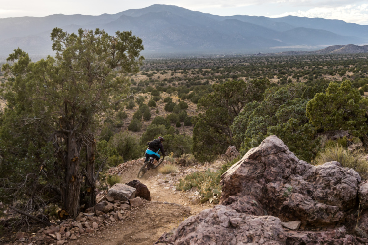
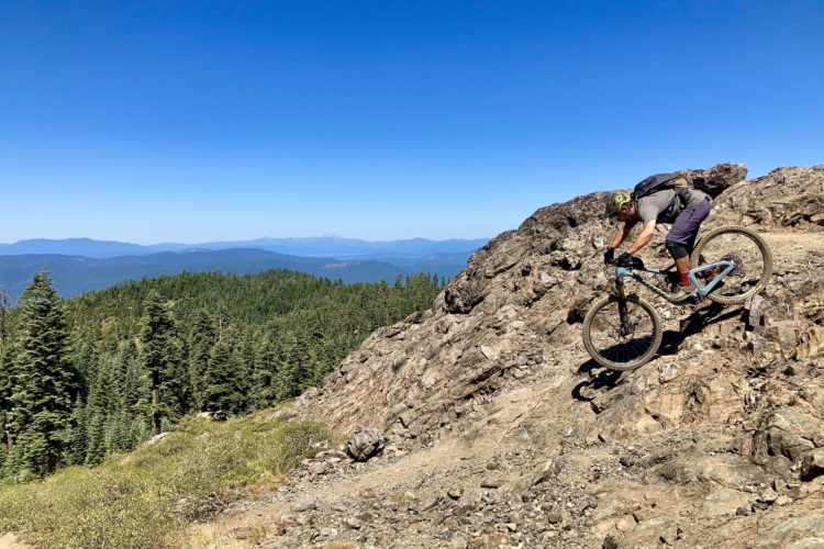
Few experiences humble you more than standing beside your bike at 10,500 feet in the dead center of Nevada, looking out hundreds of miles in every direction and seeing nothing but endless basins and ranges. Nothing but utter remoteness, a welcome loneliness, and a very real sense of being completely insignificant in the scale of the Great Basin.
At 130 miles in length, the Toiyabe Range in central Nevada is one of the state’s longest, with more peaks in excess of 10,000 feet than any other range in the state. Aside from the tiny, 80-person hamlet of Kingston at the trail’s northern terminus, the closest town is Austin, 20 miles north, located along Highway 50, aptly named the “Loneliest Road in America.” But considering barely 150 people live in Austin, the wildlife ranks in far greater numbers. The next closest town of reasonable size is Fallon, more than 100 miles to the west. If you look at a night sky map of the lower 48 states, the darkest, most lightless place in the country is a bullseye right over the center of Nevada and the Toiyabe Range.
The TCT is a National Recreation Trail (NRT) constructed by the Civilian Conservation Corps between the 1930s and 1960s. Totaling 70 miles in length, the southern half of the TCT is within Arc Dome Wilderness, while the northern half is outside the Wilderness boundary and legal for mountain bike use. Despite its congressionally-designated status, the TCT has not seen a trail crew work on it in four decades. Since the 1980s, the most frequent trail users include the aforementioned sheepherder and free-range bovine traffic.
They made it out the next day scratched up and bleeding with nothing more than an emergency blanket and a few granola bars to get them through the night.
I discovered the trail after reading a firsthand account written by my friend Yuri Hauswald in 2011, documenting an unplanned overnighter on the TCT with two friends, cliffed out and lost in the dark at 9,000 feet. The crew had no intel on the trail, got a late start, and got lost numerous times along the way because of how overgrown the trail was. At least the weather was favorable during their misadventure: they made it out the next day scratched up and bleeding with nothing more than an emergency blanket and a few granola bars to get them through the night.
With redemption as the goal, in 2016, I re-assembled the original crew for a BIKE Magazine story and successfully navigated the non-Wilderness portion of the TCT. Although it was a 15-hour, 35-mile bushwhack suffer fiesta, in the afterglow of the adventure, I imagined how incredible that ride would have been had the TCT been maintained. Since trails don’t magically maintain themselves, I grabbed a reciprocating saw and a pair of loppers and started cutting with one of the original lost trio, Chris Brown.

Resurrecting the TCT
It was about a mile into the 40-mile mission of brush busting when I realized this would take a lifetime without some more substantial help. The Deputy Administrator of Nevada State Parks, Janice Keillor, is an avid mountain biker, and when she heard of my efforts on the TCT, she recommended I apply for a Recreational Trails Program (RTP) grant. RTP is a program funded through the Federal Highway Administration, focused on motorized, non-motorized and educational recreational trail projects for state and local governments. RTP is also specifically designed to fund work on National Recreation Trails like the TCT, one of more than 1,300 NRTs in the country.
I reached out to the non-profit Great Basin Institute (GBI) in Reno, receiving help from them in applying for the grant with support from the Humboldt-Toiyabe National Forest – Austin Ranger District. Since January 2019, GBI has received two rounds of funding totaling approximately $120,000, including a contribution from the NV Energy Foundation. And in 2023, we applied for a Nevada Division of Outdoor Recreation grant, securing new signage along the entire non-Wilderness portion of the trail.

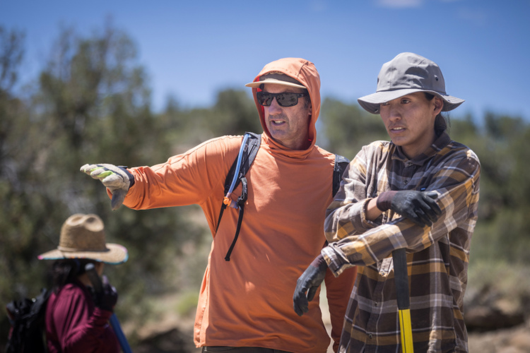
After more than 700 hours of volunteer labor coordinated mostly through a couple dozen friends, word of mouth, and six week-long deployments of the Nevada Conservation Corps – a division of AmeriCorps – 28 miles of the TCT have been cleared from Kingston Canyon south to Tierney Creek canyon, including the feeder trails of Washington Creek, South San Juan Creek, and Marysville Canyon. Approximately 12 miles remain to be cleared on the TCT from Tierney Creek south to Mohawk Canyon.
During this process, the enthusiasm and interest in the project have been remarkable. The TCT resurrection project has been featured in several magazines, Patagonia’s 2023 “Human Powered” ad campaign, and two regional PBS shows – Reno’s Wild Nevada and Las Vegas’ “Nevada Outdoors”.

How to ride the Toiyabe Crest Trail
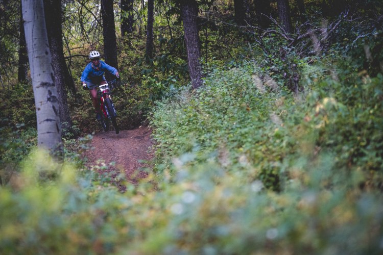
The best way to get a taste of the TCT without a huge commitment is approaching from the west side of the range, riding up the South San Juan Trail to the TCT, making a left, and heading north on the TCT for approximately 11 miles to Washington Creek. From there, descend back to the mouth of Washington Creek where it meets San Juan Canyon. Approximately 22 miles in length with 3,500 feet of climbing, this triangular loop gives riders a great option with free dispersed camping in Washington, Cottonwood, and San Juan canyons.
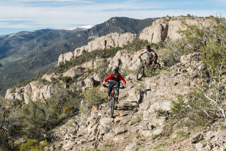
As an “extra credit,” continue north on the TCT from the Washington Creek junction, climbing an extra 1,000 vertical feet in 1.5 miles to Carseley Saddle, turning around for a full 3,000 vertical foot singletrack drop on the TCT and Washington Creek, making the loop closer to 25 miles and 4,500 feet of climbing. For a point-to-point, continue north on the TCT another 10 miles, finishing with a ripping fun 3,000 vertical foot singletrack descent into Kingston Canyon featuring massive views and a final 1,800-foot “gravity cavity” testing the worthiness of your brake pads and rotors.

For those extra adventurous types, riding point-to-point from Ophir Pass at the Wilderness boundary 32 miles north to Kingston Canyon is also an option, but just be warned that after passing the Mohawk Canyon intersection, the TCT to Tierney Creek is very overgrown and hard to follow in a couple of spots and will remain this way until 2026 when the next round of maintenance is scheduled to begin. Aside from being a skilled and fit rider, expert route finding and map reading are required. Central Nevada is one of the most remote locations in the lower 48 states. And although the trail is not rocky technical, it’s technical in a primitive and narrow tread-width sense. Purely for the sake of its primitive nature, I would consider the TCT an expert-only type of ride. You don’t want to get hurt out there. Help is a long way off.
Although there are no bike shops or big shuttle service businesses, local Kingston resident Chad Kelly has secured a guiding permit with the local National Forest Service office and can provide a shuttle from Kingston to the South San Juan trailhead for a 25-mile ride back to Kingston on maintained trail.
The TCT is one of many trails in America being lost to lack of use, maintenance, and funding. It is up to us as enthusiasts, trail users, and public lands supporters to go out there, find an old trail, and be the champion in its resurrection. For me, it’s been a rewarding and life-changing experience, introducing hundreds of adventurers to a unique and beautiful corner of Nevada. So get out there, find a trail that means something to you, and reintroduce it to a new generation of trail users.




4 Comments
Dec 18, 2024
Dec 18, 2024
Dec 19, 2024
Dec 18, 2024