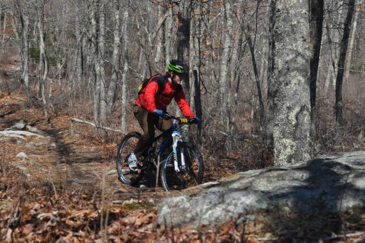
On my recent fall trip to North Carolina, my main goal was to ride Bent Creek Experimental Forest… but there was no way I was going to visit the Pisgah area without doing a ride in Pisgah proper! After consulting with GoldenGoose and doing some research in the Singletracks trail database, I decided on the Laurel Mountain trail.
The Route
After reading through the trail descriptions and all of the reviews, I decided to take GoldenGoose’s advice and ride up the Laurel Mountain trail and descend the Pilot Rock trail. I mean, who could pass on this description:
“We chose to ride the trail in reverse of the directions above and it made for a KILLER descent down Pilot Rock. DH bike worthy. Tons of pucker factor, sharp/tough switchbacks, and techy rock sections to navigate.”
Also, based on GoldenGoose’s review, it sounded like the singletrack would be much more climb-able in this direction. A rideable climb and a white-knuckled descent is always a win in my book!
To break up the monotonous gravel road climb from the bottom of Pilot Rock to the beginning of Laurel Mountain, I threw in the nearby Pilot Cove-Slate Rocks trail as well. This trail worked into the loop very well, and turned a lot of the gravel road into singletrack. However, this trail does add even more climbing (as well as descending) and mileage to the loop. Only attempt this combination if you’re looking for a long day of riding and hiking!
When everything was said and done, I traveled 16.2 miles and climbed over 3,000 vertical feet in 3 hours and 11 minutes of moving time.
The Trail
If I have ever mountain biked a route that could be classified as “all mountain,” this is it. This route is one massive bag of radically different conditions and disciplines–and it is excellent!

In classic Pisgah style, there’s no way you’ll be able to stay on your bike for the entire ride unless you have Herculean quads and lungs. I did a lot of hike-a-bike on the first climb up Pilot Cove and, as GoldenGoose mentioned, at the very top of the Laurel Mountain trail. However, I did find that the majority of the Laurel Mountain trail was much more rideable than a lot of other trails I’ve ridden in Pisgah. Granted, it is still pretty technical by most anyone’s standards, but the grade isn’t nearly as steep as it could be. Instead of mostly hike-a-bike with one or two rideable sections (par for the course on most Pisgah climbs), Laurel Mountain is mostly rideable with only a few hike-a-bikes thrown in.

As I neared the top of Laurel Mountain, I realized I was riding in low-lying clouds. It suddenly felt as if I was back in Montana. As I began to descend the Pilot Rock trail, I realized that if the clouds hadn’t been so thick there would have been many amazing views of the surrounding forest.

While the Laurel Mountain trail features classic backcountry-style ridgeline singletrack, the main event is the Pilot Rock descent: four miles of steep, never-ending rock gardens with a series of tight switchbacks thrown in. When you drop out the bottom of Pilot Rock you will either be cursing the day you were born or wishing for a teleporter back to the top to do it all over again! Guaranteed to give you serious arm pump, this is probably one of the most technical backcountry-style trails I have ever ridden anywhere in the nation.
I shot a few photos to try to showcase the rocks, but as usual these aren’t the rockiest spots on the trail (I was trying to hold on for dear life in those), and the rocks look bigger in real life:
I do have to disagree with GoldenGoose on one thing: I wouldn’t call this trail DH-bike worthy. There are no features I couldn’t ride on a 5.5″-6″ all mountain bike. Also, this is truly all mountain territory because there is no way to easily get a big hit bike up to the top of the trail, and because every inch of the suspension on your AM bike will probably be utilized on this descent.

Yeah, I’ve ridden gnarlier trails than this before, but very few (if any) that are so far out in the middle of nowhere. Most trails this challenging are much closer to civilization in the boundaries of a ski resort instead of miles and miles from the closest paved road in the heart of a national forest. If you do summon up the gumption to tackle Pilot Rock, be sure to ride within your ability level and do your best not to crash!
Your Turn: What’s the most technical backcountry-style trail that you’ve ever ridden?


20 Comments
Jan 8, 2013
Jan 8, 2013
Jan 9, 2013
I always thought the descent on Deer Creek (I'm assuming you're referring to the "Wall of Shame") was no biggie--now climbing it on the other hand . . .yet another spot I fear I may never conquer.
Jan 8, 2013
Jan 10, 2013
Jan 8, 2013
And the nice thing about both of those (Fountainhead and Watershed) are that they are close to population areas.
Jan 8, 2013
Jan 9, 2013
In the NoVa area, technical can be found about an hour in either direction--heading east toward the aforementioned Frederick Watershed or west to the Elizabeth Furnace area. The nice thing about Frederick is, if you're not sure you're ready for the Watershed, you can break yourself in at the adjacent Gambrill State Park that offers a nice progression of technical difficulty among its trails. On the other side, the Elizabeth Furnace area will have even Hans Rey shouldering his bike a couple times.
Jan 8, 2013
Fountainhead is flowy, and all the GPS data I've seen from the previous layout makes it look insane. The lack of appreciable downhill rests and near constant climbing makes it tough in my book.
I guess I need to grow my repertoire of trails to get a better appreciation of technical.
Jan 9, 2013
Jan 9, 2013
Jan 10, 2013
Jan 12, 2013
All I remember is it's in Tucson, AZ, it's technically hiking and biking but trail designer didn't want bikes so the switchbacks are tight and steep.
I do remember falling at one section of a difficult climb. Thankfully, a cactus was there to catch me from going down the mountain! :lol:
Jan 8, 2013
Jan 8, 2013
Good trail to add to my "maybe someday" list. I have a feeling I'd be walking a lot but I'd still love to experience it!
Jan 8, 2013
Just goes to show that every trail is different!
When I was writing this post, Dakota Ridge came to mind as something fairly comparable--but then I realized that that's basically located right smack in the suburbs, whereas laurel mountain (and blackjack) are way the heck out in the middle of national forests.
Jan 10, 2013
Jan 10, 2013
Jan 11, 2013
Jan 10, 2013