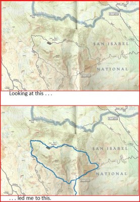
Mountain biking is full of the joy of discovery; you discover new techniques, friends, places and trails. Of course, these are just new to you at the moment–it’s unlikely that you are the first and only person to encounter any of the above. But there are many trails which have not been traditionally used as biking routes, despite being excellent as such. Some trails fall out of favor and eventually become unknown. Some trails were started as government work programs when there was no demand, but now that you’ve got a bike, there’s a demand! While I love hitting those “must ride” trails like the Porcupine Rim or Buffalo Creek, It can be equally satisfying to pioneer or rediscover a route like the Davis Meadow or the Highwood Ridge. What? You’ve never heard of the last two? That’s exactly what I mean.
Those who explore the trails less traveled rather than just making another run on the same’ ol’ same’ ol’ have a number of resources at their disposal.
Trails Illustrated Maps: Even though these are modern maps showing mostly established routes, they sometimes retain forgotten trails. You can look at a TI map and spy dashed lines with unfamiliar names or numbers. With some thought and creativity, you can create rides nobody else has done by hitting traditional non-biking trails. This is how I discovered the Davis Meadow and Platte River routes within a few miles of Colorado classics like Monarch Crest and Kenosha Pass. Of course, even TI maps can become outdated as I found out when I connected a number of trails near Steamboat Springs into an epic and encountered an unmarked fork. I took the fork that looked like it headed the direction indicated on the map and it turned out to be wrong. It was a foggy day and there was no way to use the map and compass. I ended up in Steamboat Springs after dark, a dozen miles from my trailhead, a couple thousand verts below where I started, after close to 50 miles of high altitude riding. Ouch!

USGS Quads: USGS quads cover less area than TI maps, but are more detailed. Most of them are out of date, which is both a positive and a negative for finding new routes. Many trails shown on USGS quads no longer exist and you may find yourself searching fruitlessly for a trailhead. You may find a trailhead only to see the trail disappear, leaving you to either backtrack, or forge ahead in a harsh bushwhack.
Since these maps are so detailed, they don’t cover much area, and you may need to link a few together to cover your whole route. On the other hand, some of those dashed black lines will be trails which are forgotten but still exist and you’re just the person to rediscover them. It may not be the National Treasure or the Lost Ark of the Covenant, but it may well be some sweet singletrack. The more detailed scale in the topo lines will also give you a better idea of the topography you’ll face.

USFS Maps: Each USFS map is designed to cover an entire National Forest, so the scale lacks detail. These maps are not topographic, so you won’t see the terrain you’ll face. They do, however, show many possible off road routes. USFS maps sometimes fail to distinguish between doubletrack and singletrack, so there’s no guarantee you’ll find what you like just from a USFS map. It’s best to use these maps an overview. Once you find a potential route, you can look to the specific USGS quad(s) necessary to refine your research. This is how I took on the excellent Kennedy Peak route in Virginia’s rugged George Washington National Forest.

The USFS map of the Little Missouri National Grassland led me to the Longs X Loop, a route that can be combined with the far Northern part of the Maah Daah Hey trail, which is never ridden since it’s cut off from the rest of the trail by the North Unit of the Teddy Roosevelt National Park.
BLM Maps: These are like USFS Forest maps, just covering BLM lands vice USFS lands.
Local maps: Many places have local maps that can assist in spotting singletrack. On a trip to Canmore, Alberta, Canada, I picked up a couple surprisingly detailed topo maps of the local area, which displayed more trails than you could ride in a full season.
Aerial photography: Sometimes, completely unmarked and unnamed trails make themselves known when seen from a bird’s eye view. Today, with the likes of Google Maps, you don’t need your own Cessna to use this search strategy.
GPS sites: Just as we share GPS tracks on Singletracks, folks will upload GPS tracks on sites like GarminConnect which is also a good way to find routes. You don’t need to limit your search to tracks of bike rides–uploads of hikes, trail runs, and motorcycle and ATV rides can also show intriguing routes.
Non-mountain biking guidebooks: Some guidebooks for hiking, cross-country skiing, or just about any other land-based activity, may point you to great biking routes.
Descriptions of other, nearby routes: In studying a documented route, you may find a connection to other trails. While studying the USGS quad covering the Windy Mountain trail in Montana’s Highwoods Mountains, I spotted a fork that led to another potential loop which I rode and posted here as the Highwoods Ridge, another excellent route.
Locals: Many times there’s no substitute for local knowledge. Getting to know the locals can yield positive results. Of course, most locals want to keep their secret stash … well, secret. You might have an easier time infiltrating a society of ninja warriors. But becoming a part of the local riding scene ups your chances. If you don’t live in the area, mining the right chat rooms may provide insight; things may not be discussed in the open, but a sharp eye can pick up enough clues. This is how I found a secret stash of well constructed freeride stunts in the Pike National Forest near Colorado Springs. In some cases, the local bike shop or USFS Ranger will be willing to share the lesser-known goods if you present yourself appropriately. This is how I came across the wonderful Little Spearfish and Rimrock Trail rides in the Black Hills of South Dakota.
Just wandering: Lastly, just go have a look around. When you’re driving, keep your eyes peeled for evidence of trails. When riding, go ahead and explore that faint fork you caught out of the corner of your eye. Just being observant can also yield opportunities. The first time I noticed the trailhead for the Platte River Trail mentioned above, I was tubing down the Platte River and saw a strip of dirt in the trees. I then got the appropriate map and found the trail.

Of course, mining forgotten trails entails risk. At the low end of the risk scale, you may travel only to find your new dream ride nonexistent, off-limits, or unrideable. The more severe end of the risk scale includes the potentially life-threatening hazards like unstable trail above exposure or getting lost in the wilderness with nightfall and extreme weather approaching. Know your limits, prepare adequately, and don’t be too proud to turn back. Most importantly, don’t be too disappointed if a ride doesn’t pan out; remember, this is about the journey, not the destination. Keep all this in mind and you can lay claim to experiences nobody else (or at least nobody you know) has had.


16 Comments
Feb 14, 2013
Exploratory rides such as these always make the best stories, but I find that sometimes I get lazy and would rather just hit my known routes so I don't have to worry about route finding, getting lost or stranded, etc. But when I get tired of riding, one of these adventurous rides is just what the doctor ordered to reignite my passion!
Feb 14, 2013
Feb 15, 2013
You could also try filling your screen with the map, taking a screenshot, and printing that out.
Just my 0.02! Jeff may have some better ideas.
Feb 14, 2013
Feb 15, 2013
Feb 17, 2013
Feb 17, 2013
Had I lived in VA another year, I would have had the opportunity do do a lot more exploring in the GW. That area is a classic example of forgotten and unknown trails.
Feb 14, 2013
Greg and I did a bit of this after hearing about a future project to connect two large trail systems here in GA. Using Google maps at home and on our phones once were were "on the trail," we successfully made the link. Always fun!
Feb 14, 2013
Feb 17, 2013
I can't wait for summer to check out the Highwoods Ridge!
Feb 18, 2013
Feb 18, 2013
Feb 15, 2013
Feb 15, 2013
On the hiking side, I used historic writings and outdated maps to locate and hike some abandoned trails on Mount Mondnock in NH and a few lesser peaks in the area. One of the peaks I found remains of an old private ski tow. Really cool.
Feb 16, 2013
Feb 18, 2013
I did more so called research about Monadnock since it was only 8 miles from my house. A lot of it I gathered from talking to other local and most of the time quite older hikers. There is also miles upon miles of abandoned rail road lines through out New England. Many of them maintened by snowmobile clubs and would make for some great and long rides.