Fall is arguably the best time of the year in Colorado’s high country. Temperatures have peaked and sit in the 60s and 70s, so you can never really tell if you’re sweating. The sun rests closer to the horizon and though it takes the day longer to warm up, the light is softer and everything looks prettier, including the aspen leaves as they brighten in color and fall to their demise for the year.
The past two years, I’ve done some “light bikepacking” in the fall to take advantage of my fitness before bike season ends and to take in the mountain ambiance. This year a friend and I rode the Ring the Peak route and circumnavigated Pikes Peak using the marked route while making modifications as needed.
It’s a great route for a number reasons. You can complete the Ring self-supported or using some of the towns along the way as support, and you can ride it on a gravel or mountain bike. You’ll also spend significant time on dirt roads and singletrack. Lastly, the entirety of the Ring is ridiculously pretty and most of the time you’re out there on your own.

About Ring the Peak
Ring the Peak is an established route with trail planners and advocates, but don’t let that fool you. It’s very much a backcountry experience.
According to Ringthepeaktrail.org, the Friends of the Peak group started working with land managers in the early 2000s to start designating the route with signage and create a route around the iconic 14,115ft peak. Fun fact: like the mountain, two very popular mountain bike forks are also named after explorer Zebulon Pike.
The standard route according to Ring the Peak is 63 miles long but another route lists the length at 68 miles with 8,900ft of elevation gain and loss. If you see the map above, the route (orange) is missing a connection between portals 8 and 6, so it requires the rider to get on Gold Camp Rd., and then Highway 67.
There are probably a few different ways to start this, but there seem to be two that make the most sense: starting in the funky little town of Manitou Springs–Colorado Springs’ weird little sister–or starting at portal 6 on the map above at the Horsethief Park trailhead. FYI, this trailhead is basically a road side pull-off and there is no restroom.
This is where the planning comes into play. Horsethief Park sits at just under 10,000ft and climbs to 10,500ft. Manitou Springs’ elevation is 6,400ft. Either way you chop this ride up, there is a big day of climbing and a big day of descending.
Our day one route, starting at Horsethief Park and ending in Manitou was 30 miles, with 3,200ft of gain and 6,200ft of descent. From Manitou Springs back to Horsethief, via Gold Camp Rd., we had 48 miles with 5,000ft of climbing and 1,722ft of descent.

Picking the right bike
Half the battle of Ring-ing the Peak was choosing the right bike and it largely comes down to the way you want to ride the route.
We chose to ride the original route from Horsethief Park to Manitou, starting with the Horsethief Park trail, to Teller County Road, Putney Gulch, Road 621, Raspberry Mountain, the Catamount trail, Mt. Esther, and the Ute Trail.
Most of this day was singletrack with some gravel road stretches, and most of it was rideable on a gravel bike. I can’t say I’d want to ride up the opposite direction.
On day two, we chose the more moderate gain, but longer distance of Gold Camp Rd. over the grunty singletrack climbs on the actual Ring route which gains 5,000ft in 15 miles. Instead, Gold Camp gains 3,000ft over 30 miles at a consistent, but butt-numbing 3% grade.
My ride partner Troy came up with the plan to ride the route clockwise and climb back up via Gold Camp and it was perfect for our bikes.
I rode a carbon gravel bike with 700x48c tires and a Fox AX gravel fork with 50mm of travel and Troy rode a Proudfoot steel hardtail frame with drop bars and a 100mm RockShox SID fork. Both of us had frame and saddle bags.
We rode and cleaned most everything on our bikes this way, however there are still some difficult parts. It’s unlikely there is a perfect bike for the route, but gravel bikes were great this way. The good thing about Ring the Peak though is that there are a lot of trails that parallel the route and you can mix and match to a degree.

Ring the Peak in reality
It’s hard to tell what you’re getting yourself into without actually being on the trail. You can stare at maps and GPS data until your eyes glaze over, but sometimes you need to get your ass on the trail and learn how it will play out.
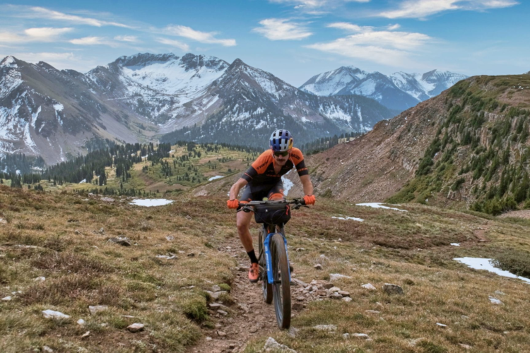
From the steep grunt out of the Horsethief parking lot, I doubted my choice of bike and whether I was in good enough shape to Ring the Peak, until we broke into a wide open valley surrounded by golden aspens.
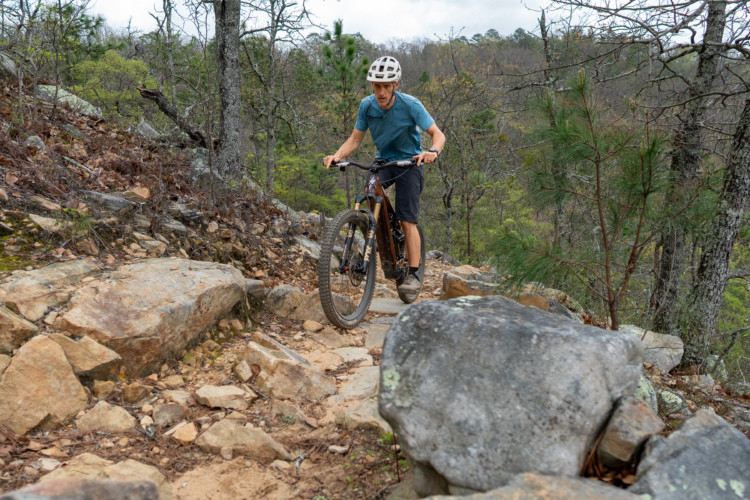
After some stiff climbing from the lot, we descended some loamy and rocky trails before getting to the Catamount Reservoir.

Catamount Reservoir
After picking through a few trails, we traced the North and South Catamount Reservoirs between 9,000 and 10,000ft with Pikes Peak in the foreground to the south. Parts of the reservoirs looked flush and other parts looked like they had been dry for years.
The dam was built in 1936 and Catamount still serves as a reservoir for drinking water, but will undergo a massive rehabilitation project in 2024-2025, according to the Colorado Springs Utilities website. This will close vehicular access and it may impact bike access, though it does say hiking access will remain open.
After exiting the Catamount area, you’ll have to find the beginning of the Mt. Esther trail, which is tucked away and not an easy find, especially with what looked like a mining business nearby. You’ll want to have the GPS route downloaded and if you follow it, it’ll take you exactly where you need to go.

The last mile or two of the Mt. Esther trail is very steep and was impossible for me to ride on a gravel bike. I’m not sure if my odds would be better on a mountain bike. It’s a steep, loose, and old trail, and unfortunately to connect to the next portion, the Ute Trail, you’ll have to hop on Highway 24 for about two miles.
The 5+ minutes of descending this stretch was more than we liked and there isn’t a great way around it. If you’re riding the route counterclockwise, be aware, you’ll have cars flying by you for a while as you climb the road.
The Ute Indian Trail
After an exciting sprint down Highway 24, you’ll make a sudden right to hop on the Ute Indian trail for rolling gravel climbs and descents and the last stretch of dirt into Manitou Springs (if you ride clockwise). It’s not exciting as a mountain bike trail necessarily, but there is a lot to love about this trail.

Having spent a few nights in bear country recently, we rode past gulleys full of scrub oak, and I reminded myself that the shrubs are exactly what black bears like to eat. Sure as scat, almost instantly after I thought this, there were bear droppings all over the trail, followed by a flock of wild turkeys that puffed up before scurrying into the foliage.
The Ute Indian trail is supposedly 10,000 years old and considered one of the oldest migratory paths in the country. The trail was a segment of Ute Pass, used to connect American Indians from the plains to the mountains and as a hunting grounds. Later the trail allowed miners to travel from the east into Colorado mountain towns like Aspen, Leadville, and Cripple Creek.
The last segment of the Ute Indian trail is Rattlesnake Gulch, a steep, loose, eroded trail, also difficult to ride on a gravel bike. But it’s short, and soon enough you pop into Manitou Springs.
Manitou Springs
We started at Horsethief Park around 10 or 11am and rolled into Manitou Springs around 6pm, ready for a margarita and Mexican food. This time we opted for a hotel so we could travel lighter, but if you were to start in Manitou and wanted to camp at the halfway mark on the other side, there are camping options in Cripple Creek and we saw fire rings near the Horsethief trailhead.
Manitou’s population is around 5,000 and it sits on the edge of Colorado Springs, as sort of an outcast to the more conservative town. The town’s hippy vibes reflect its roots as a wellness destination and “haven for tuberculosis patients” when it was founded. There are mushroom shops and mate tea and record shops and plenty of good places to eat and grab a drink.

Red Rock Canyon Open Space
Knowing we had a long day of gravel road ahead of us, we left Manitou by piecing some singletrack together through Red Rock Canyon Open Space. There’s no right way to do this one, but we mostly rode Sand Canyon and Intemann trail. The grades and surface were a perfect way to leave the city again.

Gold Camp Rd.
Gold Camp Rd. was another check in the box for a gravel bike. It’s a steady climb the whole way up with intermittent tourists and only a few other riders. Thirty miles of uphill gravel might sound dreadful, but the views popping in and out of old railroad tunnels are great.


The path was built during the gold rush during the 1800s to connect Colorado Springs and Cripple Creek, but the railroad was disbanded in 1922 and converted to a dirt road in 1924. There are a total of nine tunnels, but some have collapsed over time, so you’ll have to hike/ride up and over some. Legend has it that at least one of the tunnels is haunted by schoolchildren who died in a bus accident when tunnel 3 collapsed.

Gold Camp Rd. took us several hours to complete, but we broke it up by stopping for snacks and lunch, filtering water, and taking photos.
Ring the Peak says they have tried for years to close the Southwest gap back to the Cripple Creek/Victor area, though they say it needs a public planning process. This is another check mark for a gravel bike, because it’s still a great 7-mile stretch of valley floor and mountain roads with panoramic views between Gold Camp and Horsethief Park. While not as fast as a road bike, the gravel bike was still a versatile weapon for the pavement.

Closing thoughts
There are a lot of ways to Ring the Peak, which makes the route so cool. You can use the original route as a foundation and adapt it to your desired adventure or bike. The Pikes Peak area has to be one of the prettiest parts of Colorado and the cherry on top is that for a lot of the route, you won’t see many other people, especially in the middle of the week.
Feel free to use my Strava data for route building/setting expectations:


1 Comments
Oct 18, 2023