


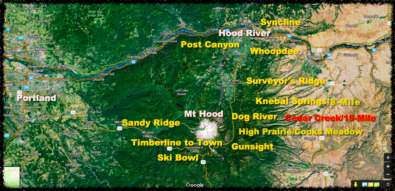
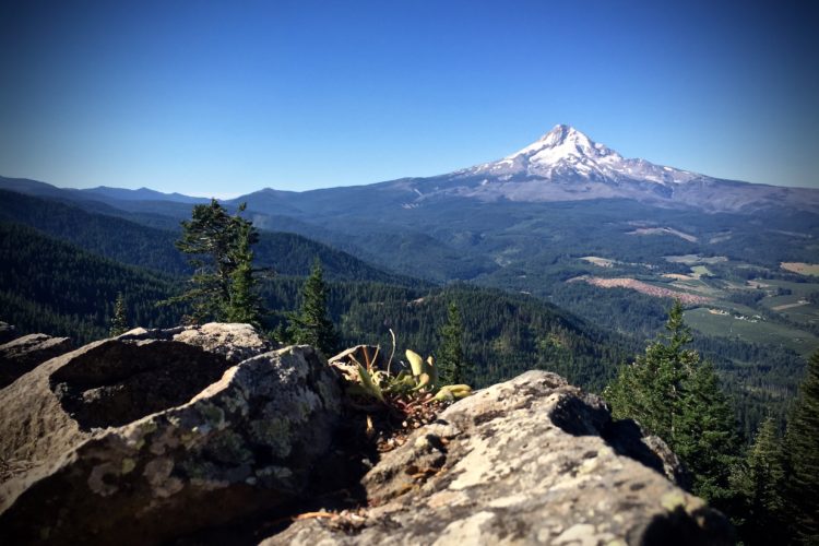
With the exception of a few connector trails (two of which are undergoing extension and re-route), this report on the Cedar Creek/15-Mile loop will conclude our coverage of the 44 Trails–geographically the most expansive network in the Mount Hood region. This collection of trails to the east of Mount Hood are special to the area, as they offer a certain remoteness and solitude not found elsewhere in the region. The Cedar Creek/15-Mile Trailhead sits about five miles south of the Knebal Springs Trailhead, and the loop delves even further into the abyss of Mount Hood forest while adding a unique feel for backcountry riding.
[see_also id=”190864″][/see_also]

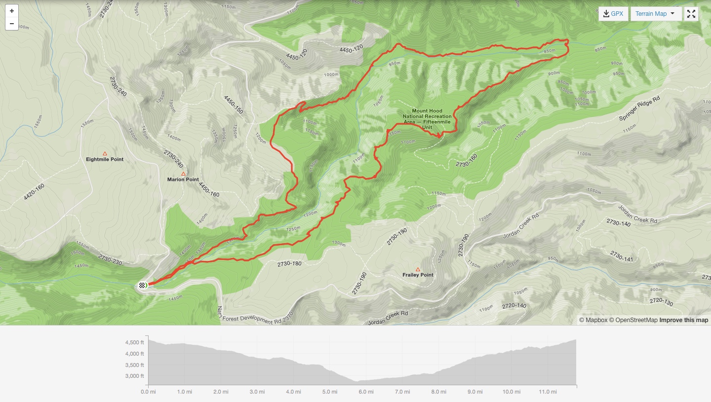
While Cedar Creek and 15-Mile parallel each other, coursing down opposite sides of the 15-Mile Creek, they are not typical river trails and, instead, require a steep and sustained climbing effort. The two trails share a common pathway for the initial half-mile, which then forks high atop either side of the creek’s ravine and continue downhill to create an inverse elevation profile. In other words, pleasure before pain. With a precipitous descent in the final mile of Cedar Creek and word that 15-Mile has a more gradual slope, we navigated a counter clockwise loop with a climb out 15-Mile, following the Cedar Creek descent. Either direction you choose, you’re going down right out the gate, with a grueling climb back to the car.

The Ride
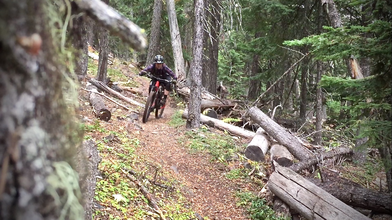
Consistent with every other trail in the 44 system, Cedar Creek and 15-Mile did not disappoint. Perched 2,000 feet above the creek, both trails sweep opposite sides of the ravine’s steep slope, diving and stretching deeper and further into the firmament. Ancient volcanic rock fields stationed on an exposed cliffside guard the eastern Oregon expanse almost as if it were Mother Nature’s personal watchtower. I don’t think she minded sharing the view. The ground was a perfect medley of rock, root, needle-pack, volcanic moondust, and black gold. I think “loam” actually sums it up nicely.
The Cedar Creek descent does, in fact, end with a sharp ridge descent over such an amount of pumice and baby head, I hardly recognized any evidence of a trail before popping back onto clay at 15-Mile Creek’s river bottom, where we were greeted by two hammock-hanging hippies and a friendly “how do?”
The initial climb out on the 15-Mile trail begins easy enough, and we were cautiously optimistic this would be the case for the duration of our 6-mile journey back. Alas, the ravine, in all its volcanic derangement, glared from above like gargoyles demanding our debts be paid in full… plus interest! Shortly after the mellow grade ascent, we were met with long stretches of hillside hike-a-bike, punctuated by more outcroppings of rock where we would catch our breath and rest our limbs. Once back on top, the trail continues climbing in earnest, but can be done so pedaling all the way back to the car.
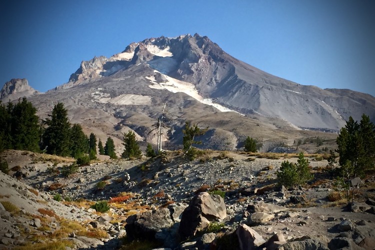
The 44 Trails are no high alpine riding. You’ll never hover over tree line, the snow is gone by mid-June, and you won’t get that on-top-of-the-world feeling like you would in the Rockies. Yet these trails, like Cedar and 15-Mile, offer something very similar in terms of solitude, remoteness, and access, making this area above the Hood River Valley special and worthwhile.

StumptownRider’s Post Bike Bites & Beverage
Stumpy enjoys his IPA with a side of pulled pork burrito at Solera Brewery in Parkdale, OR.
Getting There
From Hood River, drive 26 miles to the National Forest Development Road 44. Turn east up 44 for 5 miles and turn right onto Dufur Valley Rd. In another 3 miles on Dufur you’ll pass the Knebal Springs/8-Mile Trailhead, and your next right will be onto Cold Springs Road. 4 miles in on Cold Springs, you’ll see a campground and the 15-Mile Creek. Parking is limited, and you must have a Northwest Forest Pass.
Cedar Creek and 15-Mile
- Type: Loop
- Difficulty: Intermediate
- Miles: 12
- Elevation gain: 2,116ft
The Hood Report is a series of ride reports on trails in the Mount Hood region located along the Mount Hood corridor through the Hood River Valley along U.S. Route 26 in north central Oregon. Read our introduction and overview on Hood-area riding here.


0 Comments