


For decades, Mount Ashland in Southern Oregon has been home to one of the nation’s longest mountain bike shuttle runs. The top-to-bottom run, which drops almost 6,000 vertical feet with just over 1,000 feet of climbing, is an iconic ride that deserves a spot on every mountain biker’s bucket list. The trails on the mountain have played host to many regional enduro races.
The only problem? The top two miles of the classic descent are a boring fire road.
For years, mountain bikers have simply blasted down the steep Bull Gap Road to reach the singletrack. As you can imagine, this boring downhill has spawned a small network of rogue trails in the area, which riders have used to get off the road and enjoy a more entertaining run.
This network of rogue trails has caused a bit of a problem for both the Forest Service and the Rogue Valley Mountain Bike Association (RVMBA). Instead of simply closing the rogue trails, RVMBA has proposed an innovative solution to deal with the illegal trail riding: build a top-tier jump trail on the bed of Bull Gap Road. “This [project] looks to take the worst mile and make it the best mile of the watershed system,” said Ryan Hawk, President of RVMBA.
The Mount A-Line Vision
Mount Ashland is lovingly referred to as “Mount A,” and RVMBA saw the opportunity to pay homage to the most famous jump trail in the world — A-Line. And so, “Mount A-Line” was born. The plans put forth by RVMBA call for turning the lower mile of the nasty fire road descent into the Mount A-Line jump run with an uphill return trail for those who want to rip multiple laps.
The project to revamp Bull Gap Road began way back in 2018, and finally, after seven years of hard work, it has come to fruition. RVMBA has raised $150,000 for the project through an Oregon RTP grant and club contributions, but an additional $25,000 of fundraising will be required to cover the projected $175,000 cost.
Fundraising hurdles aside, Earthworx has been contracted for the project and plans to break ground on June 23, with the build projected to take between a month and a month and a half (fire restrictions dependent). Earthworx, run by Morgan Benbough, has built many projects around the Rogue Valley, “so we’re really excited,” said Hawk.
What can riders expect to find on Mount A-Line?
The first mile of the descent will still follow the existing Bull Gap Road, but at a big dog leg in the road about halfway down, the road-to-trail conversion will begin.
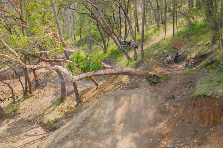
“We’re going to take that next mile […] and throw a bunch of tricks at it and make a really great downhill jump line,” said Hawk. “It’s ideally a jump line that can be ridden by anybody, so there’s no full gaps or anything like that to stop someone from coming down who’s an advanced beginner.”
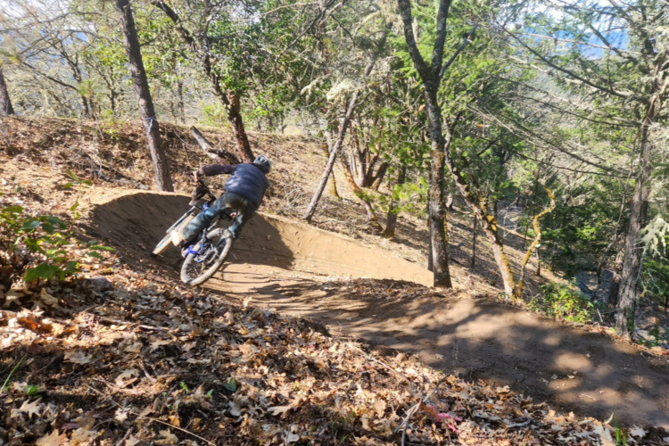
The Lizard Trail lower down the mountain is one of the best jump lines currently on Mount Ashland, even if some riders, such as the author, have a difficult time maintaining speed for the hits. In a similar vein to Lizard, Hawk anticipates that the jumps on Mount A-Line will sport two different-sized lips for riders to choose from. Providing both a shorter and flatter lip and a longer and steeper option will allow beginners and advanced riders to have a blast hitting Mount A-Line. They can simply choose their desired level of difficulty and then smash the “Send” button.
Unlike Lizard, maintaining speed down the new Mount A-Line trail won’t be difficult. In fact, the current Bull Gap Road is on a 6% grade, which is much too steep for a jump trail. Unfortunately, due to restrictions in the Mount Ashland Watershed, RVMBA can only build the new jump line on the existing road grade. So, they’re going to have to construct a lot of features to intentionally slow riders down.
“One of the pieces is adding in more hips and berms, adding some diagonals that are going to necessitate [slowing down],” said Hawk. “We’re [going to] reinforce those landings so they’re much more durable and lower maintenance. […] But that’s one of the big techniques I think that we are going to have to employ in there, because otherwise, you’re just going to be going insanely fast down this thing.”
The trail plan calls for an uphill climbing trail for riders who want to lap the jump line. However, the uphill route also needs to be built on the road grade. Exactly how Earthworks will fit the uphill route into the same road grade is still a matter of debate with the USFS.

Will existing social trails be decommissioned?
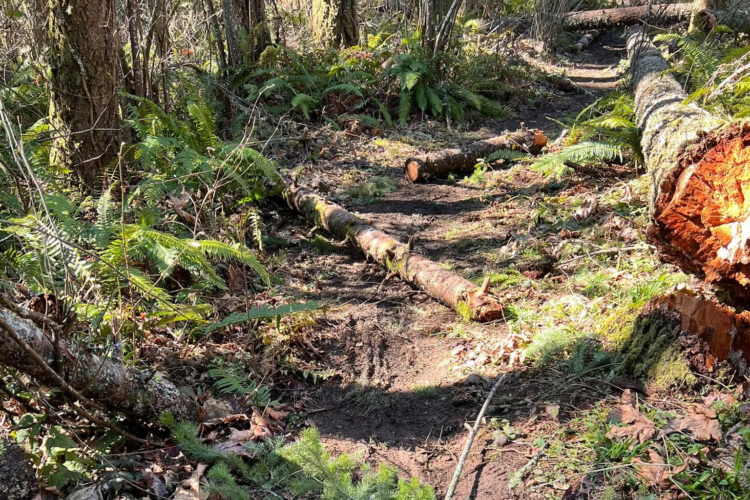
The existing social trails that parallel Bull Gap Road were “part of the leverage that we used to get through NEPA,” said Chad Thorson, Vice President for RVMBA. The pitch by RVMBA was that by building a better trail, traffic on the social trails would be reduced.
“I think it’ll reduce the traffic [on the social trails,]” said Thorson. “And I don’t think everybody that’s finding themselves on a skidder trail with dangerous drops and crazy stuff… they probably don’t really want to be on that. And so, if the road’s smooth and fun and cool, I think that they’ll choose that option. So it should reduce the traffic.”
However, RVMBA isn’t on the hook to decommission any social trails due to this new trail construction. If any of the skidder trails are decommissioned, the US Forest Service will be responsible. But it’s anybody’s guess whether or not that work will be prioritized in light of widespread staff shortages across the USFS.
It’s even possible that some of the more sustainable social trails could be adopted into the official network. “There was talk about grandfather-clausing Banditos into the trail system,” said Thorson.
The future of the unofficial trails is currently uncertain, but one thing is clear: the new jump line will dramatically improve this iconic Oregon shuttle run. If it’s been a few years since you’ve ripped down Mount Ashland, it might be time to plan a return trip!


0 Comments