

Long-distance, uninterrupted singletrack is relatively rare. Putting 20 or 30 miles together is doable, but it typically includes stringing different trails together, often with some distance spent on old fire roads. It usually isn’t terrible, but miles on doubletrack may not be the ideal experience for all.
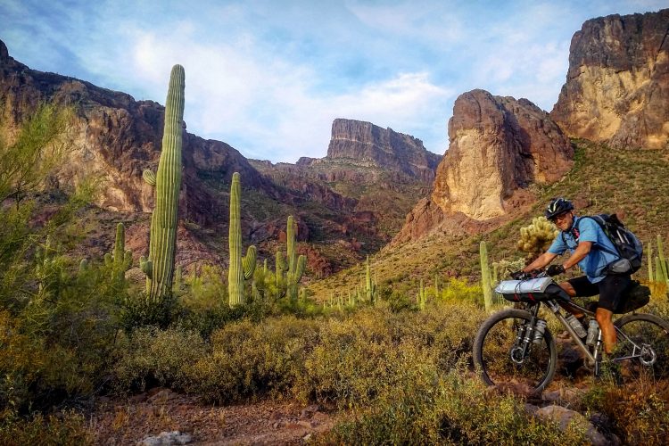
One trail in Arizona may be just what those singletrack seekers have been looking for. South of Arizona mountain bike destinations with names like Flagstaff and Sedona lies the sleepy town of Payson. While Payson may not currently be a two-wheeled AZ destination, 60 miles of uninterrupted singletrack could put them on the map — especially for bikepacking.
This is exactly what the organizations restoring the Highline Trail hope to achieve.

The Highline Trail’s rich history traces back to 1870.
The town of Payson is roughly halfway between the Pheonix-metro area to the south and Sedona to the north. The Mogollon Rim runs just north of Payson, cutting 200 miles across the Arizona landscape from Flagstaff to New Mexico.
The Mogollon Rim rises to over 7,600 feet above sea level, and 1,000 feet below the rim you’ll find Payson’s Highline Trail, not to be confused with a similarly-named trail in Sedona. Significant erosion occurred because of how the trail was built, and substantial portions had fallen into disrepair.
“Because of the escarpment of the Mogollon Rim and all of the drainages that come off it, the trail goes up and down and up and down, across dozens and dozens of drainages,” Shannon Smith, Stewardship Coordinator for the Tonto National Forest, told us. “When it was originally built, it was built more or less as a straight line across all of those [drainages].”
As it stands, the Highline Trail is roughly 55 miles of non-motorized singletrack. Established in 1870, Highline was used to travel between homesteads, hunt, and move livestock. The Highline Trail was designated a National Recreation Trail in 1978.
As is common with any long trail with multiple segments, some sections of Highline were more popular than others. In turn, those popular sections were also more likely to receive maintenance.
“There are sections where [the trail] all but disappeared,” Smith explained. “It either got overgrown, or it got so washed out that it just kind of ended up being a slope of boulders instead of a trail.”
As Highline transitioned to being a trail focused on recreation, it became obvious that the trail was built in an unsustainable fashion. Official plans to restore and reroute sections of the trail were announced in 2021.

Erosion and neglect drove the need for a comprehensive restoration plan.
Smith described a threefold plan for the Highline Trail restoration. The first aspect of the restoration being tackled is maintaining any section of the trail they can. With Highline being a historic trail, Smith stressed that they are trying to preserve as much of the original route as possible.
“We’re doing that with professional trail contractors,” she told us. “They’re doing it either by hand work or occasionally with a mini dozer.”
However, significant water erosion affected some sections of the trail. Consequently, the second part of the Highline restoration involvesrerouting some portions of the trail. The reroutes will require a multiyear effort to lay out the proposed reroutes and confirm their sustainability so the trail will not continue to wash out. Amongst the army of volunteers and organizations working on this project, Smith said much of the realignment work is falling on some of their volunteers at the Arizona Trail Association.
These reroutes are nothing to shake a stick at. All are relatively lengthy, with the longest reroute measuring 36,268 linear feet. This will reroute alone will require almost seven miles of new singletrack to be constructed. These lengthy reroutes will cause the overall trail to grow to 60 miles.
The final step in the restoration plan is to rehabilitate the washed-out areas to prevent them from worsening. Despite the trail being rerouted to a different location, the watershed will continue to be affected and further deteriorate if the old trail alignments are not addressed. For places like the Mollogon Rim, it is Pheonix’s drinking water the Forest Service is concerned about.
“There are all these other elements around the forest health and the importance for maintaining here — obviously Phoenix’s drinking water,” said Catherine Cody, Media Relations Manager for the National Forest Foundation. “About two-thirds of American drinking water comes from National Forests.”
Cody and Smith shared that partners from Wild Arizona will help with this portion of the restoration. Along with restoring the decommissioned trail so it won’t continue to erode, they’ll also plant native vegetation to further prevent erosion.

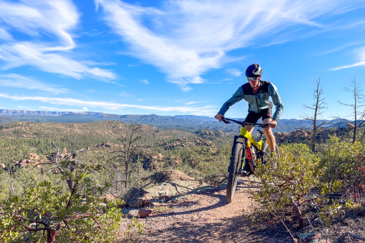
Payson’s growing trail network positions it as a future bikepacking destination.
As plans have been approved and funding has come together — nearly $1,000,000 — work is underway on many of the Highline Trail reroutes and restorations. While Smith and Cody described the plan as “threefold,” different trail segments are going through all three phases of the restoration plan at various times.
One of those segments — a fairly substantial 20 miles — is already completed. Smith shared that in phase one of the project, the section of Highline from Pine to Washington Park was maintained, rerouted, and rehabilitated. This section of trail is also known as Passage 26 of the 800-mile Arizona Trail (AZT).
Having this portion of the trail completed makes the lives of bikepackers on the AZT a bit easier. But aside from the AZT, with the eventual completion of the restoration of the Highline Trail, Payson could be put on the map as a bikepacking destination.
“There’s a lot of options because a lot of people don’t realize how many trailheads there are in the middle [of Highline],” Smith told us. “They think you have to do all 60 miles, but you don’t. If you wanted to bikepack 30 miles and just make it a one-nighter, that’s an option.”
While a 20-mile segment of the Highline Trail forms the AZT alignment, the other 40 miles of Highline diverge from the AZT, connecting to many other trails in the region. The bikepacking loop options are nearly endless!
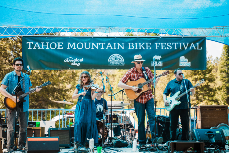
Smith hopes the word continues to spread about this incredible trail so more people will experience Highline and work can continue. She stressed the amazing partnerships with local organizations such as Rim Country Mountain Bike Association and other local businesses. These organizations put together events like the “Highline Hold ‘Em” poker ride to raise funds for the project.
As far as when work will wrap up on the entire 60 miles, Smith said she felt optimistic about the end of 2025.


4 Comments
Oct 25, 2024
Oct 28, 2024
Oct 28, 2024
Dec 23, 2024