
I can’t tell you how many times I’ve finished a ride with friends, cracked a cold one, and then proceeded to analyze the new trail that we’d just ridden. Inevitably, the conversation turns to technical difficulty.
“Is that really a double black trail? All of the difficult features had easy ride-arounds. I think a double black has to have mandatory features,” one person would quip.
On a different trail, “that trail was rated a black, but it only had one black section in it, and 99% of the trail wasn’t a black.”
Or the conversation might go, “All of the difficulty ratings around here are overblown! The blacks are blues, and the blues are greens. The riders here must not have a clue what they’re doing.”
We all love to debate trail difficulty ratings, the gnarliness (or lack thereof) of various features, and how we performed on the toughest sections of trail. But I began to wonder: how do these trail difficulty ratings get assigned in the first place? Where do the blue squares and black diamonds come from?

Why can’t anyone agree on how to rate trail difficulties?
For this article, I interviewed eight different people on three different continents and consulted at least a half dozen more. The sources in this article include authoritative organizations such as the International Mountain Bicycling Association (IMBA), innovators like the International Trail Rating System (ITRS), land managers like the Bureau of Land Management (BLM), and more. In addition to these sources, I’ve drawn on my experience traveling the world with my mountain bike for the past 20 years.
As I interviewed sources and asked several of the same questions over and over, I talked to many people who were adamant about how trails should be rated. For instance, one authoritative source was adamant that a trail should be rated based on its single most difficult feature.
But then another authoritative source would say the exact opposite — that you can’t rate trails based on one feature and must instead assign difficulty based on the overall character of the trail. In this view, one really difficult section wouldn’t warrant a difficult rating.
For seemingly every single topic I asked about, the sources I interviewed disagreed. Should trails be rated on a local/regional level, or should they be assigned scientific ratings based on quantifiable criteria that can be used all around the world? Who should be assigning these trail difficulty ratings in the first place? Should trail difficulty ratings be posted at all?
On the one hand, the lack of agreement from these authoritative sources was startling, but on the other, it made sense — this is precisely why we debate trail difficulty ratings after a ride. Even among a group of friends that ride together often, each person has a different perspective on the various technical features that each trail contains. Subjectivity on the topic is rampant.
I tried not to let that inherent subjectivity stop me — I continued to dig a little deeper in an attempt to figure this mess out.

One thing we all can agree on: new trail construction.
For the most part, all of the sources that I interviewed agreed that when a new trail is built, the intended trail difficulty and the features included in the trail should all be laid out and agreed upon before construction begins. It is then the contractor’s job to build the trail to those specifications.
“From a Trail Solutions point of view, the way we implement things is when Josh [Olson]’s team are building a trail after we’ve designed the trail, that trail, the whole length of it, is representative of the first 200 feet,” said Mike Repyak, IMBA Trail Solutions Director of Planning and Design. “We’re not throwing a double black diamond section in the middle of a green trail. That’s just wrong to do that. We’re consistent throughout the trail segment that you’re on from sign to sign, and our signage provides information that riders can make an informed decision — not just the green, blue, black, but the trail is this length, the trail has these aspects/characteristics to it, the trail’s at this average grade.”
If the project specs are clear on the front end and the contractor does their job properly, the trail difficulty rating is known before the builder even breaks ground.

Trail difficulty ratings still don’t align from one region to another.
However, even within the world of professional trail building, there’s still subjectivity inherent when assigning the rating after the trail is complete. Riders will often notice a certain degree of variance in trail difficulty from region to region: a black diamond on their home trail system won’t be the same difficulty as it is in a different area.
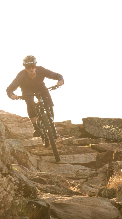
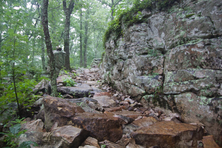
It used to be that Midwest riders heading to the Rocky Mountains (for example) would get beat down because the trails out West were so much more difficult. But now, that experience of being under prepared for a trail’s technicality can even occur in a much smaller area. I’ve spoken with trail builders in the Midwest who see riders coming from the southern Midwest to the rocky, rugged trails in the Upper Peninsula of Michigan or on Minnesota’s north shore that are entirely unprepared for what they find.
Just because you can ride a black diamond trail in your hometown doesn’t mean you can ride one in Whistler or Moab.
“What you’re seeing is that they want to provide the differentiation even inside of the region,” said Josh Olson, IMBA Trail Solutions Director of Construction and Operations. “Everybody wants to have a green, blue, and black and needs to explain their terrain. You don’t just say everything in West Virginia is blue, even though they may not have terrain that gets to Colorado black. So you’re gonna see those ratings from different regions, and they kind of represent the local topography and everything else.”
Furthermore, even though a professional trail builder may be handed detailed specifications for the trail that they’re contracted to build, they generally aren’t responsible for assigning the difficulty rating after the trail is complete. That’s up to the local land manager or the local club.

Some land managers don’t assign difficulty ratings at all.
While the ultimate decision on how difficult of a rating a trail should receive rests with the land manger, it turns out that many land managers don’t rate their trails at all. I spoke with the director of a local advocacy group who mentioned in passing that their group doesn’t post trail difficulty ratings on their trails because neither the BLM nor the Forest Service in their region post difficulty ratings. I personally found this surprising. To get to the bottom of this issue, I interviewed three different people at the BLM — two in Colorado and one in Utah — and learned that even within the BLM, the approach to trail difficulty ratings is inconsistent.
First, I spoke with Dave Jacobson, The Travel & Transportation Lead for the BLM Utah State Office. Prior to moving up to the state level, Jacobson managed the recreation in the Cedar City area, which is home to the professionally-designed Iron Hills mountain bike trail system with fantastic trail signage — including trail difficulty ratings. Other districts that now fall under his purview, such as Moab, also have extremely detailed trail signs.
In fact, some of Moab’s trail signs feature trail difficulty progression scales, ranking each trail against the others so that riders can slowly work their way up in difficulty. This system is utilized by bike parks like Whistler and Trestle, but it’s rare to see it on multi-directional trails on BLM land. Moab also breaks down their trail difficulty ratings much more granularly, including sub-ratings such as green/blue, blue/black, and more.
However, the BLM Tres Rios district in Colorado — which covers the entire southwestern corner of the state, including the town of Durango — doesn’t assign trail difficulty ratings to any of their trails. I was under the impression that even if the ratings weren’t posted, the US Forest Service (USFS) and BLM had trail management objectives (TMOs) that governed how they maintained and managed each trail. In fact, one of the first controversial articles I ever wrote for Singletracks was about a terrible rebuild of the Bull Mountain Trail in Georgia, which purportedly was done to bring it back in line with the TMO for the trail.
TMOs essentially outline the specifications that the trail is built to and how the trail will be maintained in the future. These objectives identify how wide the trail is, how big the drops are, how steep it is — all of the factors that go into a technical difficulty rating. As trails fall out of line with their TMOs over years of use and erosion, they’re often then rebuilt to bring them back in line with the TMO. Sometimes those rebuilds are viewed as “dumbing down the trails” by uninformed mountain bikers, but other times, the maintenance can go the opposite direction. For instance, if there is unauthorized trail work that makes a technical trail easier than it should be, that also goes against the TMO. In this case, the cheater line would be removed to make the trail more technical.
But after speaking with Jeff Christenson, Outdoor Recreation Planner Lead in the Colorado BLM state office, and Jason Byrd, Supervisory Outdoor Recreation Planner for the Tres Rios field office, I learned that many (if not most) BLM districts haven’t had the time to develop TMOs for all of the trails that they manage.
“TMOS are, in a perfect world, developed for all of our trails,” said Christenson. “In reality, I only know of one field office that’s actually had the staff and the time to develop them, maybe two.”
“The Grand Junction office in Colorado has been able to have the staff and time to set TMOs for their trails as they develop and maintain them,” said Christenson. “Other offices […] haven’t had that staffing and time luxury.
“Jason, how much staff you got?” asked Christenson.
“It’s me and one — well, now two park rangers,” said Byrd. “We’re stretched pretty thin. So yeah, it’s pretty hard to do. Luckily, we have partners that help us get the trails and maintain them and stuff like that. But yeah, that kind of idea — it’d be nice to be able to do that kind of stuff. But we’re just trying to stay afloat, essentially.”

If nearby regions don’t follow the same system, forget about different countries.
If two regions located just a few hours apart managed by the same government agency (albeit two different districts within that agency) don’t follow the same process, what hope do different countries have? I spoke with Edoardo Melchiori and Mischa Crumbach, co-developers and managers of the International Trail Rating System (ITRS) based in Europe, to understand how rating systems differ from country to country.
According to the ITRS website, Melchiori and Crumbach developed this new system because “in 2020, there were at least 14 different trail rating systems in Europe alone to describe the ‘difficulty’ of mountain bike trails and routes, whereby ‘difficulty’ did not always evaluate the same aspects.” When I spoke with them, they mentioned that the number is now at least 20.
In other countries, even the nuts and bolts of how ratings are shown to riders differ. For instance, the IMBA scale in the USA goes: green circle, blue square, black diamond, double black diamond. The system in most (but not all) European countries goes: green circle, blue square, red triangle, black diamond.
I also spoke with Ryan Hunt, President of Mountain Bike New Zealand, and learned that the trail rating system there utilizes a number scale. In New Zealand, Hunt said that they have “national trail guidelines,” which follow a number grading system from one (easiest) to six (hardest). Even within the small country of New Zealand, the system isn’t applied evenly, echoing the same difficulties seen in the USA and Europe.
While discussing the efforts of the ITRS is outside the scope of this article, be sure to read my dedicated article on the topic.

Ultimate responsibility falls on the rider.
Posted trail difficulty ratings serve many purposes. At their most fundamental, they allow riders to choose trails based on their perceived ability levels. Posting trail difficulties also acts as a risk management tactic for land managers. But at the end of the day, the responsibility for riding a trail within one’s skill level falls on the rider — and nobody else.
“Riding mountain bikes — it’s inherently risky,” said Olson. “If you would like to assume zero risk, you should not ride mountain bikes, you should stay at home. I mean, everything in life has a bit of risk associated. It’s just being informed and evaluating your risk levels and taking responsibility as a rider to ride within your abilities and use the signage to inform that.”
We all ride mountain bikes for the challenge of it. If all we sought was fitness, we’d be riding on the pavement. At the end of the day, trails need to be difficult, even if that means that some riders might get in over their heads and get hurt.
“The worst outcome of this would be that you would want to take all of the different trails with all the different variety and try to dumb it down to the lowest common denominator,” said Olson. “People want to have technical trails. People want to take that risk and assume that risk.”
“I think the goal would be to not necessarily dumb down the trails to reach the most common, lowest common denominator, but to just be able to provide that information as accurately as possible,” Olson concluded.
Will we ever agree? Probably not.
My foray into the murky world of mountain bike trail difficulty ratings was exciting, but unfortunately, it didn’t yield any clear answers to the questions. When even the professionals disagree, what hope is there for the rest of us mere mortals who are just trying to avoid eating shit on an unexpected ledge drop?
After talking with a slew of experts, I doubt that trail difficulty ratings will ever be standardized across different regions, much less different countries. It seems prudent to consider trail difficulty ratings as mere “guidelines.” If you’re traveling to ride a new trail, proceed with caution until you get a feel for what that region has to offer.
If we leave our egos at the trailhead and approach new trails with a healthy dose of caution and humility, we’ll be able to safely test our mettle on the technical challenges inherent in this beautiful sport.






23 Comments
Jul 15, 2024
Jul 16, 2024
Personally, I approach every new trail network with this in mind. Generally start my journey on the grade below where I am usually comfortable and work my way up.
Sometimes, the trails are comparable to home. Sometimes, it becomes quickly clear that they are not. But I have had to put myself in unnecessary danger to find out.
Jul 15, 2024
Jul 22, 2024
Jul 15, 2024
Now that I think of it, that's the kind of stuff that should probably be standardized, warning signs say 100-200' before encountering a gapped feature that can't be rolled, or a drop exceeding a certain height, or a slope above a certain grade, a kind of "last chance before your about to commit" warning
Jul 17, 2024
Jul 17, 2024
Jul 18, 2024
Jul 17, 2024
Jul 15, 2024
Jul 18, 2024
My biggest beef in all this is when there are no walk or ride-arounds, even for advanced riders, so we can more safely walk fully around a feature & decide if we're into it or not. Surely terrain dictates that sometimes, and only the most advanced riders can likely come up on huge drops that don't have walk arounds and figure that out, but ya still need to be able to move around a big feature to scout it property - and more so - to be able to get people in & out if injured. Other than that, this whole convo seems a bit simp & pointless to me.
Jul 16, 2024
Jul 15, 2024
Jul 15, 2024
Jul 15, 2024
Good piece Greg!
Jul 18, 2024
Jul 15, 2024
An intermediate-marked single track in Westchester will be much more technical and steep than an expert-marked trail on Long Island. Meanwhile, the jump lines built in Westchester (Graham Hills) will have options for beginner progression, like table tops, pump tracks, and low berms, while Long Island's Cunningham Park has hardly any skills progression. You need to be able to handle gaps with high consequence right away and be able to truly handle your bike in the air. The "beginner" area has been extensively modified to the point where its not a beginner area at all.
Part of that is geology and terrain, the other part is culture.
I think the most important thing that all trail builders should adhere to is that the trail system should at LEAST be consistent to itself. That is, a few beginner trails that do not stray too far from the trailhead, and then bigger route options that increase in difficulty without massive leaps in ability required.
Again, in my example, Long Island trails that are marked as black diamond DO in fact have features that are more difficult than do the blue trails. That those are marked as black diamond does in fact communicate helpful information to the rider. So long as all riders pick a beginner/intermediate trail for warmup, the system should work.
Jul 21, 2024
I think providing more details about the trail and the TTF that are more difficult on trail is a good thing.
If you have never ridden the trail network or just watched a YouTube video of the trail, I highly recommend you talk to the locals or find a guide.
Be safe and not a burden on the community
Jul 16, 2024
There's something to be said, however, for a given trail system, to rate the hardest trail as a black diamond and to base all other trails at that system off that scale. But that system breaks if someone comes along and build a trail at that system that is way more difficult, because then you have to go back and re-rank everything.
It's FUBAR.
Jul 20, 2024
Jul 18, 2024
Greens are clearly obvious, where anyone from all skill levels can ride with confidence and ease, and Blues are a progression that allows novice riders to progress safely to intermediate skill levels. Blue trails should never consist of anything mandatory yet provide jumps or tech that can be challenging for those just coming off of Green.
Blacks should only be for advanced riders but not out of reach for those coming off of Blues to help progression. Blacks should have features that require riders who are comfortable with good balance, high speeds, big jumps and drops, janky tech lines, etc., but will have workarounds available if the rider is uncomfortable.
Double blacks should only be mandatory for advanced/pro riders where features are mandatory. Jumps can be close to pro line jumps, drops are massive, and the tech is absolute gnar where anyone of the aforementioned features could very well be life changing in the event of a bad crash (or worse). Double blacks should not be something that anyone can drop into and easily find their way out of. If it is, then it’s not a true double black.
Finally, we come to Red. Red is and should be strictly for Pro riders only, where crashes can not only be life-changing but certainly life ending. I can honestly say that I have only ridden a handful of “true” TRUE pro lines in my lifetime where you realize if you were to miss that massive lip and take off at the wrong angle, or your bike experience a catastrophic failure while hitting 30 through a chute where you have to hit that 70-degree berm just right or fly off a cliff on the other side… yeah, Red lines are only for those who are willing to die for the sport. 1000% full send, no doubts. That is a Red. And reds, should be extremely rare to the public. If not closed off. So if you come across a red, and your weekend warrior buddy comes up to you and says, “yeah I hit that twice already in the past week, no prob” then it’s NOT a true Red.
That all being said, the one thing that frustrates me the most (assuming the metrics above hold true for most of the shredders out there) is when I come across trails that are labeled black or double black but are truly blue or black. More times than I can count where I came across riders who were given a false sense of progression only to find themselves on another mountain where they sent a double black and ended up in the hospital because they though they were ready to follow their other more experienced rider buddies down.
There is no doubt in my mind that trail ratings should have clear definitions and a more precise understanding in our culture. I mean, for most of us we’ve been riding for years and have been all over the world. But for those who are newer to the sport, there should definitely be some common understanding when labeling trail systems to keep everyone safe and informed.
Jul 19, 2024
Jul 16, 2024