Bad Trip #3
The Venue: Palmer Section 16 Loop, Colorado Springs, CO
Experience Level: 12 Years Riding
The Plan: Ride my favorite route from my home, a five-mile loop on top of a two-mile (each way) stem. No cause for concern, right?
The Difficulty: CRASH!
How it Went Down:
The Palmer Section 16 Loop was a regular ride of mine, being doable from home without needing a car. It is a classic Colorado Springs ride, with a long but doable climb, followed by a much steeper and more technical descent, filled with the Springs’ ubiquitous decomposing Pikes Peak granite. As one of my local favorites, there’s not a single nook, cranny, line, or obstacle I’m not intimately familiar with and haven’t cleaned a dozen times or more. It is technical enough to scare off many riders, or prompt others to dismount a few times, but as my local go-to, it held no horrors for me.

Where Things Went Wrong:
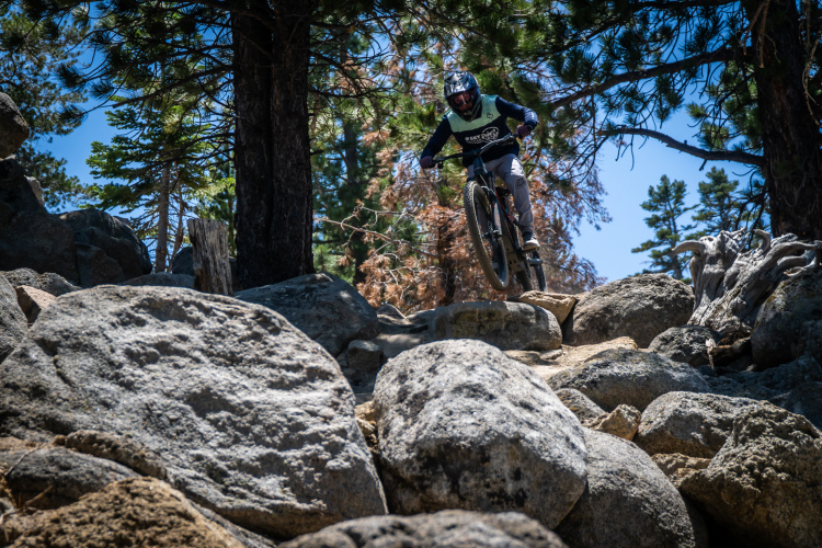
Before the descent, there is actually the single most challenging feature: a jagged bunch of granite that sticks awkwardly out of the mountain. It is rideable, but you’ve got to be on your game. There appears to be a rideable line just below the rock to the right, but it peters out before the far side of the rock. The only rideable line is to stay left, hug the high side of the rock, and just fly over it. This requires commitment at the start, with enough momentum to make it to the other side, as pedaling isn’t an option on most of the sidesloped rock where a pedal strike will send the rider sideways down the canyon. The only way is to hit it hard and with confidence. It is a test piece for many local riders. It’s much easier today with big wheels, but it is fraught with wheel traps that require excellent technique on a 26er, which is what I was riding.
As I approached the rock, I noticed some hikers approaching from the other side. I always try to exercise exemplary trail etiquette, so I prepared to stop and dismount and give the nice young couple right of way. But I realized they were still some distance back from the feature, and I had time to clear it before they got there. After doing a quick calculation in my head of our closing velocity, I decided to go for it. Of course, part of the calculation included acknowledging the fact that I would have an audience for my great technical accomplishment. Few clear the rock, and even more rare is a witness to the feat. I didn’t always clear the rock–if I wasn’t feeling it, I’d walk it. But I was having a good ride that day, and how could I back down when I was within sight of others?
But in that brief period when I was making the go/no-go decision, I lost much of my momentum. I tried to compensate with an extra strong pedal stroke as I ascended the backside of the rock, but was in a low enough gear that it offered little help. Then, just as I thought I might have enough ol’ mo’ to carry me across, my line drifted a little too low and I dropped my front wheel into a gap in the rock which served as a perfect wheel trap. The bike came to a sudden stop, and I fell, of course, to the downhill, exposed side. Given the steepness of the sideslope, it was close to 10 feet of vertical before my right knee made first contact with a particularly jagged bit of the granite.

As I extricated myself from the bushes, rocks, and bike frame, I realized I was battered in a number of places with abrasions covering most of the right side of my body. But abrasions are really no big deal. The hikers pleasantly apologized for disrupting my ride and inquired as to my well being. However I knew instantly, the blame was all mine. I also assured them I was fine, pride not letting me say anything else to the contrary. I stoically remounted to continue my ride as though nothing had happened
That’s when I felt the warmth spreading down my right shin. It seems my right knee had suffered more than just an abrasion and was bleeding profusely. Slowing the bleeding proved difficult. The best I could do was to remove my sweat-soaked bandanna and wrap it tightly around the knee and begin the most technical part of the ride.
Four difficult, painful, bloody miles later I was back at the house where I stashed the bike, transferred myself to an automobile, and drove to the ER. As I noted, the area is decomposing granite, so there’s gravel of all sizes present everywhere. It took the med techs close to two hours to flush all the little rock bits out of the flap of flesh which the rock had attempted to remove from my kneecap. Fortunately, it was just a laceration, and once the doc arrived and sutured up thirteen stitches in my knee, I was good to go.

Before the stitches were out, I went back out on that loop and rode the feature, just to prove to myself I could overcome the mental doubt from the trauma, and that I still had the skill to do so. Probably not my wisest decision, but something I had to do nonetheless. I did carry my kneepads up the hill and donned them before approaching the feature. Having satisfied myself, I didn’t ride that feature again for another two years, until I bought a bike with a 29″ front wheel, which makes a huge difference on that feature, simultaneously raising the confidence level and lowering the skill level required to clean it.
Lessons Learned:
- Indecision kills.
- Showing off carries multiple risks.
- If you’re going to ride knucklehead features, consider armor.
- If a feature requires momentum and you’ve lost yours, give it up and go back and try again properly.
- Carry your first aid kit (and know how to use it).
Your Turn: Tell us about your tales of terror from the trail in the comments section below.





11 Comments
Nov 25, 2016
More seriously, I appreciate your lessons learned section. Young riders and less experienced outdoorsmen need to be aware of the importance of preparing for the worst. With most of my riding in Mongolia, there is no cell phone coverage and no professional "resources" to rescue a person, so I almost always go over prepared. There is the possibility of hypothermia year round. I personally have never had a problem, but I have had two persons succumb to the elements and had to care for them -- hypothermia and fatigue due over exertion and cold.
It is very easy to underestimate the dangers of the small mountains that are predominate in Mongolia. On the same day in the summer you could face heat exhaustion and hypothermia. Extra water, extra protein, steri-pen, extra warm layer, map, sat images, compass, first aid kit, matches, lighter, dry paper, Ibuprofen, knife, trail side maintenance .... all are essential. This is a pretty good short list for most places. Also, a loved one should always know where you are going and when you will return at the latest. And you should not deviate from that plan too far, so that you are within a short distance of the known course for S&R to find you more easily. Great write up John.
Nov 25, 2016
Nov 24, 2016
Nov 27, 2016
Nov 28, 2016
Nov 30, 2016
Nov 29, 2016
I really appreciate your support!
I think it's pretty much happening by default with each article I write--just not in order. I'm not sure there's much of a market for "the collected works of the skibum who actually rides more than he skis"! I'm also kind of wondering how things will work out next (see "I Ride Alone"). Chapters still to be written, so to speak.
Nov 27, 2016
Experience Level: 3 years riding
The Plan: Ride the beautiful Sapphire Crest Trail to the Bitterroot River where our camper was waiting
The Problem: Blown-down trees, non-existent trails
It all started early in the morning on a beautiful clear mountain day in the Sapphire's of Montana, which reside right across the valley from the infamous Bitterroot Range. If you know your history, you know that the Bitterroot Range was the geographically obstacle that nearly stopped Lewis and Clark on their march to the Pacific. Anyways, the reviews of this trail around the internet were amazing. One even boosted, "This is the ride that remind you of why you started mountain biking." Naturally, I was very eager to experience this ride, so after me and my father were shuttled to the top of the pass, we immediately started the winding climb up to the main ridge.
At the top of the climb, the day seemed like it couldn't be beat. We were giddy from how easy the climb had been (we had just finished a trail that climbed 4,000 feet in 6 miles a couple days earlier) and the few blown-down trees that we had encountered up to that point didn't seem to phase us. So, with smiling faces and high hopes, we pushed on towards the summit of Dome-Shaped Mountain. Along the way, we were greeted by incredible views and bald eagles. After playing around in a beautiful snow bank (at 8,000 feet, I was astonished that it still existed in July) we summited Dome-Shaped Mountain. This ride was panning out to be the best ride of our lives.
Where Things Went Wrong
After soaking up the views on the summit, we quickly dropped our seats and pointed our bikes downhill. At first, everything seemed fine. Although the trail would occasionally disappear, in the open meadows we were riding through, it was very easy to pick up again. But then we entered what was left of a forest. In 2012 and 2015, forest fires had burned the area and storms had flattened those trees, so much so that the nearby Frank Church-River of No Return Wilderness was declared a disaster area. As we entered, we thought that this burn area would soon give way to unscathed trees, like it had previously on the trail. But as the stacks of trees reached greater heights, some 10 feet high and 100 feet long, we started to wonder when it would end.
After scaling hundreds of these tree stacks at a rate on barely a mile an hour, another problem started to arise. Where before it had been easy to relocate the trail in the meadows, now it was made nearly impossible by the sheer quantity of trails covering the ground. In addition, we were running dangerous low on water, and needed to find some fast. The already nearly impossible task of scaling the barriers of trees was made exponentially harder when combined with the balancing act of carrying a bike along with you. The rhythm of scaling and balancing the tree-barriers was the broken by a very foreign sound. It took me a little while to register what the sound had been. I looked own, and I saw the ground covered in a one inch thick film of murky water. Once my father reached my position, he broke out the filter and we drank.
A couple hours after our drink stop, we were at the bottom of the Dome-Shaped Mountain descent. A section of trail that would of taken us an hour by bike had taken us five. It was five o'clock, and with 15 miles remaining we sat to rest. With no end in sight in regards to the trees, we had to make the worst decision a mountain biker could make, whether to leave our bikes or not. In the end, we decided leaving them was our best option, and reluctantly left them hidden, should we decide to risk life and limb once more to retrieve them.
After another hour, the trees finally let up, and we could walk at a good pace again. We came to a trail junction, and using the map, knew it was a mile to the next trail junction. That was the slowest mile of my life. Once at the trail junction, we knew there was only a mile to our turn off the ridge. Because of quick walking, and some suspension of our disbelief, soon we arrived at the next trail junction. Our map showed our present location 3 miles past our turn. We had been looking for a trail while walking. Our turn no longer existed. Out next option was to hike 2 miles to the next turn off. We decided to put our faith in this, because it would be easy to find due to a step descent immediately before the junction. Once we got there, this junction no longer existed either. We looked and looked, but it was nowhere to be found. Our only option was to bushwhack down the mountain, and with night fast approaching, our mind were populated with the realities that might come out of doing so.
As we started down the mountain, I noticed a faint deer trail. With no better option, we started following that. Soon enough, I identified a cut branch. We had found the trail! Once we started down the trail, our victory was short lived. The threat of darkness had not been hollow, and we were hiking down the mountain in the pitch black night. This trail wasn't a well manicured, switch-backing joy either. It was loose, and went straight down the mountain. Using an IPhone flashlight, we managed to slide down trail, finally making to the dirt road that lead to camp.
After a mile battling severe dehydration (including seeing things), severe foot cramps and soreness, and low spirits, we finally made it to camp at 1:43 AM the next morning. We had just gone through 18 hours of climbing, biking, hiking, and sliding. Without saying a word, I chugged 6 A&W rootbeers, ate a whole party sized bag a Lay's potato chips, and went to bed.
Lessons Learned:
Know when to turn back
Do more research on trail conditions
Make sure you know there is nearby water
Don't underestimate Mother Nature
Bring lots of food and a good topo map
Nov 28, 2016
Nov 27, 2016
But the real outstanding question is . . . . how hard was it to backtrack to, and retrieve your bikes? From the sounds of how far back you left them and how much travel you did after dark, it seems like that may have been an adventure in itself!
Nov 25, 2016